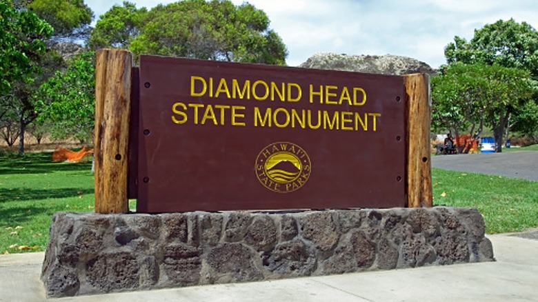
How To Hike Waikiki's Diamond Head With The Reservation System

I'm one of those people who loves the energy of Waikiki — and the view of landmark Diamond Head from Hawaii's most famous beach still gives me a thrill decades after my first visit. But despite having stayed in Waikiki a half dozen times, I had never mustered the energy to attempt to hike the trail to the summit of Diamond Head State Monument.
That changed on May 22, 2022 — 10 days after the park began requiring advance reservations for all out-of-state visitors — when I finally experienced the trail, the notoriously steep steps, the Fire Control Station and observation bunkers, and the incredible 360-degree view.
Here's a quick rundown of the reservation system and what to expect on the hike itself.
Reserve in advance and plan to hike early
It's possible to book reservations up to 14 days in advance for one-hour time frames starting at 6:00 a.m. and ending at 4:00 p.m. (the park's gates close at 6:00 p.m. and all visitors must exit by then). If you know your schedule while in Waikiki you can secure a reservation ($5 entry fee per person for out-of-state visitors, plus a $10 parking fee if you'll be arriving by car) well ahead of time.
In late May there were still plenty of reservations available a day or two in advance, but to snag the earlier times—recommended to avoid the heat and strong sun of midday and afternoon—check availability in advance for the day you have in mind. You can reserve your time slot here.
There's easy access from Waikiki

I didn't have a rental car while in Waikiki and one isn't necessary to get to the 475-acre Diamond Head State Monument entrance. I had reserved an 8:00 a.m. to 9:00 a.m. entry time and I booked an Uber, which at 7:00 a.m. on a Sunday morning cost for about $14 one-way from central Waikiki and dropped me off less than 15 minutes later in the monument's parking lot. Another option is to take the Route 23 bus, which runs along Kalakaua Avenue in Waikiki, to the stop at Diamond Head Rd and 18th Ave.
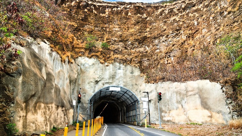
From the parking lot I walked along the left-hand pedestrian pathway through a tunnel offering access to the crater and presented my reservation QR code to the attendant, who allowed me to enter even though I was about 35 minutes early. Then I headed for the trailhead, estimating it would take about 40 minutes to reach the summit.
Prepare for direct sun and escalating heat

This trail, completed in 1911 as part of Oahu's coastal defense system, is a hike not a stroll. While just 1.6-miles round-trip, the .8-mile ascent from the trailhead to the summit is moderate in difficulty, but definitely steep in several places—there's a 560-foot gain in altitude, about equivalent to a 50-story building, with several sets of stairs—and is mostly exposed to the sun. I had slathered on sunscreen and was wearing a baseball cap.
Sneakers are a must, since surfaces on the latter two-thirds of the ascent are uneven. I also had a small nylon backpack holding a water bottle and a banana. There is a visitor's center with restrooms and vending machines selling water. Dehydration is a common issue and I saw far too many people along the trail without water in hand; despite ocean breezes the temperature can escalate quickly by mid-morning.
Set your own pace as the trail surface changes

The first thing you'll notice is that people of all ages and sizes—fit locals who practically jog up the trail just after sunrise, families with young kids, and even not-so-fit retirees with walking sticks or canes—are on the trail, so almost anyone without major mobility issues can reach the summit by setting their own pace, although there are several tricky portions. I am in my early 60s and reasonably fit with decent aerobic capacity (I have walked an average of four miles daily for the past two years), and here's how I would access the trail conditions.
The first quarter of the trail is a breeze, a flat or gently rolling paved surface that offers terrific (or terrifying if you're not a fan of heights or steps) views of earlier arrivals making their way up to the summit area.
This gives way to a series of switchback trails carved from rock, so the surfaces are rutted and uneven, but a handrail offers support for those who need it. The ascent here is mostly moderate and leads up to an overlook with terrific views of the ocean on one side and the visitor's center on the other. There are a few cement-and-steel perches that are a great spot for a photo-op.
Next comes the first set of stairs (there are 76 steps), which curve up the lava-rock slope like a yellow brick road for the aerobically fit (or a serious challenge for the average tourist). Plenty of people stopped to catch their breath on the way up.
When you reach the top, you'll need to walk through a narrow, dimly lit, 225-foot tunnel—and at the other end are more stairs, this time with 99 steps! But there's also a sign that advises taking the Loop Trail to the summit and then returning via the stairs, which is the route I opted for. The trail, which has a moderate-to-steep incline, loops around to another lookout area before leading to a set of steep metal steps to access the summit area.
Once up the steps, there's another moderate-to-steep stone trail and a final set of steps to the summit. There, I mingled with about 20 others who had just completed the climb and were angling for the best photos of Waikiki (and all of Honolulu) down below. This perch, at 760 feet above sea level, also offers a great perspective of the 3,520-foot circular crater itself, which was created by a single eruption about 150,000 years ago.
While the world knows this landmark at Diamond Head, to native Hawaiians it is Le'ahi, meaning "point of the tuna fish."
Take in the crater's history
The views are indeed awesome, but after about 15 minutes I decided that the Summit Lookout was getting a little too crowded (this was about 8:15 a.m.), so I headed back down to find the route that would lead to the infamous 99 stairs I'd avoided on the way up. Along the way, I discovered another stunning view of waves breaking along the rugged coast near a century-old navigational lighthouse.
Then it was time to shimmy down a tight set of stairs into the cement-and-steel bunker of the former Fire Control Station—yes, that's the way to exit unless you want to head back down the Loop Trail. These claustrophobic observation spaces were also used to command the firing of munitions from Fort Ruger and Fort De Russy during World War II.
There are multiple levels of observation bunkers (the rest are closed to the public), linked by a rusted spiral staircase. Descending it is the first challenge for visitors seeking to exit this way; those who opted to climb the 99 steps must also scale the spiral stairs on their way up. I passed a number of 99-step climbers on my way down—but descending was a heck of a lot easier. The Loop Trail on the way up was definitely the way to go.
Bottom Line

To finally have hiked Diamond Head felt great. While it's not for everyone, those who are reasonably fit and can walk uphill for at least 30-40 minutes (including climbing several sets of stairs) should be able to make it to the summit. Just remember, the earlier the better, wear a hat and sunscreen and bring water.
As I retraced my steps back through the tunnel and down the rutted switchback trails, which by 8:30 a.m. were quite crowded with hikers on their way up, I was happy that I was able to hit the trailhead by 7:15 a.m. and finish by 8:45 a.m., about 90 minutes roundtrip.
After a quick Uber ride back to Waikiki, I showered and ate breakfast. But before leaving for the airport for my flight back to New York, I stood on the balcony of my hotel room and stared once again at Diamond Head, still awed by its iconic silhouette, but now also privy to its history, geology, and the climb that every Oahu visitor who is physically able should do—at least once.