Rhode Island's Only True Border-To-Border Thru Hike Is A Scenic Trail Through The Whole State
How small is Rhode Island? Very small. The Ocean State is only 48 miles long and 37 miles wide, making it the tiniest state in the nation. Rhode Island is only half the size of Delaware — the second-smallest — and there are more than 500 counties in the U.S. that have a larger land area. On many U.S. maps, Rhode Island is barely visible, and even New Englanders tend to forget it exists. You may be shocked to hear that more than a million people live here, and it still manages to fit in 14 state parks and 400 miles of coastline.
Some might smirk at the idea of a hiking trail across Rhode Island, but the North South Trail is a pretty serious endeavor. At roughly 77 miles, this network of paths and roads stretches from the southern coast to the northwest corner of the state, and most hikers need 5 days to a week to complete it. Drivers can bomb through the state on Interstate 95, transporting themselves from one border to the next in only 45 minutes, while thru-hikers spend long days in fields and forests, small towns and gentle hills. You could easily add this trail to a list of incredible places in Rhode Island you need to visit at least once.
The nature of the North South Trail
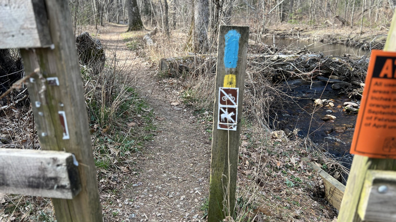
The North South Trail was first developed in the early 1990s as a way for hikers to safely walk across the state and explore the abundant natural spaces of Rhode Island's western border. The trail was completed in 1999, marked throughout with blue blazes (pictured above) and occasional signs. To hike the whole thing, most people start at Charlestown Beach, then head straight north; the meandering route takes you through Burlingame State Park, the Arcadia Management Area, the Georgia Washington Management Area, and many rural villages in between.
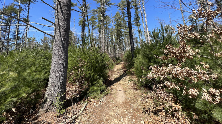
The route is largely composed of dirt trails through woods, but many segments run along actual roads, which means walking on the shoulder and watching out for traffic. While Rhode Island doesn't have an abundance of campgrounds, most of them are located on or near the North South Trail, so thru-hikers should have a place to set up their tents during the warmer months.
Local campgrounds are generally closed between fall and spring, so winter hikers will have to make other plans. Note that there are few hotels or motels along the route, which is why hikers may consider taking the North South Trail in stages. You're never too far from civilization, but some sections are more remote than others, and you may walk for miles before finding a place to resupply. If you're thinking of going it alone, here are some safety tips to know before your first solo hike.
Logistics of the North South Trail

The start of the North South Trail is pretty easy to get to: Either someone can drop you off at Charlestown Beach, or you can take a ride-share from one of the larger towns. The historic village of Westerly is located in the southwest corner of the state, and it has its own Amtrak station; from there, you can take an Uber or Lyft to the beach in about 25 minutes.
A bigger challenge is what to do when you've finished: The North South Trail ends in Douglas State Forest, a quiet area at the intersection of Rhode Island, Massachusetts, and Connecticut. There's no mass transit here, and cell service is patchy. Your best plan is to coordinate with a trusted friend to pick you up at a certain time; the forest is fairly large, so make sure you pinpoint a specific rendezvous point.
Then again, you don't have to stop there. Douglas State Park is also the southern terminus of the Midstate Trail, which runs for 92 miles through Massachusetts. The Midstate is a logical extension of the North South Trail, and it continues all the way to the New Hampshire border. It also passes over Wachusett Mountain, New England's most accessible ski resort in the heart of Massachusetts, which is a beautiful hike in summer as well.