Tucked Between Reno And Lake Tahoe Is An Underrated Mountain Getaway With Trails And Surreal Beauty
Lake Tahoe is surrounded by tall peaks enticing hikers to test their resolve at high elevations. The pristine, crystalline lake straddles both Nevada and California at the base of the Sierra Nevada Mountain Range. Countless opportunities to trek through the surrounding alpine landscapes can be found throughout the region, but Tahoe's Nevada side offers some underrated mountain trails that guide hikers through positively surreal scenery. Among them is the amble up Mount Houghton.
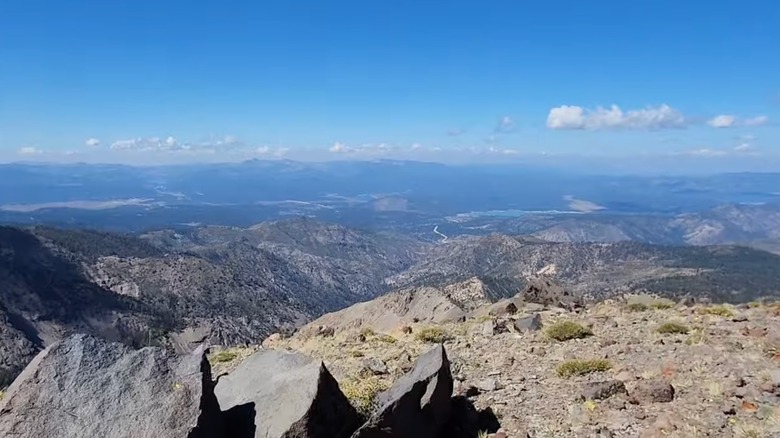
Cresting Mount Rose, the tallest peak on Lake Tahoe's Nevada side rising 10,776 feet above sea level, is by far the more popular hike. However, the looping trail up nearby Mount Houghton offers equally sublime views with generally less foot traffic. A challenging journey, every step is rewarded upon reaching the mountaintop where hikers behold panoramic views of the picturesque lands that the indigenous Washoe peoples have lived off of for centuries plus glimpses of Lake Tahoe.
Trekking through the Mount Rose Wilderness Area
A crystal-clear vacation haven straddling two states, Lake Tahoe is a draw for travelers the world over. Trekking to the surrounding mountaintops provides some of the most extraordinary views of this aquatic jewel. Dotting the valleys below Mount Houghton and its neighboring peaks are other mountain oases much smaller in size than Tahoe, North America's largest alpine lake, but still strikingly scenic.
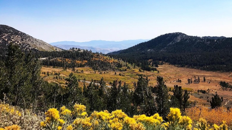
Along the route to Mount Houghton's 10,490-foot summit are sweeping vistas of the Mount Rose Wilderness Area and its carpet of colorful flora. Nevada's Great Basin and Sierra Nevada landscapes blend sublimely in this transitional wilderness area. Traversing the gravel path up the mountainside, pass by granite and basalt outcroppings left over from past eruptions of the now-dormant volcano looming overhead. Abundant in the beginning, plant life gets sparser as elevation increases but patches of snow linger long into summertime up here. When snow melts, a waterfall cascades down the rock face along the way.
Pine trees accompany hikers early on. Gnarled, weathered trunks that long ago lost their foliage act as guardrails at times. In spring and summer, periwinkle lupines and larkspurs, berry-dotted manzanita bushes, and crimson red paintbrush plants add vivid tones to the landscape. Autumn's often-dramatic High Sierra temperature changes bring gilded mule's ears and goldenrod shrubs, plus golden aspen leaves. Darting through it all are squirrels and rabbits, among other wildlife, while red-tailed hawks soar overhead.
How to head up Mount Houghton
To get to Mount Houghton, drive up the Mount Rose Scenic Byway, among the most picturesque Lake Tahoe road trips. A 35-minute journey from the Reno-Tahoe International Airport, take Interstate 580 South for 8 miles to the byway, officially dubbed Nevada Highway 431. This highway winds up the mountain another 16 miles to the trailhead, largely hugging a cliff's edge.
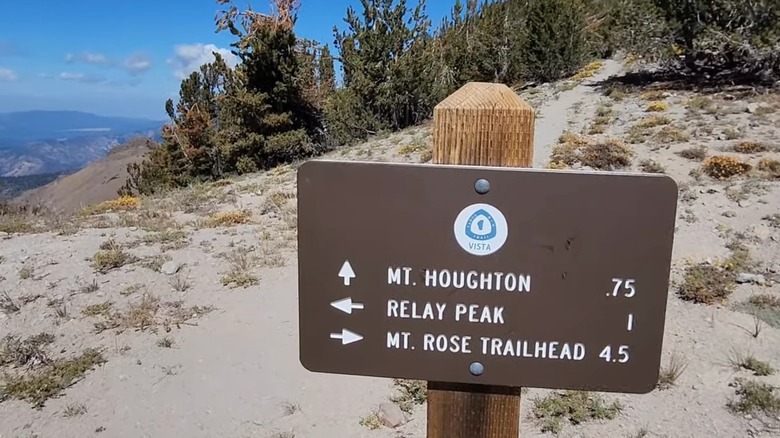
Eventually a sign marking the summit of the "Highest Year-Round Sierra Pass" and a parking lot at approximately 8,900-foot elevation emerges on the right. From here, several paths take you upwards. To get to Mount Houghton's summit, take the "Hikers Only" Relay Peak trail from the parking lot and up some stone steps. Being a loop trail, taking the Relay Peak Road will also get to the mountaintop, but horses and mountain bikes could also be sharing the wider route. Either way, ascension up to the second highest peak in the area begins here.
Block a good six hours at the minimum to tackle this 11.5-mile trail with an elevation gain of nearly 2,000 feet. The views are breathtaking, but so is the ascent, literally. While temperatures here are at least 10 degrees cooler than on the valley floor at any given time, in the summer the largely exposed trail can get hot. Spring and fall are ideal for both views and temperatures. Bring plenty of water, sun protection, and good hiking shoes no matter the time of year.