
Forget The Grand Canyon, Visit The Western Region's Lesser-Known Escape With Trails, Waterfalls, And Rock Arches
Backpacking the Grand Canyon is on just about every dedicated hiker's bucket list, and for good reason: Descending the South Kaibab Trail at sunrise is like plunging into a vivid kaleidoscope, one of the world's greatest natural light shows, and an experience you'll remember forever. But there are many good reasons to look beyond one of the Seven Natural Wonders of the World in search of adventure. While the Canyon will always be the gold standard for dramatic desert scenery, planning a hiking trip below the rim comes with its own set of challenges. Meanwhile, there are other, less-traveled desert canyons to explore in the American West, and few are as potently memorable as Coyote Gulch, a rugged, red rock beauty in Southern Utah.
Sitting at a much lower elevation (around 4,500 feet as opposed to the Grand Canyon South Rim's 7,000 feet), Coyote Gulch is well below the snow line, offering a more extended season of hospitable weather. If you hike all 26 miles of our recommended route through Coyote Gulch to the Escalante River, you'll gain and lose around 2,500 feet of elevation (by contrast, a rim-to-rim Grand Canyon hike via the South Kaibab and Bright Angel Trails roughly doubles that elevation in just 24 miles). Coyote Gulch permits are self-issued at the trailhead, unlike the Grand Canyon's complex lottery system.
The typical backpacking trip into Coyote Gulch will begin on Hole-in-the-Rock Road in Utah's Grand Staircase-Escalante National Monument (GSENM), but the gulch itself stretches into the Glen Canyon National Recreation Area, where it joins the Escalante River, which in turn feeds into Lake Powell. While casual visitors can take in the majesty of the Grand Canyon from the rim, visiting Coyote Gulch requires a hike. But if you're willing to put in the effort, the reward is an utterly unique wilderness experience.
What you'll see in Coyote Gulch
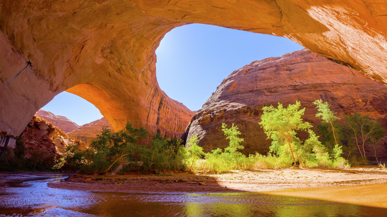
This 14- to 26-mile hike (depending on how far down the gulch you choose to go) from the Hurricane Wash Trailhead has a magnificent concentration of scenery, including red rock slot canyons, waterfalls, and natural arches. If all you have time for is a weekend one-nighter, you can hike in around 7 miles to the much-photographed Jacob Hamblin Arch, a flaming, cathedral-like amphitheater that frames the blue sky overhead, giving you much the same sense of awe visitors to the Grand Canyon experience.
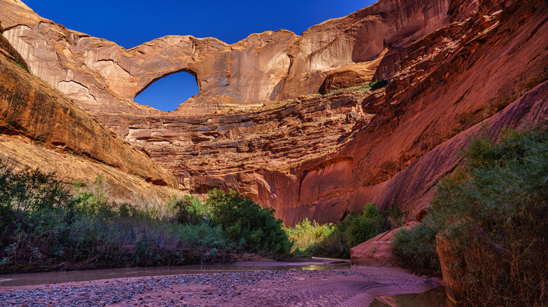
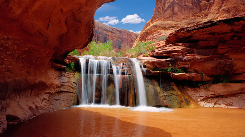
Further downstream, you'll see a series of small, pretty waterfalls as the stream meanders. The next feature you'll encounter, around 8 miles from the trailhead, is the Coyote Natural Bridge, a grand archway that spans the creek. Past this, another mile or so, look out for a steep, sandy slope. Ascend this to check out a stunning set of pictographs. If you make it as far as the confluence of Coyote Gulch and the Escalante River, a short trip upriver will gain you a view of Stevens Arch, one of the largest natural arches in the world. Add an extra night and take a day to explore the Black Lagoon box canyon. "The black lagoon was a very special treat — talk about an oasis in the desert!" one Tripadvisor backpacker wrote.
The shoulder seasons are highly recommended for this hike, as summers can be very hot, and winters freezing. Fall can be an especially beautiful time to take this trip. "We went in mid November and the weather was perfect! Only saw a few people down there the whole time and the trees had all their bright fall colors," writes one Redditor.
Planning a trip to Coyote Gulch
Any trip into Coyote Gulch should begin with a visit to the Interagency Visitor Center in one of America's best trail towns, Escalante, Utah, where you should check on road and trail conditions and the weather (don't rely on standard forecasts for flash flood risk in monsoon season; always check with the rangers). It's around 40 miles from the Visitor Center to the Hurricane Wash Trailhead, the last 33 miles on Hole-in-the-Rock Road, a dirt road that begins at Highway 12. When dry, it's passable by two-wheel-drive passenger vehicles. This trailhead provides the easiest access to the canyon (other routes, including day hike options, can involve ropes and scrambling, or canyoneering).
Much like Zion's Narrows, this hike involves multiple creek crossings and wading, so you will want specialized footwear, as described by Dreamland Tours, which offers guided hikes locally. Bringing a lightweight water filter or LifeStraw lets you stay hydrated while traveling light. "Go do it," urges one Redditor who toured Coyote Gulch as a 19-mile backpacking trip. "I liked this hike better than any hike in Zions because of the seclusion factor."
The first 3.5 miles you'll be hiking through a sandy wash, but then you'll reach the gulch and begin hiking through water. Following the flow means it's easy to keep the trail, but do download your navigation aids before leaving Escalante, because there is no cell service here. At mile seven, you'll arrive at Jacob Hamblin Arch. For a two-night itinerary, you can set up a base camp near here, then leave your tent and sleeping gear set up and spend day two exploring further down the canyon as far as the confluence with the Escalante River, returning to spend another night before hiking back out on day three.