
Between Blackpool And North Pennines National Landscape Is England's Majestic Mountain With Sweeping Vistas
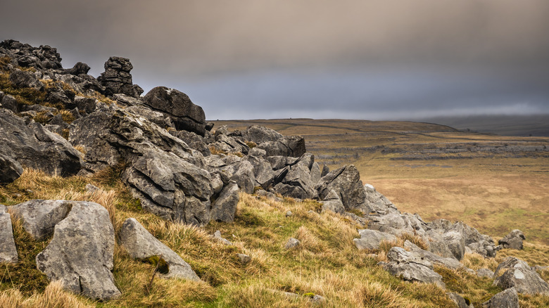
Sitting at the nexus of rugged, beautiful English terrain is Yorkshire Dales National Park, just halfway between Blackpool and the North Pennines National Landscape. Within the Yorkshire Dales National Park, hikers and nature lovers can find some of England's most interesting and beautiful natural features, from caves and waterfalls to hills covered in purple heather and majestic mountains. With regard to this latter feature, Gragareth Mountain is one can't-miss attraction if you're in search of eye-catching panoramic views.
Gragareth is a mountain located on the western portion of the Yorkshire Dales National Park, north of Ingleton, straddling the border of North Yorkshire and Lancashire. At around 2,057 feet, it is considered to be the highest point in modern Lancashire county. It also has some unique features such as cairns, drystone walls, and a triangulation point, also known as a "trig point" or "trig pillar." This pillar is one of 6,500 that were built around the United Kingdom and used to retriangulate the country for more accurate map making.
A heads up for hikers, the journey to the top can be quite arduous and steep, but it's well worth the visit. To get closer to the mount, head to the town of Ingleton, which has darling stone structures and the historic Ingleton Railway Viaduct. If you're traveling from London (and you've already avoided breaking these five London Underground Rules), you can take the London North Eastern Railway to Leeds or Shipley, the Northern train towards Morecambe to Giggleswick and from there grab a coach to Ingleton.
The best way to explore Gragareth
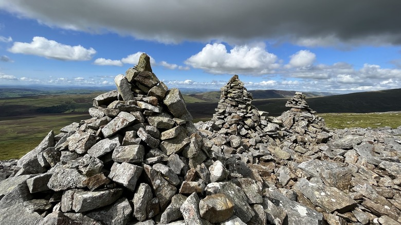
There are many scenic routes to Gragareth's peak. A popular option is the Crag Hill, Great Coum, and Gragareth Circular, a great route if you're looking for a challenging but beautiful hike. At 9.4 miles long, you will not only get to summit Gragareth but also Crag Hill, Great Coum, and Green Hill, where you'll get panoramic views of the rolling hills from multiple vantage points. You'll also pass by the County Stone, which denotes the northeast corner of Lancashire, and the Three Men of Gragareth, piles of stone cairns that stand watch over the valley below. To start, park at Bullpot Farm, also home to the Red Rose Cave & Pothole Club.
Another option within a 10-minute drive of Ingleton is the Ascent of Gragareth from Leck, beginning and ending at St. Peter's Church. The 9.3-mile route takes hikers around six hours to complete. This route runs along paved roads, gravel paths, and grassy tracks, passing scenic landmarks like the flowing Leck Beck stream, the rocky limestone valley of Ease Gill, and quaint family farms.
Along either trail, you'll likely pass by grazing sheep and cows, giant boulders, deep gorges, curving valleys, and grassy meadows laced with spider webs made opaque by the morning dew. At the top, the mountain opens its arms to the world with great grassy stretches of rolling hills and outlines of distant peaks. On a clear day, you get 360-degree views, including the Three Peaks of Yorkshire and the distant eastern mountains of Lake District National Park, home to one of England's most dangerous peaks.
An easier route to Gragagareth and Yordas Cave
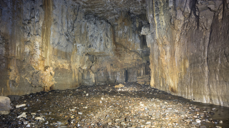
For a less lengthy hike that still gets you to the peak, try the out-and-back trail from Yordas Cave to Gragareth Peak. To begin, drive to the entrance to Yordas Cave and park on the west side of the road. From here, you can walk up to Yordas Cave. The unassuming exterior with its rocky ledges and stone steps does not at all betray the cave's jaw-dropping, expansive interior. Within the main chamber, there's a stream and a waterfall, and smaller passages allow for ample exploration. Be sure to bring the proper gear for caving, such as a headlamp and waterproof coats and shoes.
Most visitors finish their cave exploration after about 20 to 30 minutes. To continue your journey, you'll need to double back to the road where you parked to pick up the 1.5-mile stretch to the summit. Keep in mind, while the distance is shorter, you will still have a steep trek to the top. Once there, though, you'll feel on top of the world, having seen two sides of what this beautiful mountain has to offer. For more interesting caves, you might consider a trip to Castleton, a village in the Peak District National Park with a scenic castle and nature walks.
Either before you set off or after your hike, you'll definitely want to stop at one of the many top-rated eateries in Ingleton. For breakfast, consider GEM Café's unique options, including the classic "full English" (called The Gem) or the Bombay Breakfast, with fried chicken and Bombay potatoes in a Katsu curry sauce. Sample their variety of teas and coffee drinks. For lunch or dinner, head to Masons Freehouse, and try the locally-sourced venison burger or the most popular choice, steak pie.