Snaking Through Washington DC To West Virginia Is A Scenic Hiking Trail Highlighting American History
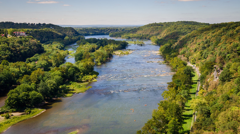
When it comes to American history, the largest concentration may be along the Potomac River. Along the 405 miles from its source at the Fairfax Stone in West Virginia to Chesapeake Bay, what came to be known as "the Nation's River" has witnessed the birth, rise, and struggle of the United States with a front-row seat. In tribute to this primacy of place, Congress established the Potomac Heritage National Scenic Trail in 1983. Not only does the route host dozens of sites key to the founding and growth of the country, it also offers an exceptionally rich natural and cultural tapestry in the peoples and landscapes along the trail's 900 miles — starting with the Patawomeck Tribe that gave the river its name.
The Potomac Heritage National Scenic Trail is more a patchwork than monolith, pulling together existing trails managed by federal, state, local, and nonprofit authorities. It's also growing and becoming more cohesive, with new segments opening regularly. Overall, the trail divides into eight defined regions. Running west to east — from Pennsylvania to the mouth of the Atlantic — these are the Laurel Highlands, the Great Allegheny Passage, Eastern Continental Divide, Chesapeake and Ohio Canal, Northern Virginia, Southern Maryland, Washington D.C., and Northern Neck of Virginia. Toward the southern end of the trail, you'll find Woodbridge, Virginia, America's fastest-growing suburb, surrounded by renowned outdoor beauty. Geographically, the trail covers five physiographic provinces, showcasing the tremendous natural diversity of the Coastal Plain, Piedmont, Blue Ridge, Valley and Ridge, and Appalachian Plateau.
Highlights of the Potomac Heritage National Scenic Trail
History lovers become kids in a candy shop along the Potomac Heritage National Scenic Trail. That's because it passes through locations hallowed by the events that took place there. Antietam National Battlefield — the site of America's bloodiest day — in the Chesapeake and Ohio Canal segment is a prime example, as is Harpers Ferry National Historic Park, where the Civil War sparked to life; Great Falls Park, home to one of the nation's first canals; College Park, which saw flights of the Wright brothers; George Washington's home at Mount Vernon; and numerous stops on the Underground Railroad. However, the largest concentration is in Washington D.C. itself, where the trail connects to the Frederick Douglass National Historic Site, near the National Mall, and so much more.
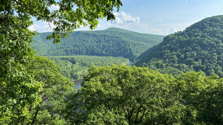
The historical treasures are matched by the natural ones. In Pennsylvania, these are crowned by the dramatic views of the river and gorge at Youghiogheny Overlook in the Laurel Highlands, one of the East Coast's most underrated state parks. In Maryland, Big Savage Mountain, Savage River Reservoir, and Douglas Point Special Recreation Management Area rank among the stunners. Virginia looks to Prince William Forest Park and Great Falls Park. Even urbanized Washington D.C. can boast Rock Creek and Glover-Archbold parks, as well as the wooded uplands and swampy bottomlands of Theodore Roosevelt Island in the Potomac itself. Often the nature and history are combined.
Travel tips for the Potomac Heritage National Scenic Trail

Owing to the length of the Potomac Heritage National Scenic Trail, there are hundreds of access points between Pennsylvania and Virginia. However, the eastern half is somewhat easier, as it contains the major airports, Washington Dulles International Airport and Ronald Reagan Washington National Airport. Baltimore/Washington International Airport in Maryland and Richmond International Airport in Virginia are not far, either. Go west on the Potomac Heritage National Scenic Trail, and the airports get farther away. In Pennsylvania, for example, Pittsburgh International Airport is the closest, about 80 miles from the trail. Amtrak offers several options on the Floridian line, which counts a half-dozen stops near segments of the trail as it heads northwest from Washington D.C. Nevertheless, a car remains the most convenient way to reach the Potomac Heritage National Scenic Trail.
The east-west divide applies to preparation, too. The eastern half of the Potomac Heritage National Scenic Trail keeps you in close contact with large population centers, hotels, hospitals, shops, and stronger cellphone signals. Head west, and these distances may grow along with the roughness of the terrain and challenge of individual hikes, with the Laurel Highlands ranking among the most difficult. On the C&O Canal Towpath, some forested sections can run 30 miles at a time. As such, it's important to prepare carefully and watch the weather to avoid problems along the path. This includes protection against ticks, poison ivy, dehydration, hypothermia and heat-related illnesses.
If you're visiting Washington, D.C. but you're not prepared to hit the trail, visit this fascinating Maryland marine sanctuary that preserves World War I-era history.