Colorado's Hike To An Eerie Plane Crash Site Near Bellvue Is A Flowery, Challenging Trail Alongside Mountains
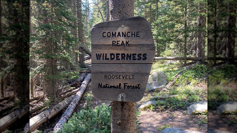
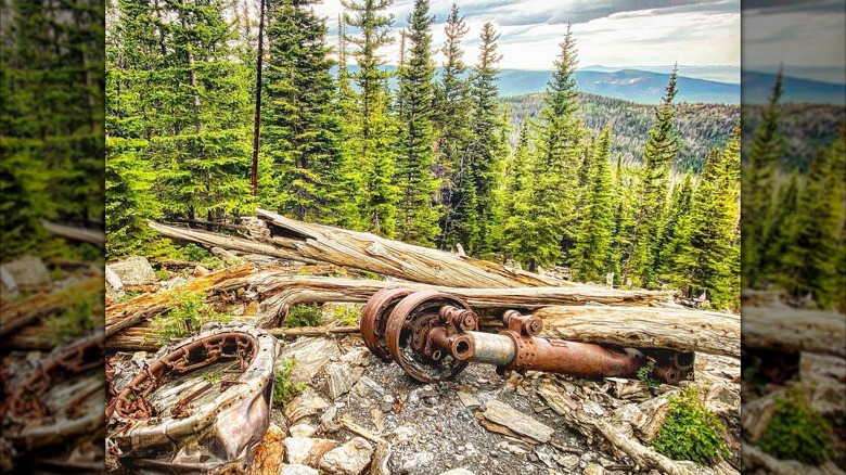
Colorado's Comanche Peak Wilderness Area might seem like an unexpected travel bucket list destination, but for wilderness hikers and World War II history buffs, it can't be missed. Tucked away in Roosevelt National Forest's Ponderosa pine-dotted Rocky Mountains, this wilderness hides a hard trail leading to the rusted-out wreckage of a B-17 bomber. Its deteriorating wing tips and engine parts sprawl across an expansive boulder field surrounded by evergreens, a haunting reminder of a tragic accident that occurred over 80 years ago.
On June 13, 1944, the doomed bomber took off from Rapid City, South Dakota, on a training mission with 10 servicemen onboard. At around midnight, the plane veered off course, crashing into the mountainside and killing four airmen. Due to the crash site's remote location, at approximately 11,400 feet, cleanup crews were unable to remove the mangled plane, choosing instead to destroy the remains with explosives. Today, the plane's gnarled debris field is a local legend, a place people's grandfathers tell their grandkids about.
When researching the Crown Point B-17 crash site, be careful not to confuse it with the Pingree Park B-17 crash site. Both sites are in the Comanche Peak Wilderness Area. However, they aren't accessible from the exact same trail. The trailhead to the Crown Point B-17 crash site is located about an hour and 45 minutes from Fort Collins, Colorado's less-touristy city hidden in the Rocky Mountains, and 1.5 hours from Bellvue.
How to reach the Crown Point B-17 crash site
To reach the debris field, you'll need to start from the Browns Lake Trailhead, which you can find by entering "Browns Lake Trailhead Parking Lot" into Google Maps. The road leading to the trailhead is on the bumpy side, but nothing that will ruin the day. However, the hike itself is lengthy — 13 miles in total —and will take you six hours or more due to the 2,400-foot elevation gain.
The first part of the trail is an uphill climb to Crown Point and Crown Point Benchmark with panoramic views of the surrounding peaks. Take a moment to rest and refuel before descending about 3 miles to the junction with the Flowers Trail. During the late-spring and summer months, blue columbines and other wildflowers dot this section of the high-altitude trail. Next, hike along the Flowers Trail for another 3 miles until you encounter a detour to the crash site. The detour is extremely short (about 0.10 miles) and marked with a plaque paying tribute to the four victims.
This trail is remote and marked mostly with stone cairns instead of traditional signage. This means you need to be extra careful and let someone else know of your hiking plans. Bring hiking poles, sunscreen, snacks, lots of water, and supportive hiking boots. If you feel the effects of the high elevation, remember that one of the best things you can do when you experience altitude sickness on a hike is to stop ascending.