Nestled On The Mississippi River Is Wisconsin's Colorful Getaway Bursting With Trails, Trees, And Crisp Air
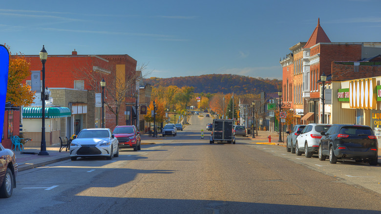
Mention Wisconsin and its award-winning cheddars likely come to mind. But there's a southwestern city in the Driftless Area where the great outdoors is really the big cheese. An upper Midwest region with no official borders, the Driftless Area is defined by its rugged, unglaciated terrain straight out of an outdoor enthusiast's dream. Peppered with everything from steep karst canyons and hardwood forests to prairie grasslands, its raw natural beauty captivates — and you might even spot the northern lights there. At the heart of Wisconsin's Driftless Area, Crawford County's Prairie du Chien is a city rich in history and scenic landscapes to discover. Situated above the confluence of the Mississippi and Wisconsin rivers, it's the second-oldest settlement in the state, after Green Bay, and the perfect all-season getaway for exploring nature trails. Among an abundance of routes, this underrated riverside city offers forested trails that traverse diverse ecosystems and historical sites. Along the trails, colorful vistas change with the season, from the white of winter snows and the greens surfacing in the spring, to summer's vivid emerald foliage and blue waters to the orange, red, and gold leaves billowing gracefully in the crisp air of fall.
One of the Northern Grain Belt Ports, Prairie du Chien began its chronicled history on June 17, 1673, when French Jesuit missionary Father Jacques Marquette and French-Canadian explorer and fur trader Louis Joliet became the first European settlers to map the Upper Mississippi River. Due to its strategic geographic position, the settlement caught the interest of French fur trader Nicolas Perrot who, in 1685, built a trading post in the area eponymously named Fort St. Nicolas. The Meskwaki (People of the Red Earth) bartered pelts for supplies with French traders who later named the settlement Prairie du Chien after Meskwaki chief Alim, which translates to "dog" in English and "chien" in French.
Prairie du Chien's scenic trails are part of its historic landscape
Nature lovers will be spoiled for choice with more than 600 acres of parks and green spaces and over 120 miles of trails in and around the city. Whether you're wanting a tranquil hike to observe wildlife, a bike adventure along hilly terrain, a leisurely horse ride through the woods, or cross-country skiing on a groomed winter run, Prairie du Chien has trails of varying difficulties and distances and historic landmarks along the way.
La Riviere is a 300-acre city park and a habitat of grassland, forest, and prairie. Here you'll have your pick of trails including 6 miles of hiking trails that are a birder's paradise and horse trails that extend to connecting bridle paths for more than 50 miles. You're literally trailing history: Tracts of La Riviere rest atop Bridgeport Terrace, the prehistoric Mississippi River's old riverbed.
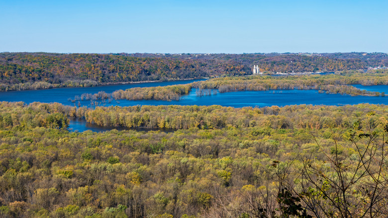
Wyalusing, one of Wisconsin's oldest state parks, offers two designated mountain bike trails with amazing vistas. The 1.8-mile Mississippi Ridge trail gives bikers a stunning bluff view of the Mississippi River. Whitetail Meadows trail is a 1.7- or 3.1-mile bike loop overlooking where grasslands skirt the forest. It's also a double-track loop for cross-country skiers. Check out Wyalusing's Point Lookout and the nearby rock marker that commemorates Marquette and Joliet's arrival. You can also view sacred Native American burial sites along Wyalusing's 1.8-mile Mississippi Ridge Trail and the 1.6-mile Sentinel Ridge trail and loop. About a 12-minute drive away, on Iowa's side of the Mississippi River, Pikes Peak is a dreamy state park with scenic Mississippi River views. Hike the half-mile boardwalk trail to see a bear-shaped effigy left behind by Native Americans and the photogenic Bridal Veil Falls.
Sustained forestry melds past and present in Prairie du Chien
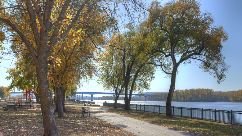
Without the luxury of modern signs, Native Americans and settlers created trail markers by bending the trunks of young seedlings to grow in a certain direction. Many of these historic trees have been lost to modern development, but Prairie du Chien's reforestation efforts include planting new saplings in parks and community gardens, and these newcomers share ground with older trees venerating local history. Stroll amid St. Feriole Island's 240 acres of parkland and explore the Trail of Presidents, a double row of 22 red and white oaks honoring presidents who have lived in or visited the city. Anchored by two blue spruce, the trees were planted on Arbor Day in 2014. During the War of 1812, St. Feriole Island was also the site of the Battle of Prairie du Chien, where the British fought American forces for control of the fur trading routes.
With parks that are truly awe-inspiring in the fall, from September through November, Prairie du Chien is a great place to hit the trails and go leaf peeping as the foliage achieves its peak color. During the fall months, temperatures reach average highs of 60 degrees Fahrenheit and average lows of 40 degrees Fahrenheit, making it an ideal time to enjoy the crisp air and discover the magic of Prairie du Chien's scenic trails. Come prepared with the best fall foliage finder resources.
The best way to reach Prairie du Chien is to take a fly-and-drive route. Several national carriers fly into Dubuque Regional Airport (DBQ), which is about 65 miles away and an hour and 24 minutes' drive from the city. Alternatively, you can fly into Rochester International Airport (RST) in Minnesota, which is 113 miles away, and then make the approximately two-hour drive to Prairie du Chien.