The Scenic Alaskan Drive That Showcases Stunning Mountain Views Along The Arctic Circle
You don't go to Alaska for the weather. But with vast tracts of untouched wilderness along its coastal routes and beautiful black-sand islands scattered across the North Pacific, it may come as a surprise that Alaska is America's least-visited state. It's also the largest by area, covering 570,000 square miles, and the most sparsely populated, with half of the total population living in the city of Anchorage. In short, Alaska is a big, beautiful, and mostly empty place where hikers, mountaineers, road-trippers, and kayakers go to feel like they're the last person on Earth.
Nowhere is this truer than on Alaska's Dalton Highway. That it starts at an active gold-mining town called Livengood (which shares a latitude with Iceland and Canada's Nunavut territory), and ends 400 miles later north of the Arctic Circle in an ice-blasted community known as Dead Horse tells you a lot about this epic highway. The scenic byway traverses the Yukon River and the Atigun Pass, the highest in Alaska at 4,739 feet, from which you'll get epic views of the Brooks Range.
Scenic as it undoubtedly is, don't expect much in the way of traffic or amenities around here. There are only three refueling stations along the entirety of the route, and most of the vehicles are articulated trucks designed for the uneven gravel roads. Add to that a total population of 60 along the highway's 400-plus miles and scarcely a drop of cellphone service from stem to stern, and you can see why it's known as the loneliest road on the planet.
When to drive the Dalton Highway
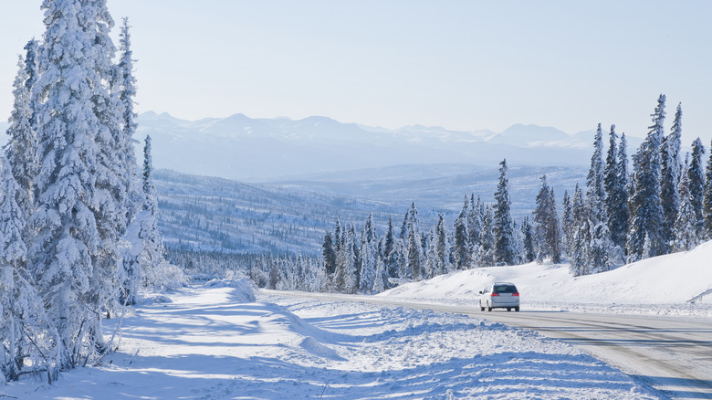
There are several precautions to take before driving the Dalton Highway: bring plenty of supplies, prepare for temperatures that can plunge to minus 80 degrees Fahrenheit, and purchase a citizens band (CB) radio. After all, fatalities are not uncommon on the route, but this shouldn't dissuade you altogether. The summer months, particularly July and August, when the sun never dips below the horizon, are the most agreeable this far north of the equator. This is also when the monochrome white landscape reveals itself in technicolor.
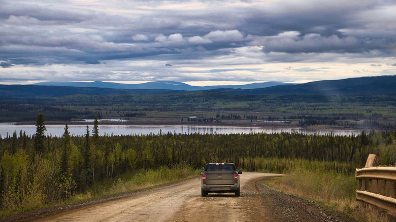
The Atigun Pass becomes a series of yellow-brown slopes, bisected by the winding gravel track. Thick, evergreen forests hugging the roadside make the region appear as though it's teeming with life. Skies, once darkened by the long polar night, become bright blue, and evenings are illuminated by the midnight sun. Summer still poses some of its own driving challenges, like swirling dust and gravel chips thrown up by large transport vehicles.
During these months, you can stop at the Arctic Interagency Visitor Center in Coldfoot, which provides general tourist office services and assistance. And if you make it all the way to Deadhorse, you can join a tour of Prudhoe Bay with the Northern Alaska Tour Company. If you're nervous about driving, express buses and private charters also make the trip north and south in summer. With these options, you'll lose the freedom of being behind the wheel but gain an experienced Dalton Highway driver in return. Be aware that accommodations are few and far between in this part of Alaska, but there are guest lodgings at the Yukon River Camp at Mile Post 56 and in Coldfoot and Deadhorse.