California's 'Little Patagonia' Is A Breathtaking Region Of Ice Blue Lakes, Glaciers, And Mountain Peaks
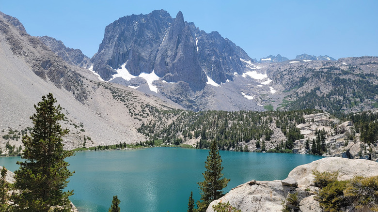
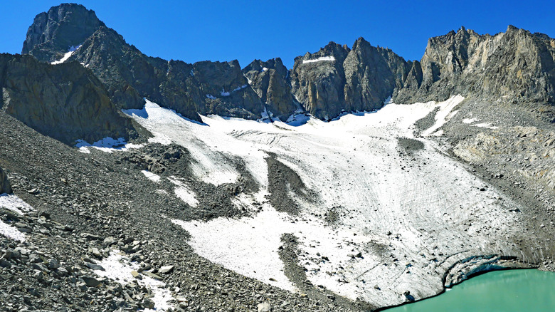
When you think of California, you think of warm and sunny beaches perfect for a late-night bonfire, like Aliso Beach and Playa Pacifica Park. That said, some of the most breathtaking scenery in the state can be found far from the coastline. In Sierra Nevada, there's a region that has chilly lakes, a glacier, and towering mountains. This is the Big Pine Lakes region, also known affectionately as "Little Patagonia." Considered as one of the finest day hikes in California, it holds unmatched mountain views and access to America's southernmost glacier.
To reach Big Pine Lakes, trekkers will have to start at the Big Pine Creek Campground. This is about 10 miles west of Big Pine, a census-designated place sandwiched between Yosemite and Death Valley National Park. From Los Angeles, the drive averages around four to four and a half hours. Those coming from San Francisco will have to endure a drive of over six hours. Visitors are encouraged to start their trek early. Even though the area is accessible due to paved roads, parking for day use is limited.
The Big Pine Lakes hike along the North Fork Trail is a 15-mile loop trek through the John Muir Wilderness. Expect to gain about 3,400 feet in elevation. Many hikers stop at Second Lake to set up a picnic and enjoy the views, while others continue to the other lakes for a more secluded experience.
Trekking to Palisade Glacier
For hikers seeking an added challenge beyond the lakes, the trek to Palisade Glacier offers one of California's most rewarding high-altitude adventures. This area sits at over 12,000 feet. That's why it's not surprising that the way to it is far from simple. The route from Second Lake to the glacier viewpoint covers roughly 8 miles round-trip, with an elevation gain of about 2,500 feet. The terrain becomes progressively more rugged. The trail becomes harder to follow past Sam Mack Meadow, where cairns often guide hikers across rocky terrain. There's also a steep ascent involving massive rocks and loose talus slopes.
Because of its difficulty, proper preparation is key. Weather in the John Muir Wilderness can change quickly. Layered clothing, sturdy hiking boots, and a reliable navigation plan are highly recommended. Carrying an offline map or GPS device is also critical.
Three items that every outdoor enthusiast should bring on their camping trip or hike to the Palisade Glacier to make it easier include a pull-string fire starter, a Swiss Army knife, and battery chargers. Altitude sickness is a genuine risk, especially for those who haven't acclimated to elevations above 10,000 feet. If you plan on undertaking this challenging trek, pre-hike conditioning and gradual adaptation are more than necessary.
Mountain peaks around Big Pine Lakes
The peaks rising above Big Pine Lakes are as much a destination as the vibrant waters below. Temple Crag is perhaps the region's most recognizable landmark. It towers above Second Lake and draws both photographers and climbers to its imposing granite peak and spires. Surrounding it are four of the Sierra Nevada's highest summits, which include North Palisade, Middle Palisade, Mount Sill, and Polemonium Peak. All of these are visible in the area due to their heights of more than 14,000 feet.
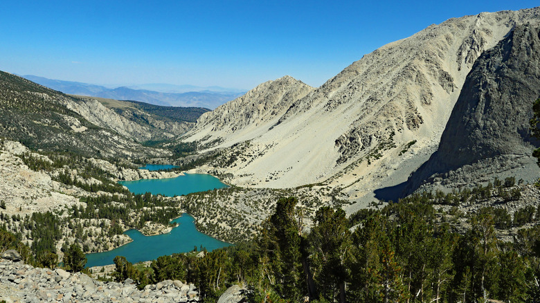
From the Palisade Glacier viewpoint, travelers have the opportunity to look at Big Pine Lakes' breathtaking terrain from above. Here, sweeping vistas reveal valleys, cascading creeks, and the pristine basins below. For the highly skilled and properly equipped, the surrounding ridgelines and climbing routes offer challenging opportunities. Temple Crag and nearby fourteeners like North Palisade and Mount Sill feature technical ascents suited for experienced climbers. Most visitors, however, find the ridgeline above the glacier to be the perfect stopping point.


