The Longest Trail In The World Stretches From Coast To Coast Across Canada's Idyllic Landscape
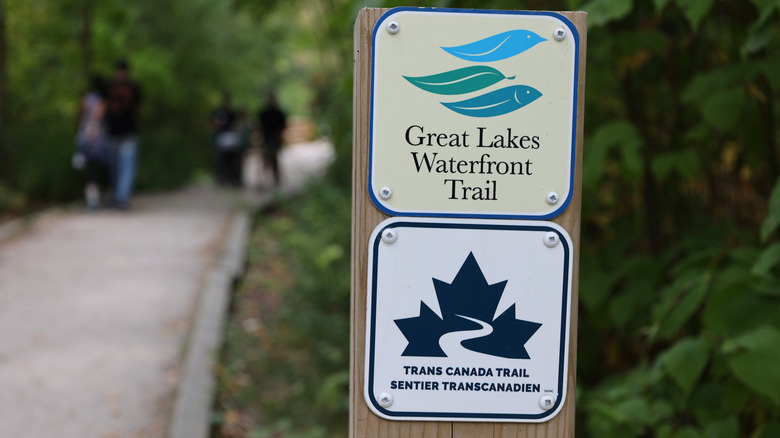
Canada is the second-largest country in the world by area, with an incredible diversity of landscapes: mountains, prairies, rugged coastline, and more. Canada is also home to the longest multi-use trail system in the world — the Trans Canada Trail. This epic 28,000-kilometer (17,000-mile) trail was established in 1992 and is accessible for hikers, cyclists, and horseback riders; in the snowy winter months, cross-country skiers and snowmobilers can use the trail, too.
The Trans Canada Trail is made up of around 400 local community trails, which are linked together to create one massive trail that spans the whole country. The Trans Canada Trail's official website notes that 80% of Canadians live within 30 minutes of one of these trails, meaning it's easily accessible. However, using this route is different than if you were to hike the Appalachian Trail, for example. Only 32% of the Trans Canada Trail follows off-road trails — meaning there are many stretches using roads and highways as opposed to rugged paths through the wilderness.
The Trans Canada Trail's route
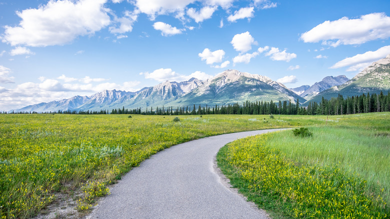
The Trans Canada Trail passes through every province and territory in the country — plus it connects all three of Canada's oceans: the Atlantic, Pacific, and Arctic. The trail starts at Cape Spear, the easternmost point in North America — designated as the trail's Kilometer Zero — before heading into the Canadian destination that Samantha Brown says to visit for European culture and experiences, St. John's in Newfoundland. The route then travels through Nova Scotia, Prince Edward Island, New Brunswick, Quebec, Ontario, Manitoba, Saskatchewan, Alberta, British Columbia, Northwest Territories, Nunavut, and the Yukon. It's a phenomenal journey to explore Canada's diverse landscapes as well as its history, from the indigenous First Nations to the Gold Rush.
The scale of the Trans Canada Trail makes it very impractical to complete the route in one go. Traveling at a pace of 30 km (19 miles) per day, it would take 26 months to complete the entire trail! Due to cold weather and snow, most hikers wouldn't want to hike and camp continuously through winter, so it's best to break it up into sections by doing individual trails or provinces.
Highlights of the Trans Canada Trail
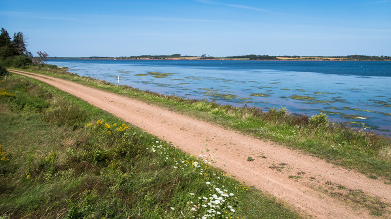
A trail of this magnitude may be difficult to complete in its entirety, but many segments of it can be tackled individually. In Prince Edward Island, the Confederation Trail runs for 449 kilometers (279 miles) from one end of the province to the other, with scenic coastal views. Le P'tit Train du Nord in Quebec is a 234-kilometer (145-mile) cycle trail through the forests and pretty small towns of the Laurentian Mountains.
There are some sections of the Trans Canada Trail you can hike in a single day. In Alberta, Prairie View Lookout Trail is a 6.7-mile hike with truly spectacular mountain views. Myra Canyon Trestles, a 7.5-mile hike, is a real highlight of the much longer Kettle Valley Rail Trail in British Columbia. In St. John's in Newfoundland, the Quidi Vidi Loop has great views over the harbor and old fishing village.
The more remote trail segments are breathtaking as they traverse the tundra. The Itijjagiaq Trail in Nunavut follows a traditional Inuit route with magnificent views. After visiting Yukon's capital, Whitehorse, a town brimming with gold rush history and creative vibes, set out for an extraordinary journey on the Dempster Highway starting in Dawson City and crossing the Arctic Circle. Whichever portion of the Trans Canada Trail you choose to traverse, it's sure to be an adventure.