Southern California's Recently Re-Opened Mountain Drive Is A Spectacular (And Dangerous) Thrill Ride
Road tripping is a quintessential American activity, immortalized countless times on the big screen. The American West, in particular, is chock-full of scenic drives through vast, breathtaking landscapes. But in a very Hollywood twist, the West is also home to drives like the steep views along New Mexico's "Bridge to Nowhere" and the road given the unsettling nickname of "America's Death Highway," straddling a fine line between spectacular and dangerous. For yet another example, look no further than the Angeles Crest Highway, which reopened in early September 2025.
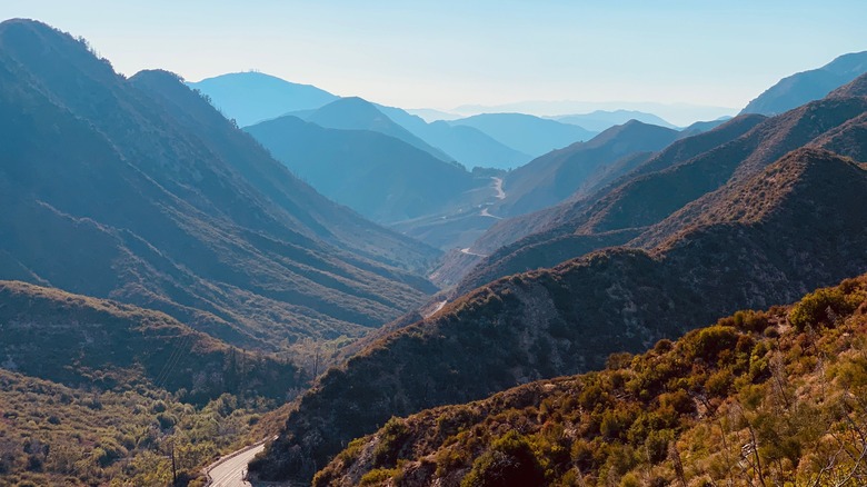
This iconic two-lane Southern California mountain drive runs through the Angeles National Forest, which spans about 60 miles from La Canada Flintridge in Los Angeles County to Wrightwood, at the border of San Bernardino County. A 10-mile stretch of the highway was closed after heavy storms in the winter of 2022-23 caused rockslides that damaged both the roadway and retaining walls, leading to unsafe conditions. These issues have now been remedied with additional reinforcement added to prevent similar occurrences in the future. Unfortunately, this isn't the first time that the Angeles Crest Highway has been temporarily shut down for safety reasons. It was closed for several years, as a result of landslides following the Station Fire, before reopening in 2009.
What you'll see on the Angeles Crest Highway
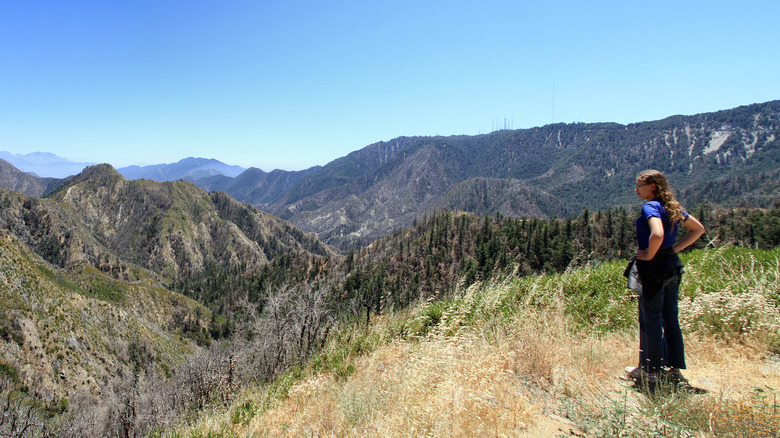
At this point, you might be asking, why bother driving along this risky road? All you have to do is look out the car window for an answer. This exceptional scenic byway winds through the San Gabriel Mountains, offering glimpses of chaparral and montane forest and the Mojave Desert. From high above the Los Angeles basin, you'll be afforded stellar views of Mount Baden Powell, the Mount Wilson Observatory, and other L.A. landmarks.
With its convenient starting point in La Canada Flintridge, located just 20 minutes from downtown Los Angeles, this is a particularly accessible scenic byway for Angelenos and visitors to enjoy as a quick excursion. You can easily follow up the drive with a tasty meal at Grand Central Market, downtown Los Angeles' iconic food hall with eclectic, award-winning eats, or pack your own food and pull over at one of the byway's numerous picnic spots for a snack or lunch with an unbeatable view. Some of these picnic areas, like Charlton Flats, are even equipped with grills you can use, but be sure to keep tabs on rules and regulations for fire safety.
Things to know before driving the Angeles Crest Highway
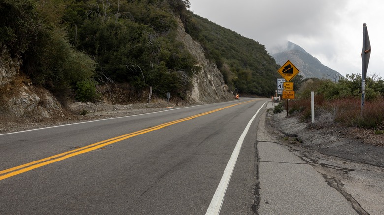
Before heading out on this drive, check the weather forecast: in addition to causing wet or icy roads, inclement weather can also lead to rockslides that obstruct the road. You'll also want to be aware that even without landslides, the Angeles Crest Highway can still be a treacherous road to traverse due to other drivers. With many twists and turns, you'll want to be sure to take your time driving and decelerate before rounding a bend. Be wary of other drivers taking the highway's steep hills and hairpin switchbacks at perilous speeds. Fortunately, you can make use of the many pullouts to allow passing traffic to overtake you if necessary.
All warnings aside, if you or your designated driver can stomach this thrilling ride, you're in for a real treat. After all, there's a reason why the Angeles Crest Highway has been referred to as "the most scenic drive in Southern California," according to Recreation.gov. As one of the highest roads in Southern California, this stunning showcase of mountain vistas is well worth experiencing, and the panoramic elevated views give new meaning to the name "City of Angels."