America's 5 Cities With The Most Confusing Public Transportation Systems, According To Visitors
For many travelers, landing in a new city and navigating a subway map is their first test on a trip. A city's public transit system can truly make or break how you feel about a destination. One study from Travel Behaviour and Society found that there's a link between transportation satisfaction and overall destination satisfaction, showing that the ease of using a city's public transportation affects whether a visitor enjoys and returns to the city. Knowing which direction to go in, whether to go by bus or metro, and how to pay are just a few of the things that differ from city to city.
Across travel forums like Tripadvisor and Reddit, people have made entire threads dedicated to the confusion of visiting certain cities due to their transit systems. Others have expressed their grievances in blogs and opinion pieces, sharing past blunders. We looked through these discussions to rank the American cities that visitors have complained about the most, with a more detailed breakdown of how we analyzed sources afterwards. These are the American cities that have the most confusing public transportation systems, including their quirks and limits, to help you have a better understanding of what to expect.
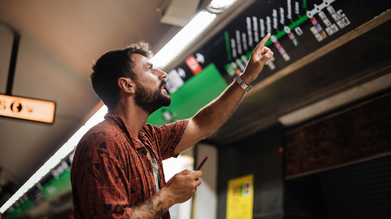
New York City
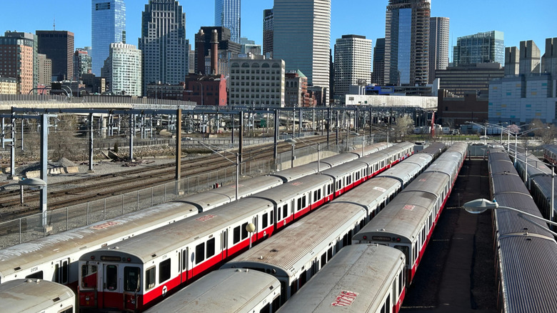
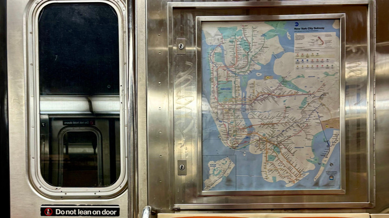
The New York City subway has 468 stations, over 650 miles of tracks, and over two dozen routes. If that doesn't sound daunting enough, there are additionally over 300 bus routes, six ferry routes, and one aerial tramway, which takes you on a scenic ride to the quiet escape of Roosevelt Island. Despite the myriad ways to get around the city, multiple Reddit threads, Quora discussions, and social media posts are dedicated to venting frustrations about the NYC transit system.
One Reddit user summarized some of the dizzying elements for newcomers: "...express and local tracks, extensive interlining, and a directional system that often uses borough names and uptown/downtown instead of endpoints or cardinal directions." Add on that some stations have very similar (or the same) names, at times there aren't connections between uptown and downtown sides of a station, and crushing rush hour crowds and it can feel a bit like anarchy. You might be dissuaded from even attempting NYC's transit, but there's an underlying logic to the system that some tricks help simplify.
Firstly, know whether you're going uptown or downtown. These are the directions the subway trains use in place of north and south, respectively. Make sure to check which of these a station is labeled, since sometimes you can't cross to the other direction if you enter on the wrong side. NYC blogger Tracy Kaler says, "For newbie straphangers, a good New York subway map is the best way to learn the lines." Citymapper is a reliable option that provides a map and easy directions, with 4.9 stars on the Apple store. MetroCards were phased out as of 2026, so all stations now have contactless payment readers. You can simply tap a contactless payment card or mobile wallet, and you're good to go.
Chicago
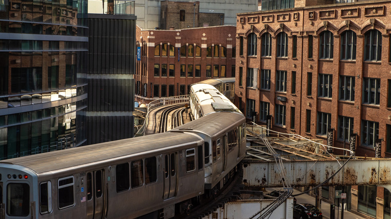
Chicago's metro system has some of the most stations for a single subway in the U.S., after NYC. The train system has 146 stops, spread across eight routes and over 200 miles of tracks. Unlike NYC's subway system, which crisscrosses the city with interconnected lines, Chicago's "L" train system radiates from a central core, called the Loop. In a Reddit thread about confusing public transportation systems, one user singled out that "all the trains in Chicago only go to or from downtown, there's no train connecting the lines."
A blog post from Barstool Sports even went as far as claiming that Chicago's system was more confusing than NYC's for a first-time rider, highlighting how the "L" doesn't have uptown or downtown designations. Instead, to know which direction you're going in, trains are designated by their terminal stop, and each line is color-coded. For example, the Blue Line runs in two directions: towards Chicago-O'Hare International Airport or Forest Park. The Barstool Sports post pointed out that the colors can be confusing — sometimes pink looks like purple, and some colors share tracks at the same station. So, make sure to look for the destination that's listed on the front of the train.
If you fly into Chicago-O'Hare or Midway, a great perk of the "L" is that it connects directly between the airports and downtown. Just note that it costs more when you're traveling to or from O'Hare. Another tip shared by a Reddit user: "Definitely don't count out the bus... express [buses] like the 146 make it super easy to get to River North or the Loop." Sometimes stops aren't announced on the bus, though, so be sure to check your location on a map app or street signs.
San Francisco
Though San Francisco's public transit system is smaller than New York City's, one area where it exceeds NYC in baffling first-time riders is how many different transit operators there are. San Francisco has over 20 transit agencies, making up a network of trains, streetcars, buses, and ferries that connect neighborhoods within the city and to other parts of the Bay Area, with a flurry of acronyms that can make heads spin. "I am so confused about the types of public transportation and the various ways to pay for them – I have tried to understand about Muni, Clipper cards, Bart, etc., but just can't keep it all straight," a Tripadvisor user lamented.
The two main systems that visitors typically take in San Francisco are Bay Area Rapid Transit (BART) and Muni. BART is a color-coded, regional train system that runs through some of the mainstay neighborhoods of San Francisco proper, like Hayes Valley, one of the city's best shopping neighborhoods with clever boutiques. It also connects the city to both Oakland and San Francisco International Airports. However, Muni is the most commonly used transit network in the city, according to SFGate. It's a system of buses, light rail, streetcars, and cable cars that circulates more extensively within the city. More likely, you'll take some form of Muni transit for routes inside the city limits, which are labeled by numbers and letters (as opposed to BART's colors).
How you pay for these different systems is sometimes brought up as a point of confusion. The good thing is that you can pay for all the public transit operators in San Francisco, including both Muni and BART, with a single tap-to-pay pass called Clipper. You can buy one online and add it to your phone to use digitally.
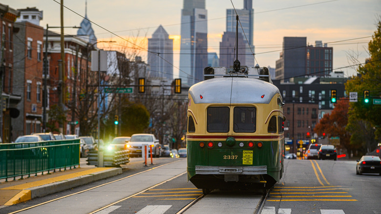
Boston
While one study has named Boston's public transportation the most reliable in America for its thoroughness, it can be a headache to navigate for people unfamiliar with the system. Boston's transit system is called the "T" — one op-ed from The Harvard Crimson quipped, "T stands for Terrible" — and it comprises an intricate lattice of branching subway lines, commuter rails, bus routes, and ferries.
Something about the "T" that can trip up first-time riders is the fact that the subway directions don't indicate north or south, or uptown or downtown, but rather "inbound" and "outbound." One Reddit user said the inbound/outbound convention "feels weird even for locals who are in a different part of the system than usual." The anchor of these directions is Boston Common. Inbound trains head towards the stations closest to Boston Common, while outbound trains move away from them. That can be a bit misleading, since some central downtown stations (including South Station, Boston's largest) have trains in an "inbound" direction.
Boston's rail lines are color-coded. Its Green Line gets frequently singled out as its most confusing, largely because it splits into four different branches with letter labels: B, C, D, and E. In Downtown Boston, the branches all go to the same stations, though, so the distinctions only matter if you're venturing further out. Another thing that might confuse visitors is that portions of the Green Line run underground, but other parts are street-level, which means it's sometimes slowed by street traffic.
Philadelphia
Philadelphia's public transportation system — the Southeastern Pennsylvania Transportation Authority (SEPTA) — has acquired a reputation for confusion that goes back to the 1980s, when it bore the slogan: "We're getting there" (per The Philadelphia Inquirer). It was called "Philadelphia's labyrinth" by CBS News and an "absurdity" by Loco Mag. Visitors have waxed frustration about the system on Reddit and Quora. One Reddit user said, "SEPTA does not make it easy to know where you are and need to go if you 1) don't actually know the route and 2) lose cell phone reception or power."
One of the main complaints about SEPTA's navigation is its signage. When CBS published its article in 2015, there were ideas being floated about how to improve signage for getting to different platforms in stations, but the issue has persisted. Take, for example, the City Hall Station, one that regularly comes up in discussions. "The lack of signage pointing you in the right direction is abysmal." a Reddit user said. Another issue is that SEPTA's regional rail runs on a zone-based fare system, and you have to know what zone you're ending at to get the right ticket. The signage also lacks in this regard, as some have noted that the zone demarcations are unclear.
If you'll just be staying in Center City on a visit, you most likely won't have to worry about taking the regional rail, unless you're coming from the airport. Center City hinges on two main metro lines: the Market-Frankford Line, running east to west, and the Broad Street Line, going north to south. These lines will get you to most of Philly's main attractions, including Independence Hall, Reading Terminal Market, and Temple University.
Methodology
We based our ranking of the most confusing public transit systems in the U.S. on visitor complaints across forums, blogs, and media coverage. We looked through Reddit, Quora, Tripadvisor forums, and newspaper op-eds to narrow down the cities that are mentioned most for having public transportation challenges like unclear signage, maze-like stations, multiple modes of transportation, and overlapping metro lines. All the cities considered have at least two rapid-transit lines and at least 50 stations, which makes the systems more complex for unfamiliar riders.