
The 'Tallest Mountain In The Netherlands' Is A Rainforest-Covered Peak In The Caribbean With Idyllic Island Views
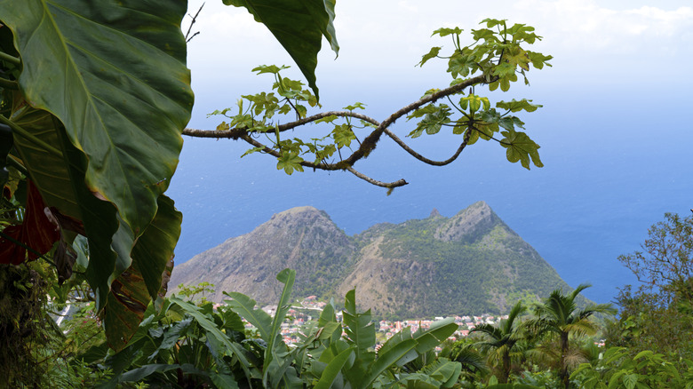
The tallest mountain the Netherlands is 1,804 feet tall, and its steep slopes are coated in tropical forest. As you climb Mt. Scenery, you may spot orchids, elephant ears, and wild plantain trees. Hummingbirds may flitter through the branches, and a blackbelly racer snake may slither near the path. Clusters of white-walled cottages will recede beneath you, just as the bright blue sea expands across the horizon. No matter what time of year you visit, you can expect temperatures between 75 and 90 degrees Fahrenheit.
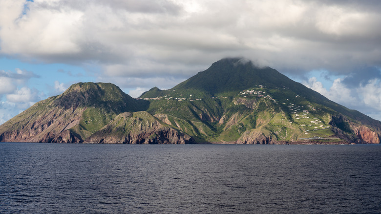
This probably doesn't sound anything like the flat, temperate Netherlands you're familiar with — which makes sense, because the "tallest mountain in the Netherlands" isn't in Europe, but on the Caribbean island of Saba. Thousands of miles from Amsterdam, Saba is a tiny Dutch "special municipality" that takes up only 5 square miles. Unlike the actual Low Countries, Saba is a volcanic island with astonishing verticality: As the seagull flies, the summit of Mt. Scenery isn't even 1 mile from the nearest shore. The land surges from (literal) sea level to nearly 2,000 feet in the span of about 17 football fields.
Saba is most closely associated with St. Maarten, a popular Caribbean getaway that is a more recognizable Dutch settlement. However, travelers consider Saba one of the most underrated Caribbean islands, and if you're willing to take an additional 20-minute flight (in a very small plane), this hike makes for a thrilling experience. Not feeling great about jungle trails? Don't worry: It's mostly stairs.
How to hike Mt. Scenery
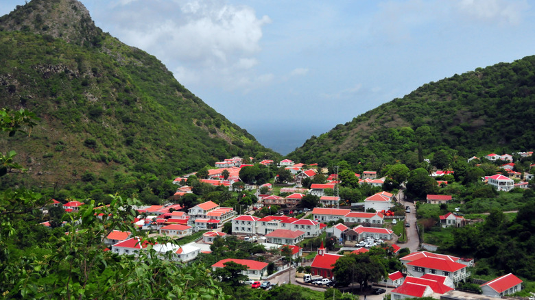
All visitors start their Saba journey at Zion's Hill, a village in the northeast corner of Saba, right next to the airport. A steep and twisting road leads you through the hills to Windwardside, a landlocked community that specializes in hosting tourists. This trip takes less than 10 minutes, but the narrow highway is only really suitable for motor vehicles. Green slopes and brightly painted buildings crowd around as you approach The Trail Shop, a shingled little cottage stocked with maps and gifts. You'll learn that the main path up Mt. Scenery is just one of around 20 established trails on Saba, amounting to hours of challenging hikes on an island that's about one-tenth the size of Nantucket. Conversely, Saba's tallest point is 16 times higher above sea level than Nantucket's.
This height is the reason it takes about 90 minutes for most hikers to reach the top, though the climb is only a little over 1 mile. The trail is a mishmash of stone steps, cement landings, packed earth, and stone retaining walls, which zigzag relentlessly skyward. You pass a radio tower, and then, with a final burst of adrenaline, you'll use a rope to scramble up the uppermost cliffs. On clear days, the summit affords a spectacular bird's-eye view of the island, with the town of Windwardside and coastal edges spread out directly below. Just be aware that this is a humid climate, and sheets of fog often obscure the panorama.
The trail is open to anyone and free to use. The Caribbean is home to a lot of a scenic, low-key destination for avid hikers, and a growing number of visitors have come to appreciate Saba's shockingly abundant natural spaces.
Prep for hiking (and staying) in Saba
Hiking Mt. Scenery doesn't require any special training or equipment, but you'll need sturdy footwear and weather-ready clothing. This island is warm year-round, but there's always a chance of rain, so you'd be wise to bring both sunblock and a windbreaker. You should also carry a snack or even picnic lunch; the full journey can take 3 hours, even for seasoned hikers. Unfortunately, the trail isn't passable for folks with certain mobility challenges, and visitors should be especially careful in the precipitous final stretch.
To economize your time, stay in Windwardside, which is well appointed with hotels and restaurants. The forecast will help you time your visit around clear skies, although weather patterns can change unexpectedly. It's almost impossible to get lost, but do stick to the trail.
Small though Saba is, there's an astonishing amount to see here. The peak of Mt. Scenery is a great place to start, so you can behold the island in its entirety. Down below, you'll find epic cliffs, clear waters, abundant seafood, and a number of local artists and crafters. Saba is also known for being the home of Juancho E. Yrausquin Airport (SAB), the world's smallest commercial airport.