
Between Little Rock And Tulsa Is Arkansas' Canyon Escape In The Ozark Mountains With A Loop Trail And Waterfalls
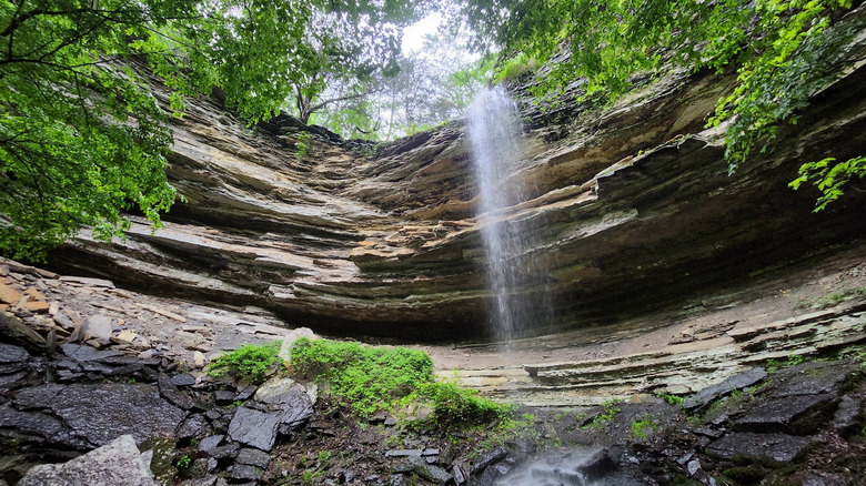
The Ozarks of Arkansas are famous for their mountain forests and lakes, but the Devils Canyon Scenic Area offers a geological surprise among the rolling Ozark landscape. The canyon, located in the Ozark-St. Francis National Forest near the small town of Mulberry, is a secluded hiking area with some incredible scenery. Giant boulders, forested hillside, and a creek set the scene for the canyon's signature sights: two waterfalls plunging over towering rock walls. For anyone interested in getting out to this rugged Ozark outpost, the area is roughly midway between Little Rock and Tulsa, doable as a day trip or weekend outing from either hub.
Much of the Ozark Plateau was shaped by millions of years of erosion carving ancient rock layers, giving the region its distinct, sheer bluffs and hollows, per the Arkansas Archaeological Survey. Devils Canyon offers a particularly remarkable view into the landscape's rockier side, classified as a Special Interest Area by the U.S. Forest Service because of its exceptional geology and scenery. The area has several cliffside overlooks with expansive views across the mountains and creek. "Beautiful waterfalls and rock formations!! I could spend all day playing around the canyon area," one AllTrails reviewer wrote. Just brace yourself for a bit of scrambling if you want to reach both waterfalls, and read up on some of our safety tips if you're tackling the hike solo.
Hike Devils Canyon's waterfalls and rock formations
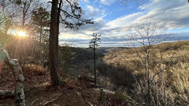
Hikers can get up close to Devils Canyon's cliffs and waterfalls on a 3.2-mile loop trail, per AllTrails. Shortly after the parking area, the trail winds into the woods, opening up onto a few canyon overlooks. Ozarks blogger Ozarkmountainhiker notes, "Trails around Devil's Canyon are not established and maintained, but foot traffic and an old forest road make it possible to walk around the canyon's edge." The route is generally considered moderately challenging, with around 500 feet of elevation gain, according to AllTrails.
At the trail's first stream crossing, you'll find the Devils Canyon Junior Falls — the smaller of the two waterfalls in the area. The waterfall tumbles over a broad stone shelf into a blue pool, which you can approach closely when conditions allow. After passing the first falls, you'll hike through a jumble of boulders, hollows, and ledges, where the trail's path is a bit murky (it might help to have an offline map downloaded and even a printed one — one park ranger-approved tip for staying safe while hiking). You'll know you're near the second waterfall when you see a red rope tied to the trees, which you can use to help with descending into the canyon. At the bottom of the rope, you can see the taller Devil's Canyon Falls, pouring over massive sheets of stone. Arkansas guide Hike Arkansas puts the waterfall at 63 feet high.
There's a parking area and trailhead on a driveway off Highway 215. The trailhead is about a two-hour drive from Little Rock or closer to 2.5 hours from Tulsa. If you're looking for somewhere to stay overnight that's closer to Devils Canyon, consider Alma, a quaint town known as the Spinach Capital of the World, under a 30-minute drive away.