
England's First National Trail Is A Nearly 270-Mile Hike Through Mountains, Moorlands, And 3 National Parks
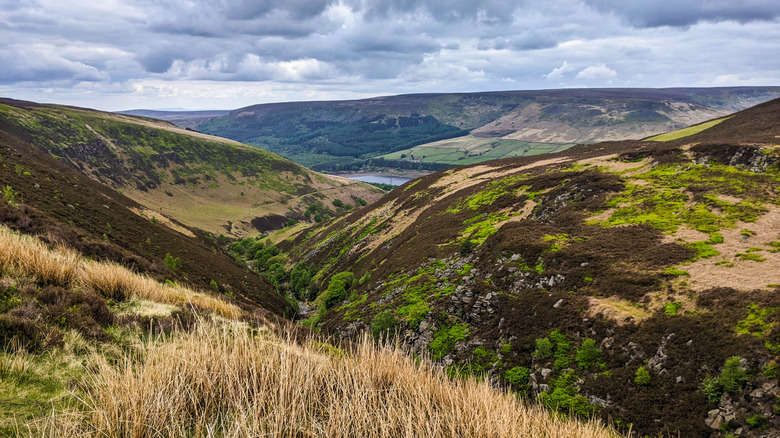
Spectacular hiking trails can be found in every part of the world, boasting scenes of unimaginable beauty. However, some are not merely trails but journeys, requiring painstaking effort, which is repaid with sights one will never forget and a sense of accomplishment that won't be attained with a simple day hike. The 268-mile Pennine Way will put any hiker to the test as the first national trail in Great Britain. The route is also one of the most famous, leading through dense moors, rugged mountains, and three national parks for a marathon hike, encompassing more than three weeks that will test one's fortitude.
The trail follows the Pennines, a hilly upland range in Northern England. Hikers will make their way up multiple mountainous peaks, seeing some of the country's most stunning landscapes all around them. One of the first major milestones is reaching the top of Kinder Scout, the tallest peak in the Peak District. The High Fell peaks often rise up from vast swaths of moorlands, and the tallest mountain along the trail is Cross Fell, standing at almost 3,000 feet! Farther along, the Cheviot Hills contain lovely heather-covered moors that bloom purple in September. However tired one's feet become, taking breaks to enjoy England's scenery will be a welcome respite.
This is a trek that requires ample preparation in physical ability, supplies, equipment, and mental strength, as hikers will be traversing rough terrain from the trail's start in Edale, England (about a 45-minute drive west of Sheffield), to its final stop in Kirk Yetholm, a mere 1.5 miles from the Scottish border. If one took a physical picture of every landmark, monument, and historical site to be seen along the way, it would likely fill a shelf of photo albums, as there are 458 markers just on the trail alone.
Getting started on the Pennine Way
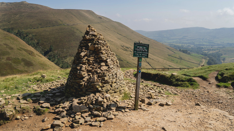
The Pennine Way begins in the tiny town of Edale. The trail's early miles show some of the challenge to come. Before heading out, be sure to fuel up for the trail at The Old Nag's Head, which marks its beginning. One of the first landmarks reached is Jacob's Ladder, marked by a conical tower of stones and surrounded by lovely valley views. Hikers will find themselves simultaneously on the first national trail and in England's first national park, the Peak District, with unrivaled beauty all around.
Throughout the trek, hikers tread through wild, rugged moorlands found within the Pennines, made up of heathland, bogs, and grasslands. In the northern Peak District, the rolling Marsden Moor spans about 5,000 acres and contains evidence of a Mesolithic settlement. Hikers will also pass by the glassy Wessenden Reservoir on the western side of the park, surrounded by grassy moorland. Upon crossing the border of the Peak District, travelers can take a well-earned rest in the cozy village of Marsden.
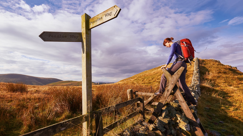
The Pennine Way travels northward through the English countryside, marked with signs bearing the acorn symbol of the U.K.'s national trails system. Those with limited time or ability needn't face the entire trek all at once, opting for short sections to experience just a part of this iconic trail. An official online map allows visitors to craft sections of their own journey.
Passing through national parks along the Pennine Way
England's national trails and parks form the country's natural legacy, and the Pennine Way passes through three impressive areas. In addition to the Peak District, the Yorkshire Dales is the second national park along the Pennine Way. Here, hikers will pass by the striking limestone cliffs of Malham Cove, which loom about 230 feet above the trail. About 2 miles north, travelers will reach Malham Tarn, noted for its sheer slate lakebed that doesn't allow water to sink in. Take in the water's reflection of the sky while continuing to one of the Yorkshire Three Peaks, Pen-y-Ghent. At this point, the trail is laid in stone, resembling old Roman roads. The panoramic view at the top is quite a reward.
Northumberland National Park is the third and last national park, where the journey leads into the North Pennines Area of Outstanding Natural Beauty, which is registered as a UNESCO Global Geopark — there's an impressive 500 million years of geological history here. Part of the famous Hadrian's Wall is encountered on the trail, where hikers can get up close to some Roman fortifications and see one of England's best historical sights. It's certain to be talked about all the way to the trail's end at Kirk Yetholm.
The trail is best done between April and October to avoid the freezing winter and see the lush landscapes. While one's kit should be kept as light as possible, some of the most essential items to bring would be a worn-in, waterproof pair of quality hiking boots and clothes for all types of weather. Plus, phones and navigation tools with rechargeable power banks, a well-supplied first aid kit, and physical maps would be helpful, as there are areas with little to no cell phone signal.