One Of Washington's Most Popular Spring Wildflower Hikes Is A Steep Trail With Jaw-Dropping River Views
The best hikes have that sweet spot between challenge and payoff. A hike that's too easy can leave you feeling less accomplished, while other hikes are so strenuous that you find yourself questioning if it was worth it halfway through. The Dog Mountain hike in Washington has the perfect blend of intensity and reward. It's a steep, wildflower-lined climb in Washington's Cascade Range, home to one of the prettiest mountain routes, that's become one of Washington's most popular for a reason.
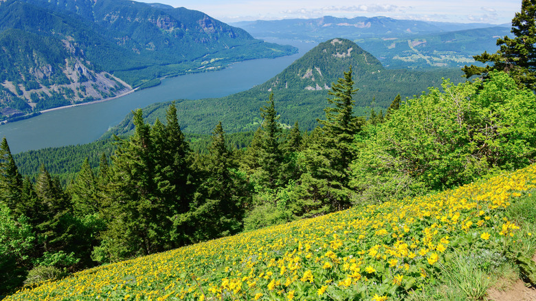
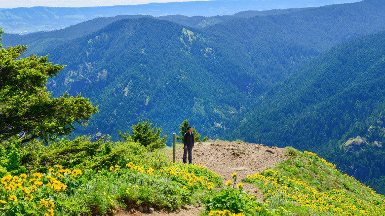
The trail up Dog Mountain has earned a reputation as breathtaking, both literally and figuratively. One Instagram user called it "a notorious hike with 3k altitude gained in just over 3 miles." The incline is no joke, the winds can be punishing, and it can get crowded during peak season. But people continue to be drawn to the trail for its incredible lookouts. When you reach the upper meadows, you're above the clouds looking down into the Columbia River Gorge, and on clear days, you can see all the way to Mount St. Helens and Oregon. Above all, the spectacular wildflower display here rivals California's best wildflower views.
Mid-April to mid-June is when peak bloom on Dog Mountain occurs. The most prominent wildflower that blooms in the meadows along the trail is bright yellow balsamroot. As Pacific Northwest travel blogger Holly described in a post for Adventures with Holly & Bryan, "From a distance, the hillsides seem painted yellow with a thick sheen of balsamroot." Other native wildflowers that dapple the meadow include purple lupine, white cryptantha, and red paintbrush. The best spot for wildflower-meets-river views are along the upper ridgeline near the summit.
What to know before hiking the Dog Mountain Trail
Located near Stevenson, Washington, Dog Mountain is about an hour drive from Portland International Airport. The trailhead is also about a 20-minute drive from White Salmon, Washington, an artsy Columbia River Gorge city. You'll find the trailhead off Washington State Route 14, where there's a parking area and bus stop, and you can park here for a small fee. Note that on weekends during the peak wildflower season, hikers are required to have a permit to help regulate the trail's crowds. You can get one online three days before your hiking date, or there is a limited amount available at the parking area on the day of.
The trail totals 6.9 miles out and back, and it's open year-round — in the winter, you won't get the wildflower views, but you will experience smaller crowds. The first about half-mile of the trail goes through a ponderosa pine forest, then comes to a split. Here, you can choose between the "difficult" and the "more difficult" routes (yes, that's the actual sign). "Most people do the more difficult route up and the 'difficult' down to get to the summit faster and save their knees on their way down," wrote hiker Stefanie in her blog Smile4Travel. "This also allows you to hike the loop trail." Both routes connect again as you approach the summit, where the dense forest gives way to meadows and views of the Columbia River Gorge. There are also some flat areas at the top that are great for having a picnic break.