Oregon's First Rail Trail Is A Gentle Forested Path Between Two Charming Towns
If you're an outdoorsy person, Oregon is one of the best destinations for green spaces and exploration. Whether you love hiking, biking, camping, or all three, you can find plenty of spots to indulge your nature-loving side. While there are so many places to choose from, one that stands out among the rest is the Banks-Vernonia State Trail. Although this particular excursion didn't make this list of breathtaking trails bikers should visit at least once, it's still a fabulous destination.
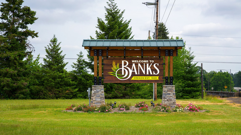
The trail itself spans just over 20 miles between the towns of Vernonia in the north and Banks in the south. The southern tip of the trail is situated just north of Forest Grove, the charming city with a downtown full of shops and wineries. So, if you're really trying to explore as much of northern Oregon as possible, this trail offers plenty of opportunities to get the full Beaver State experience.
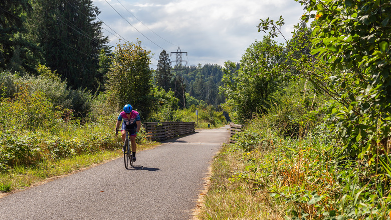
Although you don't need a bike to traverse the Banks-Vernonia State Trail, it's highly recommended so you can travel the entire length in an afternoon. Otherwise, you should plan to take either a whole day or a weekend to walk from one end of the trail to the other. Either way, pack your favorite outdoor gear, and let's see what this trail has to offer.
What you'll see along the Banks-Vernonia State Trail
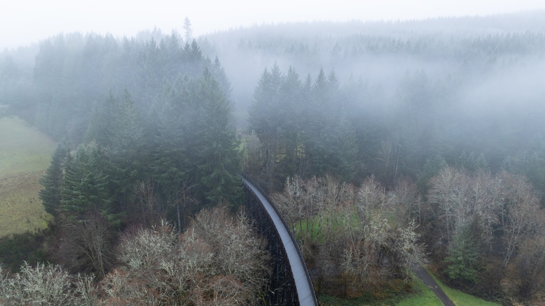
The Banks-Vernonia State Trail is considered Oregon's first "rails to trails" project. Much of the trail follows along a defunct train route through different scenery, including 13 bridges. Ideally, you can start your journey in either Banks or Vernonia and make your way to the other side. However, there are five total access points along the trail, so you can pick and choose which sections you want to explore. The midpoint is at L.L. Stub Stewart State Park, which also allows overnight camping. You can see each access point on the Banks-Vernonia Trail Map.
Because the trail follows the train tracks, it's mostly level with mild grading. This means most everyone can experience the trail regardless of fitness level or hiking experience. The paved trail is 8 feet wide throughout, and it's open to walkers and cyclists. There's even an accompanying gravel trail for horseback riders.
In Vernonia, the best place to start your trail adventure is the loop around Vernonia Lake. The lake is part of a city park, and you can even stop for a treat at Calypso's Soft Serve Ice Cream at the northern tip to give you an energy boost. Along the trail, you'll pass over the Nehalem River and Beaver Creek and cross through miles of forests and farmland. South of L.L. Stub Stewart Park, you'll encounter most of the bridges, including the Buxton Trestle, which offers some of the best views on the entire trail. Once you reach Banks, you'll be close to Hop Cycle Brewing Company, so you can get a refreshing pint to cool off.
Adding the Banks-Vernonia Trail to your next Oregon vacation
The Banks-Vernonia Trail is just west of Portland, so you can fly into one of the best airports for food and drive out to the trailhead of your choice. If you want to start in Banks, it'll be just under an hour. If you want to start in Vernonia, it'll be about an hour and 15 minutes, depending on traffic. One thing to keep in mind is that there is just one hotel in Vernonia, the Caden Hotel, and none in Banks. If you want to stay closer to Banks, you'll have to book a room about 12 miles away in nearby Hillsboro. Alternatively, there are campgrounds dotted throughout the area between Banks and Vernonia, so you can sleep under the stars and get even more nature out of your trip.
At around 21 miles, it's possible to walk or bike the entire length of the trail in a single day. However, the best option is to make a weekend out of the experience. Both Vernonia and Banks are charming towns with local shops and restaurants. So, feel free to explore them at your leisure before heading out on the trail.
Once you're walking or biking, you'll probably want to stop regularly for water breaks and scenic views. As mentioned, most of the bridges and creeks are on the southern half of the trail, between Banks and L.L. Stub Stewart Park, so plan accordingly. The trail can get a bit crowded depending on the season and time of day, but you shouldn't have to worry about getting stuck anywhere along the way.