The Majestic Waterway Known As 'America's River' Has Just Been Named Its Most Endangered In 2025
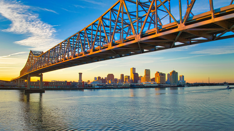
The mighty Mississippi River is an iconic natural landmark that has shaped the nation, stretching 2,350 miles from Canada to the Gulf of Mexico. Initially, it served as the western border of the newly independent United States, then became the natural boundary that bisects the country, defining east from west. You can follow the Mississippi across 10 states along the Great River Road, starting from the river's birthplace in Minnesota's oldest state park.
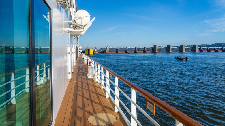
But if you want to cruise along its waters, climate change has made it more difficult. Low water levels have forced some Mississippi cruises to cancel. One Mississippi cruise line, American Queen Voyages, closed shop in 2024, limiting cruise options for visitors hoping to travel "America's River."
A new report from American Rivers, a conservation group, has named the Mississippi the most endangered river in the country. Intense flooding and prolonged droughts have created erratic swings in water levels that endanger the ecosystems and communities that live off the Mississippi. Compounding the problem, says American Rivers, are changes to federal flood management, especially FEMA, the Federal Emergency Management Agency. "It is essential that the federal government maintain a robust role in managing floods and other natural disasters since rivers know no borders," the report states.
Why is the Mississippi River in danger?
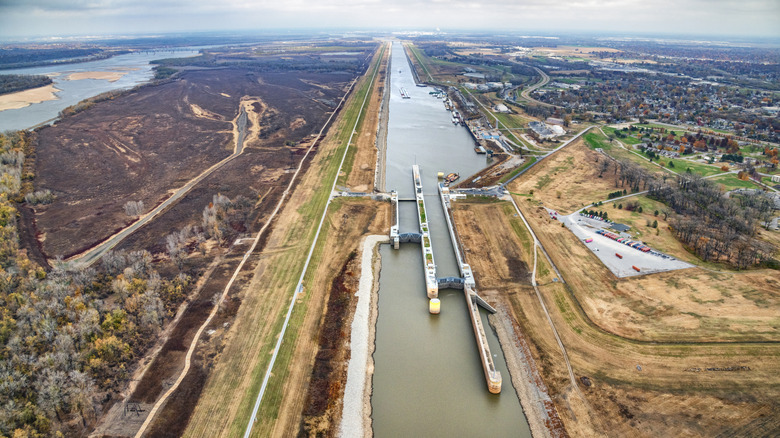
The Mississippi River pours an astonishing 593,003 cubic feet of water per second into the Gulf of Mexico. Its waters provide the main drinking supply for about 20 million people, and nearly 500 million tons of goods are shipped through it. Maintaining this busy waterway is more than just nature, however. The US Army Corps of Engineers operates a network of levees and dams that regulate how the Mississippi flows. This system was built, in part, as a response to the Great Mississippi River Flood of 1927. It was the most destructive flood in U.S. history, killing more than 200 people and causing hundreds of millions of dollars in damage. Levees and dams were built to try and prevent flooding.
New data suggests, however, that these human interventions into nature's water flow may have made things worse. According to an excerpt of a recent study published by Northeastern University, "the probability of a 100-year flood occurring in the Mississippi River system has increased by 20 percent over the past 500 years, three-quarters of which is due to river engineering and other human activities." Add to that the increasing frequency of extreme storms and heavy rainfall from climate change. This is why the American Rivers report says the Mississippi needs federal government support, now more than ever.
How to visit the changing Mississippi River
Engineers are now challenged to find ways to work with the might of the Mississippi River, rather than against it. One example is a project to reintroduce freshwater and sediment from the Mississippi to the Barataria Wetlands in Louisiana. These scenic swamps are filled with wildlife and play an important role in flood management, which visitors can explore for themselves along accessible boardwalk trails.
Of course, the best way to experience the grandeur of America's River is by boat. The Mississippi remains America's best river cruise destination, especially for foodies and music lovers, who want to immersive themselves in the rich culture that revolves around the river. Keep in mind that spring is the best time to travel the Mississippi by boat. Fresh rainwater should keep water levels high enough to ensure passage even by large river boats. Some cruise lines may need to shift itineraries or adapt to smaller vessels to cope with changing water levels. Don't be dissuaded. Check with cruise lines to see what kind of alternatives they have in case of fluctuating water levels, especially along the more volatile routes in the Lower Mississippi. It's all part of adapting to changes in America's River.