Vermont's Fifth-Largest State Forest Offers Miles Of Enchanting Mountainous Trails And Wildlife
For all the accolades about how the route known as "Vermont's Main Street" shows off the state's charming towns, resorts, and beauty, there are almost always several more roads nearby sharing equal beauty with a fraction of the traffic. One great example is Route 12, which runs parallel and east of Route 100 from Woodstock to Morrisville. The northernmost section of it not only avoids the usually massive traffic jams that arrive each fall between Stowe and Waterbury — a tiny Vermont mountain town with some artsy quirks and delicious food — but it also opens easier access to some off-the-beaten-path experiences, such as the gorgeous Lake Elmore and the adjacent C.C. Putnam State Forest.
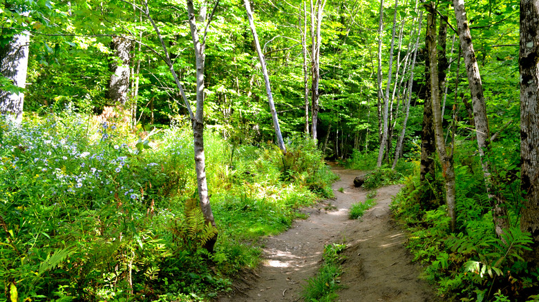
The fifth largest state forest in Vermont, C.C. Putnam covers 17,503 acres in dense woodland and mountain terrain. Elevations among the northern hardwoods, white birch, spruce fir, white and red pine range between 500 to 3,642 feet, culminating in five major peaks — Mount Hunger, Mount Worcester, White Rock, Putnam, and Stowe Pinnacle — that form the "third range" of the Green Mountains. The park is also the headwaters of the North Branch, a tributary of Vermont's third-largest river, the Winooski. All these ingredients translate into an abundance of wildlife, including bear, deer, grouse, beaver, mink, coyote, and more than 100 species of birds. Moose numbers are also growing in the area. As such, it's important for hikers and campers to remember they won't be alone and to tread lightly and smartly.
Hiking C.C. Putnam State Forest
Owing to the size of the forest, trailheads can be found on nearly all sides. On the eastern side, just off Hampshire Hill Road in Worcester, find the start of the Worcester Trail that leads to the summit of Mount Worcester. This challenging hike runs 4.5 miles round trip with nearly 2,000 feet of elevation gain. Further south along Route 12, follow North Bear Swamp Road to the Middlesex Trailhead, the start of a 6-mile, lariat-like trek that encompasses the summits of White Rocks and Mount Hunger. The latter is particularly popular for its mostly tree-free summit that opens to broad views in all directions. Mount Hunger can also be reached from the western side of the forest on a 3.8-mile trail from Waterbury.
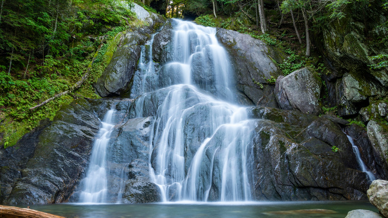
In Stowe, one of America's best small towns and nicknamed "Fall's Color Capital," there are two main trails heading into C.C. Putnam State Forest. The first is Stowe Pinnacle Trail, with two branches — a 3.6-mile leg from Upper Hollow Road and a 2.6 one from Pinnacle Heights Road. Both are of moderate difficulty. At the top, it's possible to link to the ridge-top Skyline Trail, which runs between Mount Hunger and Mount Worcester. The final option in Stowe is the trail to Moss Glen Falls. The falls themselves are only about a quarter mile in, but the trail continues for several miles beyond. Most visitors come for the waterfall, which has become somewhat famous due to both national and social media attention.