One Of South Carolina's Best Birding Spots Is A Wildlife Area Near The Coast Known For Open Spaces And Quiet Hikes
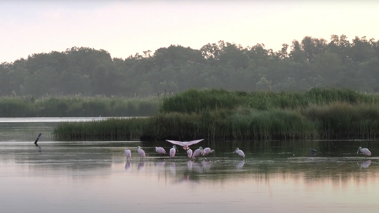
Walk on open paths between windblown reeds and spot an osprey perched at the top of a high tree surveying the wetlands for signs of movement. Watch the rippling blue water, and see brilliant pink roseate spoonbills walking through the shallows. Look up at the sky, and see the incredible seven-foot wingspan of a bald eagle soaring overhead. This is Bear Island Wildlife Management Area, a little-known natural wetland oasis situated between the Southern charm of Charleston, South Carolina, walkable, picturesque Savannah, Georgia, each about an hour and a half away. This wetland paradise on the Atlantic coast is known to be a haven for wildlife, and alligators are frequently seen floating at the surface and basking by the water's edge. As impressive as these scaly reptiles are, however, most people who visit Bear Island Wildlife Management Area are here to see the island's other inhabitants: the birds.
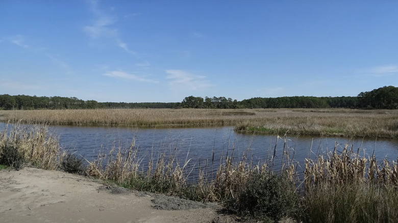
While it's not particularly well known, Bear Island Wildlife Management Area might just be one of the best birdwatching destinations that the United States has to offer. This place is more than 12,000 acres of unadulterated wild wetland with rushing rivers on two sides and the open ocean on the third. This creates a blend of salt and fresh water marshes, perfect for migrating birds. Many migrating birds choose to spend their winters here in Bear Island Wildlife Management Area, but only parts of the area are open to birders all year long. Unless you're hoping to see a specific bird that is only likely to be on Bear Island in the coldest months, you are probably better off visiting between February and October, when the main part of the island is open for exploration.
Where to go for the best birdwatching in Bear Island Wildlife Management Area
The main way of getting around Bear Island is on the 25 or so miles of hiking trails and little roads that crisscross it. The route known as Johnny Hiers Road (sometimes called Titi Lane) is the best place to start. When you drive into the wildlife management area you will take the Bennett's Point Road, which connects to the unpaved Johnny Hiers Road. Keep your eyes open for signs, and once you've turned onto it, look for a picnic area and lodge. You can park your car there before hiking the route on foot. Not only will this protect your car from sinking into the mud if there's been any recent rainfall, it will give you the best opportunity to see birds without startling them.
This route could take you anywhere from an hour and a half to four hours to hike, depending on if you decide to explore down the side trails. You'll see many smaller trails branching off Johnny Hiers Road, and all of them lead to marshy habitats where you can spot interesting birds. Just make sure not to barge into any gated areas with keep out signs, since those are generally there to protect fragile ecosystems and nesting areas.
You may also want to check out the South Edisto River Loop, an at least three-hour trek that takes you through forested areas, rice fields, and peaceful salt marshes. Here, you're likely to see far more wildlife than people. In fact, many hikers on AllTrails reported seeing hundreds of birds and dozens of alligators on this loop, and most of the time they were the only hikers there.