California's Byway 'With Lake Tahoe And Yosemite National Park As Its Neighbors' Shows Sequoias And Alpine Lakes
There are quite a few ways to travel through California's mighty and majestic Sierra Nevada by car. Many of them are downright gorgeous routes that'll have you gasping as twisted granite mountains and sweeps of evergreen forests emerge around every bend. One of the best routes is the snaking California State Route 4, better known as the Ebbetts Pass Scenic Byway, which the National Scenic Byway Foundation boasts has "Lake Tahoe and Yosemite National Park as its neighbors."
Curving, bending, peaking, and troughing its way through the mountains for 61 miles, the byway links up the small town of Arnold in the west with Markleeville in the east. It's largely along California State Route 4 but also includes a short northbound section of State Route 89 to boot. And — here's the kicker — it's jaw-droppingly beautiful the whole way along. You can see everything from glimmering alpine waters to soaring highland passes, snow-doused ski fields to reserves of mighty Cali redwoods along this route.
You can drive Ebbetts Pass Scenic Byway in either direction. Starting in the west means coming up from the enchanting Gold Country, where you could easily connect with the scenic Sierra backcountry and historic towns of Highway 49 to make this an even longer road trip. On its eastern side, the byway comes tantalizingly close to the gleaming waters of Lake Tahoe — it's under 40 minutes' drive to the sun-warmed rocks and secret trails of South Lake from the byway. It should also be easy to access the drive from major airports in Sacramento (around two hours to the west) or Reno (about an hour to the north).
Hike sequoia forests and splash in alpine lakes on the Ebbetts Pass Scenic Byway
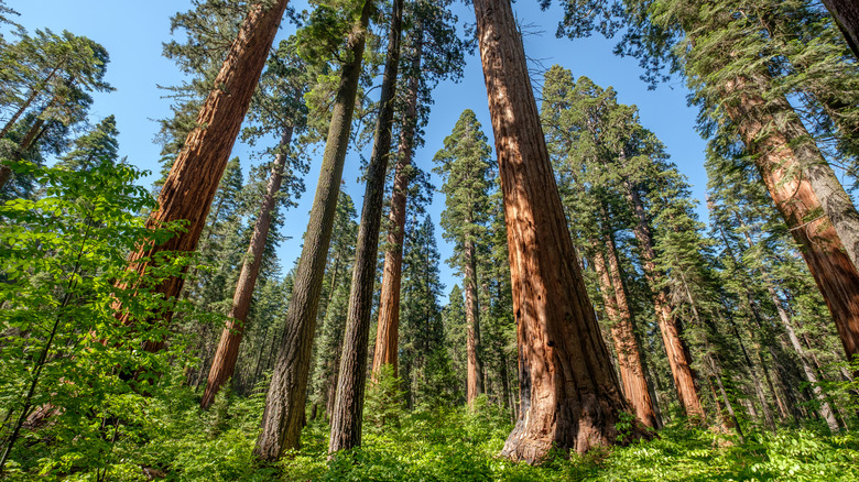
One of the very first highlights of the Ebbetts Pass National Scenic Byway as you approach from the west is surely the colossal sequoia trees of California's most underrated sequoia tree state park. The park is home to not one but two stands of mighty Sierra sequoias. The South Grove is the largest of the duo, with a 5-mile hiking path that hits a zenith at the gargantuan Agassiz tree, the biggest and possibly oldest in the whole reserve.
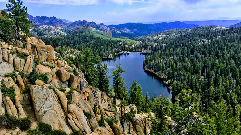
From there, drive along Ebbetts to the east to enter the altitudinous domain of Lake Alpine at nearly 7,400 feet. It's an adventure-lover's dream come true up there, with kayak stations, mountain biking trails, and more. A mostly wheelchair-accessible hiking path loops around the lake to offer just over 4 miles of serene, tree-shaded walking.
Keep going east, and the byway soon achieves its highest point at its namesake pass. Just after that is the trailhead for the highly rated hike to the Kinney Lakes, a route that boasts 4.7 out of 5 on AllTrails. Wildflowers abound on the path, as do sweeping views of Ebbetts Pass itself.
Things to know about driving the Ebbetts Pass Scenic Byway
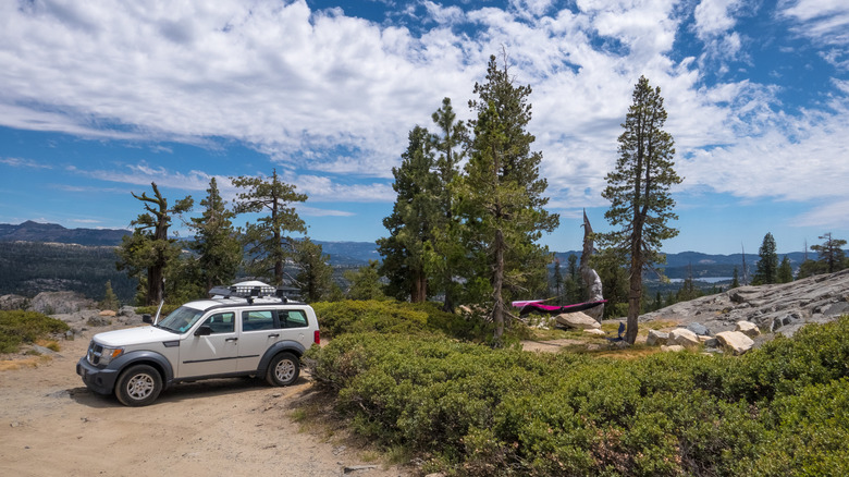
If you're after a quick shoot through the mountains from one side to the other, the Ebbetts Pass might not be the best choice. This is a snaking, weaving, winding road that clambers a whopping 8,736 feet above sea level as it approaches the central crest of the Sierra Nevada. On the flip side, this is a doozy for slow travelers. If you don't mind navigating lots of twists and turns, you'll be rewarded with chiseled granite mountains and picnics amid wildflower meadows.
One thing to note is that the Ebbetts byway isn't at all like the major interstates that crisscross California's peaks. You don't get four lanes and breakdown areas here! In fact, there are long portions of the road that don't even have a center line or shoulders, plus hairpin bends and steep fallaways on the side. Drivers will need to have their wits about them.
On top of all that, in true Sierra Nevada style, the Ebbetts Pass highway can close for long periods throughout the colder months of the year. That usually happens around late fall and into the new year. Reopening comes with the snowmelt, typically around early to mid-May.