This Under-The-Radar Oregon State Park Is A Scenic Gem With River Views And A Striking Geological Landmark
Oregon holds a special place in the hearts of outdoor lovers all across the country. The Beaver State's ample Pacific Northwest forests and snow-laden Cascade peaks provide it with some of America's most beautiful public lands. Among its federally-protected treasures are the divine Crater Lake National Park and its namesake deepest lake in the U.S., not to mention mountainous treasures like the iconic Mount Hood. However, Oregon's impressive collection of national parks and national forests sometimes eclipses its equally impressive collection of state parks. And yet, many of Oregon's finest natural wonders are actually administered by the Oregon State Park System, rather than the National Park Service or U.S. Forest Service. One of these underrated state park wonders is the defining feature of the remarkable Hat Rock State Park, a unique geological spectacle that creates a wholly distinct (yet no less beautiful) natural icon from the towering Cascade Mountains and the magical Oregon coastline.
Located about three hours east of Portland, Hat Rock State Park lies on the other side of the mighty Cascades, in a region of north-central Oregon defined by large sagebrush grasslands, rolling hills, and rugged river valleys. From this under-the-radar vantage point, Hat Rock State Park provides exceptional views of the Pacific Northwest's most famous river, not to mention the picturesque scenery of Oregon's oft-overlooked eastern expanse. However, for all of its wonderful scenery and viewpoints, Hat Rock State Park centers around its eponymous Hat Rock, one of the most breathtaking — and historically significant — natural formations in the northwest. Not only did the park's signature Hat Rock serve as a major landmark on numerous historic trails, but today it serves as one of Oregon's most underrated destinations for hiking, fishing, and scenic outdoor recreation.
Discover one of Oregon's secret natural wonders
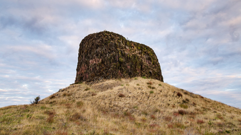
Even from a distance, Hat Rock State Park's signature Hat Rock is pretty difficult to miss. The 'hat' is actually a 478-foot rocky column jutting almost vertically from the grassy hills below. As an unmissable monolith of volcanic rock, Hat Rock attracts obvious comparisons to Wyoming's famed natural wonder (and America's first national monument) of Devils Tower. And while Hat Rock is only about half the height of the 867-foot Devils Tower, it still forms a unique visual spectacle and a key clue to the region's geological history. Hat Rock consists primarily of a type of volcanic rock called basalt, an heirloom of the much larger Columbia River Basalt Group spread out across the Pacific Northwest. Geologists believe that this particular slab of basalt formed around 12 million years ago and was subsequently eroded by massive glacial melt floods during previous ice ages. These floods (called the Missoula Floods) carved the basalt into the exposed monolith that stands in the park today.
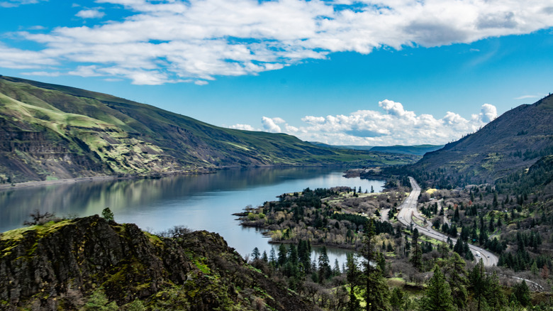
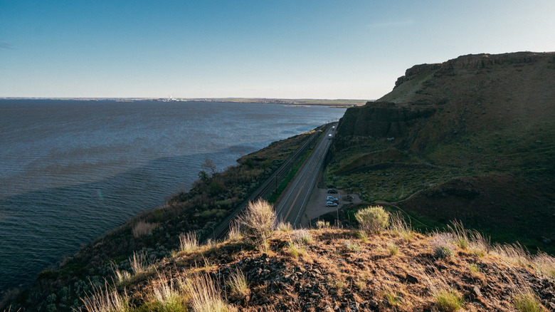
While Hat Rock is its most obvious attraction, Hat Rock State Park also sits along the banks of the spectacular Columbia River and the Lake Wallula reservoir, just south of the river's natural border between Oregon and Washington. The park, therefore, provides exceptional views of the acclaimed Pacific Northwest river and the surrounding Columbia Plateau. Being so prominent, Hat Rock was a major landmark for the famed Lewis and Clark expedition as it traveled westward in 1805. In fact, the name Hat Rock comes from William Clark himself, who noted in his journal a towering rock resembling a hat. Today, Hat Rock is one of the few riverside landmarks that Lewis and Clark passed that has not since been flooded by subsequent damming of the Columbia River.
Experience Oregon adventures beyond the mighty Cascades
Taken together, Hat Rock and the Columbia River provide the perfect backdrop for much-needed hikes. The Hat Rock Loop trail is a simple yet magnificent hike covering a mere 0.9 miles past the base of Hat Rock and around a scenic pond that branches off from Lake Wallula. Though the trail is less than a mile, it still provides picture-perfect shots of the stunning Hat Rock right from the base, with plenty of interpretive displays along the way providing information on the park's geological history. The Hat Rock Trailhead is conveniently located right off the main parking area, while the trail's Lake Wallula Overlook provides excellent views of Lake Wallula and the Columbia River basalt formations rising above the water. If you're looking for a longer hike, the Hat Rock Loop connects to the 8-mile Lewis and Clark Commemorative Trail, which showcases many more of the complex geological wonders along the Columbia River.
Unfortunately, to protect its fragile structure, Hat Rock itself is off-limits, so there's no rock climbing allowed in the park. However, Hat Rock State Park's pond does offer excellent fishing, with both natural populations of bass and legal-sized trout regularly stocked in the spring. The park even has a boat ramp that provides easy boating access to Lake Wallula and the Columbia River, plus facilities for picnics, volleyball, swimming, waterskiing, and day-use pavilions (as well as handicap-accessible restrooms). The ever-growing Oregon city of Umatilla is just 10 miles away, with plenty of superb lodging nearby. A bit further south is Oregon's massive alpine playground of the Umatilla National Forest, with some of the state's best camping options outside of the Cascades.