This Short, Sweet Loop In The California Sierra Is A Lake Daytrip Called 'The Most Beautiful Drive In America'
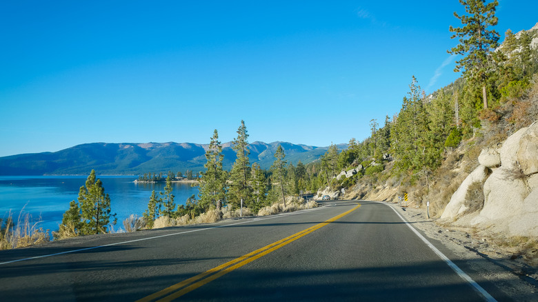
Lake Tahoe's 22-mile-long and 12-mile-wide expanse is hard to describe. It's one of those places you just have to see to believe, with its emerald-tinted, crystal-clear waters, and striking granite mountain cliffs. North America's largest alpine lake, nestled in the Sierras, is a must-see, and one of the best ways to experience Lake Tahoe's beauty is by road trip. Whether you're road tripping with kids or mountain road cycling, the simplest option is to drive the 72-mile loop around the lake, known as "America's Most Beautiful Drive." The over 6,000-foot elevation allows stunning views across the lake. On any other highway, it might just take three hours, but here, you'll want to give yourself more time to truly enjoy it. With every turn, the views demand that you stop, breathe, and take it all in.
Because the lake straddles the California/Nevada border, the loop includes California State Routes 89 and 28, Nevada State Route 28, and U.S. Route 50. You can start anywhere, but beginning in the west and ending in the east lets you catch a lake-crossing sunset (looking west). Emerald Bay, on the east side, is a notable spot to catch the sunrise, if you're starting very early.
Your starting point for the loop can also depend on your overall point of origin. Driving from Los Angeles? It's common to start in South Lake Tahoe, about 450 miles away, and the closest lake access point coming from the south. Coming from Reno? Incline Village, on the north end of the lake, is a sensible entry point, about 35 miles away. Either way, you'll choose to head right or drive left on NV-28 heading clockwise or counter-clockwise around the lake. Clockwise offers better passenger views of the lake and easier pull-offs, while counter-clockwise may give the driver better lakeside scenery.
Stop for views at iconic lookout points around the lake
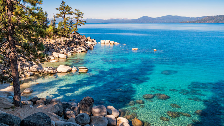
If you start in South Lake Tahoe, you'll drive along California State Route 28, passing Lakeview Commons and El Dorado Beach before reaching Emerald Bay State Park, with unique turquoise water, a Scandinavian-style castle, and Inspiration Point, one of the best views of Lake Tahoe, just 13 miles into the trip. The water appears, well, gem-like and is a breathtaking stop. From Emerald Bay State Park, you can also hike the Rubicon Trail. Onward at D.L. Bliss State Park, find quiet Lester Beach or drive a little further north to Meeks Bay, a peaceful beach, perfect for paddling (kayak rentals available).
About 31 miles in, you'll reach Tahoe City, where you can grab lunch at Fire Sign Cafe — a family-run restaurant open since the 1970s — or Tahoe House Bakery & Gourmet for a pick-me-up coffee and pastry before CA-89 turns into CA-28. The 10-mile Truckee River Bike Path is also here — rent bikes to cruise along the river with alpine wind in your hair.
Next comes Kings Beach on the northeast shore, a long, sandy beach with a chill, eclectic vibe. At the California-Nevada border, stop at Crystal Bay, a tranquil spot for paddleboarding or hitting up the local casino. A few miles on, you'll arrive at Incline Village, a charming town with mountain amenities. Pause for views, brews, and a scenic stroll along the path from Tunnel Creek to Sand Harbor. Sand Harbor Beach is one of the most photographed spots on the lake. Continue south on NV-28, hugging the shoreline. Bonsai Rock and Cave Rock are both recommended sunset viewing spots. Before ending your loop, stop at Zephyr Beach, a popular, mile-long, sandy beach with everything from volleyball courts to beachfront cocktail service.