This Map Of La Niña Is Making Some Key Predictions About Winter 2025
If you've lived through a soggy Pacific Northwest winter or a scorching California autumn, you probably know the names El Niño and La Niña all too well. These Pacific-born climate patterns are powerful seasonal directors, often driving extreme weather across the globe. Whether you're on the snowy Northern Plains or in the arid Southwest, the La Niña forecast is always worth watching.
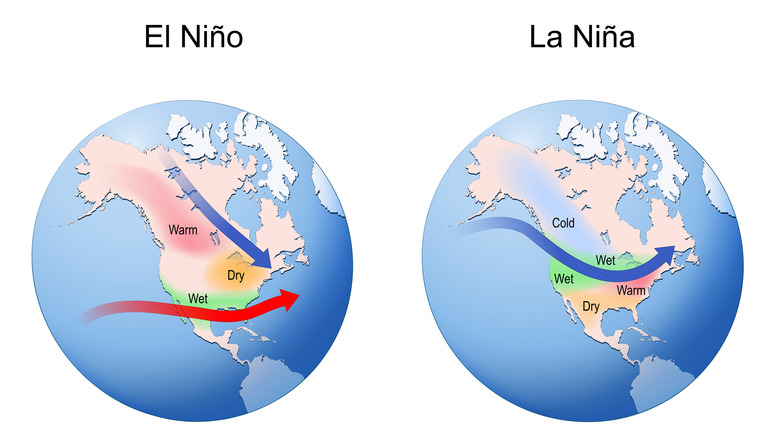
As fall 2025 unfolds, the Climate Prediction Center (CPC) estimates a 71% chance that La Niña will influence climate patterns from October through December 2025. According to a Newsweek analysis, much of the U.S. can expect near-average temperatures during that period, but parts of the Southwest and New England — including New Mexico, Arizona, and Texas, and the Atlantic corridor from New York to Maine — are predicted to experience higher-than-average temperatures. Increased rainfall is likely in south Florida and the Northwest U.S., while the South — from Louisiana to New Mexico — may face drought conditions.
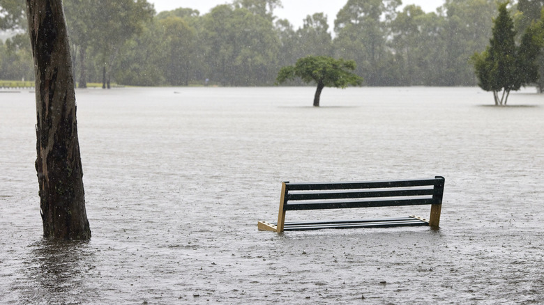
La Niña is the cooler phase of the broader climate pattern known as the El Niño-Southern Oscillation, or ENSO. It arises when strong equatorial trade winds push warm surface waters toward Asia, drawing colder waters to the surface along the U.S. West Coast. Historically, La Niña events recur every three to five years. Both La Niña and El Niño significantly impact ecosystems, precipitation, temperature, and the likelihood of extreme events such as droughts, hurricanes, and wildfires. As La Niña pushes the jet stream north — bringing heavy rains and flooding to the Pacific Northwest — it leaves the southern U.S. drier and brings colder winters to the Northern Plains. Colder oceans can intensify seasonal extremes, which risks exacerbating already-dangerous urban heat island temperatures and increasing hurricane risk in places like Florida and Texas.
Future La Niñas may increase in severity
The most recent La Niña was relatively weak and short-lived, lasting from December 2024 until early 2025. However, in recent memory, one of the most significant La Niñas was the rare "triple dip" from 2020 to 2023, when three consecutive winters experienced unusually prolonged La Niña conditions. This resulted in persistent drought across the Southern U.S. and parts of Africa, a very wet Pacific Northwest, and an above-average hurricane season in the Atlantic. The 2010-2012 La Niña was also particularly strong, linked to major global weather disruptions from catastrophic flooding in eastern Australia to prolonged droughts in Africa (which can also influence hurricane growth).
Historically, ENSO patterns have been tracked for centuries. In the 1600s, South American fishermen noticed that, around Christmas, the waters off their coast would occasionally become unusually warm and calm, accompanied by weaker trade winds. Those east-to-west equatorial winds were favored by sailors for helping ships cross oceans. They named the phenomenon El Niño, meaning "the little boy" in Spanish. La Niña — "the little girl" — is essentially El Niño's opposite.
With climate change intensifying, scientists warn that increased greenhouse gas emissions may amplify the frequency and intensity of extreme weather patterns tied to ENSO, making budget cuts at the National Oceanic and Atmospheric Administration (NOAA) all the more alarming. The CPC updates its ENSO forecasts monthly, with the next ENSO Diagnostics Discussion scheduled for October 9, 2025. Stay tuned for developments on whether La Niña will return — and what it might mean for global weather in the months ahead.