Arizona's Largest Lake Within Its Borders Has Mountain Views And Crystal-Clear Waters
Imagine the scenery of Arizona. Most picture the Grand Canyon, a destination hiding a unique village with teal waters and remote charm. Some may think of the iconic Camelback Mountain, with its challenging hiking trail and dramatic silhouette at sunset, or the cactus-studded desert landscapes of Scottsdale. But there's another noteworthy geographical feature that fewer travelers are familiar with: Roosevelt Lake. The largest lake contained entirely within the state's borders, it has 128 miles of shoreline, gorgeous mountain views, and crystal-clear waters ideal for outdoor recreation in all four seasons.
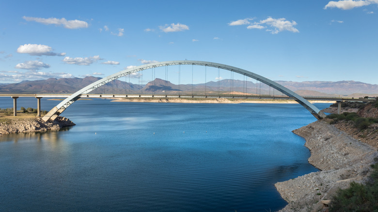
The manmade body of water, officially named Theodore Roosevelt Lake, was formed after the Bureau of Reclamation constructed a large dam on the Salt River. The sitting U.S. President dedicated the Theodore Roosevelt Dam in 1911. As noted by the National Fish Habitat Partnership, the reservoir, part of central Arizona's Tonto National Forest, has gone on to become one of the region's top destinations for bass fishing. It's also popular with boaters, hikers, and campers who pitch their tents on the picturesque shoreline with views of the Superstition and Sierra Ancha Mountains.
A good place to begin exploring is the Roosevelt Lake Visitors Center (open daily from 8 a.m. to 4:30 p.m.), where staff offer maps and advice on water sports, bird-watching, and camping around the lake. Another smart place to stop is the Roosevelt Lake Marina, where you can rent a speedboat, purchase bait, or just relax over fish tacos and views of the lake's clear water at Ffinch's Waterfront Restaurant & Bar.
Enjoy outdoor adventures at Roosevelt Lake
For hikers, there's a half-mile trail that leads up to prehistoric cliff dwellings overlooking the lake. Per Visit Arizona, if you start early, you might spot coyotes, deer, and rattlesnakes on your way to Tonto National Monument. On-site park rangers are available to share more information about the ruins and the tribal communities that once lived there. The round-trip hike to the lower cliff dwelling takes about an hour to complete, though be sure to bring plenty of water and sunscreen to combat the heat. The longer hike to the upper cliff dwelling is only accessible on a guided tour with the National Park Service ($10 per person).
Camping around Lake Roosevelt can be arranged through the park's website. There are various campgrounds around the lake, including some on the shoreline offering dramatic views. Generally, campsites cost between $23 and $30 per night, and campfires are permitted unless wildfire restrictions are in place. The Roosevelt Lake Marina has a store where campers can buy groceries, including beer, wine, and ice.
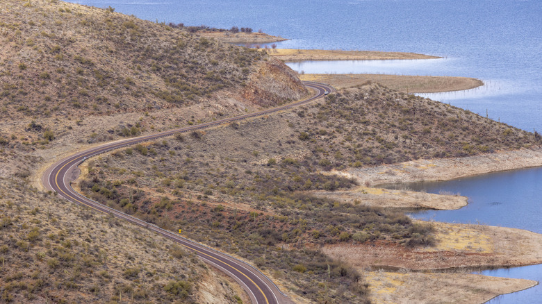
Lake Roosevelt is located northeast of Phoenix and its international airport. The most direct route between the two places is the mountainous Highway 88, but as noted on the Arizona Department of Transportation website, it was not only closed for repairs for years, but some parts of the road are especially precarious and aren't suitable for all vehicles. So visitors from the city typically have to take a longer drive (about two hours on AZ-87/AZ-188 or US-60) to get to the lake. While in the area, don't miss a visit to the nearby Apache Lake, surrounded by incredible cliff canyon walls.