America's Most Reliable Public Transportation Subway Belongs To A Thriving East Coast City
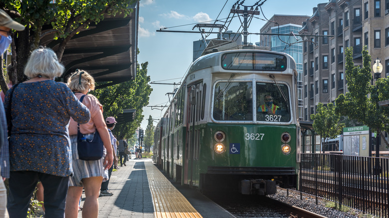
The first subway system in North America opened in 1897 — not in New York, not in Chicago, but in Boston, Massachusetts. Formally called the "Tremont Street Subway," this five-mile route was literally groundbreaking, allowing trains to run through underground tunnels, avoiding street traffic altogether. Now known as "The T," Boston's subway and light-rail system has expanded to include five lines. Because of that growth, Boston's transit-station density is among the highest in the U.S. In fact, according to a 2025 assessment by vacation rental site Wander, Boston has about 41.45 public transport stations per 100,000 people, a higher ratio than any other U.S. city. This figure also includes bus stops, which are spread across 162 routes.
Wander went on to name Boston the "best U.S. city for public transportation for travelers," a far cry from New York, which has a notoriously chaotic subway system. This distinction might come as a surprise to many, possibly even a good number of Bostonians. While residents tend to grumble about the Massachusetts Bay Transportation Authority (MBTA) and rant about every closure, delay, and (occasional) derailment, this century-old system does consistently transport riders to every corner of the city. The elaborate transit map is a boon for travelers who don't want to drive Beantown's notoriously tangled streets or face aggressive traffic. The T is known to be comprehensive, efficient, and affordable, especially in the warmer months. It's also better for the environment — one reason this iconic New England gem is considered one of the greenest cities in the world.
How travelers use (and benefit from) Boston's train system
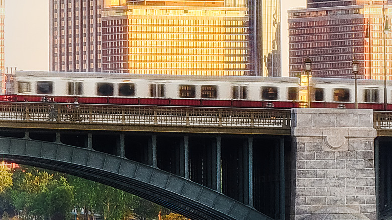
Many visitors are often surprised to learn how small Boston is: The city proper only has about 652,000 residents and covers roughly 49 square miles of land. Because of its many tall buildings, compact neighborhoods, and sometimes confusing layout, it may feel much larger. And to be fair, when you include the surrounding communities of Greater Boston — Cambridge, Newton, and Braintree — the overall metro area is home to millions of people. The region's transit network helps circumvent all those garbled streets and connects the city with nearby suburbs and other cities. For example, you can ride the Red Line from downtown Boston to the suburbs like Quincy in about 30 minutes. The same line also serves major destinations, including Harvard University in Cambridge, while the Green Line reaches into Somerville and the Blue Line runs to Revere.
Two aspects of the transit system help it stand out, which may have informed the Wander website's praise. First: The Silver Line links Logan International Airport with downtown Boston. Though technically a bus, it's quick, affordable ($2.40 one-way, as of this writing), and stops at several subway stations. This is convenient for arriving travelers, especially if they know that this New England airport ranked as America's best for getting tipsy. Second: The MBTA commuter rail reaches other New England cities as well. Train lines extend to Gloucester and Newburyport in the north — both popular coastal escapes — and to Providence, Rhode Island, in the south, along with dozens of other destinations across Massachusetts and the Ocean State. Between its subway lines, buses, and commuter trains, Boston makes it pretty easy for both locals and visitors to get around without battling city traffic.