Santa Cruz, California's Secret Paddler's Paradise Has A Hidden Gem Around Every Lazy River Bend
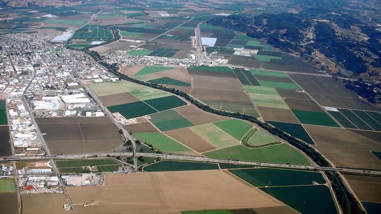
The scenery around Northern California's Monterey Bay is hardly a secret. It's here that you'll find the most photographed tree in the world, in Monterey's Pebble Beach, and the iconic Santa Cruz Wharf often lined with sea lions on its upper shores. But running between Monterey and Santa Cruz, the Pajaro River corridor offers a more low-key escape into nature, with all the beauty of the Pacific shoreline and its inland riparian landscapes. Technically, you can swim in the Pajaro River, according to the Pajaro Watershed Conservation Alliance, but paddling is the river's underrated draw. The river is a slow, easy paddle with tons of scenic turns, from seaside dunes to shorebirds nesting along the banks.
A reviewer on Paddling.com described the experience of paddling on the Pajaro River: "Very peaceful most of the time ... virtually no current, water fairly murky, no rapids or rocks, just a gentle easy float." The reviewer also noted that no other boats were spotted on the route, so there's a good chance you could get the river all to yourself on a paddling excursion.
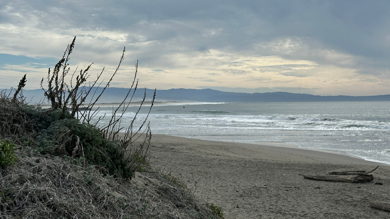
As for its scenery, the launch site commences at the Pajaro River Picnic Area, a quiet, tree-lined strip of the river that's an eBird hotspot, with red-tailed hawks, herons, and pelicans being some potential sightings along the banks. The river drifts gently downstream towards its mouth, surrounded by the Watsonville wetlands. As the river widens, you'll get views of the Pajaro Dunes, a sweep of grassy dunes that contour the bayside beach, and you might encounter some wildlife, including seals.
Tips for paddling on the Pajaro River
To reach the Pajaro River Picnic Area launch site in Watsonville, expect about a 30-minute drive from the Monterey Regional Airport. Or, if you're seeking more extensive flight connections, it's just under an hour's drive from the San Jose Mineta International Airport. According to a Google reviewer, you have to walk with your boat for about a quarter mile before reaching the river launch. But, as another reviewer noted, "if you have wheels, the path is good enough you can roll all the way through."
From the launch point, you could go either upstream or downstream. However, going upstream will likely only get you as far as the highway bridge about half a mile in, because the river tapers and becomes impassable. Downstream gives you better access and exposure to the river's most scenic points.
After reaching the river mouth at Monterey Bay, you have a couple of options for going back or extending the trip. The Paddling.com reviewer suggested going north along the Watsonville Slough, though you can only go for a bit before being blocked off by culverts. Another option is to coast southward along the bay and paddle into the Elkhorn Slough. This estuary is home to Moss Landing, a family-friendly spot and another hidden gem for outdoor adventure. The slough provides view points for harbor seals, sea otters, and even whales.