Circumnavigate One Of Lake Michigan's Most Beautiful Islands On This Unforgettable Great Lakes Kayak Trail
It's no secret that Michigan has incredible lake adventures. It's the Great Lakes State for a reason, boasting more than 3,000 miles of shoreline on four of the five Great Lakes. All of that lakefront is also extremely diverse, taking the form of rocky shores, towering cliffs, rolling dunes, wetlands, sandy beaches, and more. In other words, Michigan has you covered when it comes to any lake-related activity imaginable. For those looking for an epic multi-day kayaking adventure, you should consider paddling all the way around Lake Michigan's largest island.
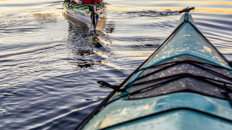
Beaver Island is part of a 14-island archipelago and sits 30 miles offshore from Charlevoix, an underrated beach town and charming gem situated between three lakes. That distance from the mainland means the only way to get there is by plane or ferry, the latter of which makes two trips a day in the summer months. The island has a year-round population of around 600 people and is a substantial 56 square miles in size. The kayaking trip around it, known as the Beaver Island Water Trail, is a whopping 42 miles, making it suitable for experienced adventure kayakers in good enough shape to complete the journey.
There are 18 designated landing points along the way, and the journey typically takes three to four days, with overnight backcountry camping. To take on this adventure, paddlers need to know what they're doing, be able to handle unpredictable weather, and follow standard safety precautions, like always having a personal flotation device (PFD), not going alone, having a spare paddle, and avoiding kayaking too close to trees, among other things. If you're not an experienced kayaker, Beaver Island is still a cozy locale with museums, restaurants, and natural beauty, offering plenty of laid-back paddling opportunities. But for those who want to push it, the Beaver Island Water Trail is a great challenge.
Kayaking around Beaver Island: What to know
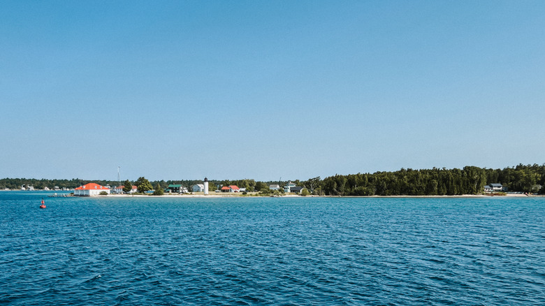
Since the only way to reach Beaver Island is by plane or ferry, if you want to bring your own kayak, you have to take the ferry from Charlevoix. Kayak rentals and advice, like up-to-date conditions, are available on the island at Happy Paddle. The first step off the ferry is going to the Beaver Island Community Center to register your float plan. That way, should you not check back in on time, they can alert the authorities — cell service is spotty at best on most of the island. You can also pick up a Beaver Island Water Trail map at the center and set off right there by the Paradise Bay ferry docks.
Then, you simply follow the plan. The ferry arrival time will dictate how many miles you can cover the first day, but the Bill Wagner Campground is 7.5 miles from the launch point, which is a good spot to spend the first night. Beyond that, it's cruising by day to one of Beaver Island's landing points and pitching a tent. And, of course, basking in the Lake Michigan scenery. There are plenty of bluffs, coastal wetlands, lighthouses, and sand dunes to see. And a stop in Donegal Bay on the western edge of the island is a must for some time on the beautiful sandy beach there. There's also plenty to see under the surface, like the old cars and trucks sunk beneath the surface to create an artificial reef in Paradise Bay or the 1873 shipwreck of the Bessie Smith in Little Iron Ore Bay.
During your watery trip, stay diligent. The weather can flip overnight from clear summer sunshine to dark skies lashing your kayak with 20-mph winds and sizeable waves. Pack extra food in case conditions force you to spend an extra night; bring layers and a decent sleeping bag, as temperatures can dip into the 40s, even in the summer.