Colorado's 5 Longest Hiking Trails Are Full Of Beautiful Sights
We may receive a commission on purchases made from links.
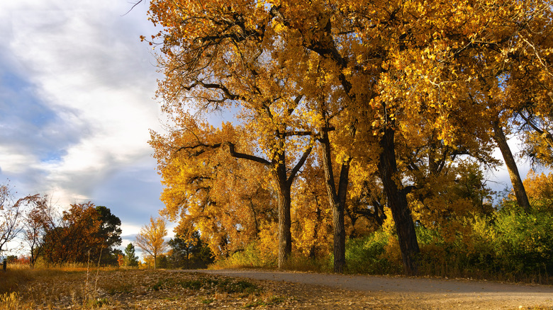
With towering mountains and vast swaths of wild forests, Colorado has earned a reputation for being outdoorsy. Winter transforms Colorado into the country's premier skiing destination. Spring turns entire sections of the state into a stunning explosion of colorful wildflowers. Come summer, residents abandon their jackets and skis in favor of hiking boots and backpacks to explore the state's almost 40,000 miles of hiking trails.
Most of Colorado's hiking trails are under a few miles in length — ideal for short day trips. Even inexperienced hikers generally take only a few hours at most to complete them. However, some trails present much more challenging conditions, spanning several miles and gaining thousands of feet in elevation. Quite a few of these are long enough to require multi-day trips and overnight camping. While casual explorers may shudder at the idea, the length of these trails and the promise of stunning vistas attract ambitious hikers who welcome the idea of roughing it out in the Colorado wilderness.
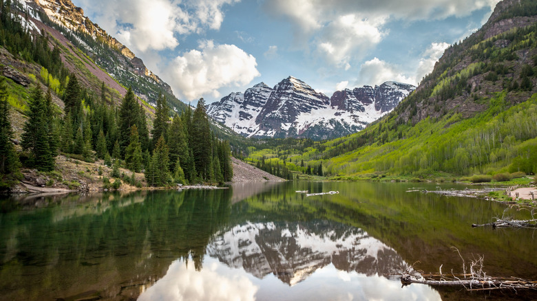
Colorado has four national parks, 42 state parks, and 15 mountain ranges, and many of the trails therein have become famous for their epic views at high elevations. Aspen and pine trees clustered together in a green carpet, gushing waterfalls, and birds' eye views of flower-filled valleys are just some of the sights that await prospective hikers. While shorter trails allow visitors to catch a glimpse of the state's famed outdoor beauty, the real spectacle is visible along the five longest trails in Colorado.
Nokoni and Nanita Lakes Trail
The 21.2-mile out-and-back trail to Nokoni and Nanita lakes in Rocky Mountain National Park features Cascade Falls, wildflower-ringed paths, and craggy peaks across green meadows. The crème de la crème is the view of the lakes themselves. Granite smoothed by years of water erosion gently slopes down to calming blue waters. Rough, gravel-covered mountain peaks and evergreen trees surround the lakes.
The trail begins at the North Inlet Trailhead in the town of Grand Lake (around 103 miles from Denver) and meanders through approximately 8 miles of tree-covered roads and single-track trails before reaching the North Inlet Junction. These initial 8 miles are fairly easy, with great views of the mountains in the distance and colorful seasonal wildflowers around every corner. Squirrels and small birds dart through the trees far above, while deer and the occasional moose graze off the path. Cascades, creeks, and pools of water lie along the path, adding to the serenity of the mountains.
There's a dramatic jump in difficulty in the last couple of miles from the junction to the lakes. In these two miles, you'll gain over 1,000 feet in elevation via a series of switchbacks. The climb leads to the granite slopes next to Lake Nokoni, with Ptarmigan Peak cutting into the sky behind the lake. From Lake Nokoni, you'll have to climb 300 feet over a ridge to get to Lake Nanita, which offers even more impressive views of gentle waves framed by looming mountains. There are several campsites along the trail, and you'll need camping permits from Recreation.gov to stay overnight in Rocky Mountain National Park. Most people set aside two or three days to hike this overall difficult trail.
Lost Creek Wilderness Loop
The Lost Creek Wilderness Loop is an approximately 27 to 37-mile trail that shows off the unspoiled beauty of the Lost Creek Wilderness area in Pike National Forest. The route uses intersecting trails to create a loop through thick forests and grassy meadows with a total elevation gain of over 5,000 feet. One section leads you up the mountains for phenomenal valley views from the ridge between McCurdy Mountain and Bison Pass. This section is often considered the highlight of the trail, and The Trek suggests hiking the trail counter-clockwise to save these views for the end.
The suggested starting point for this trail is at Goose Creek Trailhead, approximately 60 miles from Colorado Springs. From there, you'll choose to move west (clockwise) or east (counter-clockwise). Moving counter-clockwise, you'll use the Wigwam Trail, the Brookside-McCurdy Trail, the Lake Park Trail, and Hankins Pass to come back to the Goose Creek Trailhead. Most of the journey is characterized by marshy, grass-covered meadows with mountains in the distance, and otherworldly rock formations. The trail occasionally ducks into more forested areas and guides you across creeks. Pro-tip: Use a portable water purification canister to fill up on water whenever you come across these creeks, since there may be long stretches of trail with no water.
While you need permits for Lost Creek Wilderness, they're free of charge and self-service at the trailhead, and they allow for dispersed camping in Pike National Forest. Most hikers plan to complete the trail in three or four days, although you can do it in two if you push yourself. This trail is among the best dog-friendly hikes, although dogs have to be on a leash the entire time.
Capitol Creek Circuit
Like many of Colorado's trails, the Capitol Creek Circuit takes advantage of the state's tall mountains to deliver some truly astonishing views. You'll cross four mountain passes and four lakes in the Maroon Bells-Snowmass Wilderness through this almost 50-mile trail in the White River National Forest. You'll also gain around 10,000 feet in elevation. This circuit also uses interconnecting trails to create a loop, allowing you to enjoy the views of popular trails like the Maroon Bells 4 Pass Loop without the crowds.
The route starts on Ditch Trail (marked by the Upper Capitol Creek Trail sign), connects to Capitol Creek Trail, then makes a wide, counter-clockwise circle through other trails before coming back to Capitol Creek Trail. Along the way, you'll witness panoramic views of valleys cradled by massive grey mountains, and splash through crystal clear creeks. Occasionally, the trail will take you across a meadow bursting with color and the scent of wildflowers. When the going gets tough, you can stop for a breather at one of four lakes — Geneva Lake, Snowmass Lake, Avalanche Lake, and Capitol Lake — to take in the tranquil alpine water surrounded by rugged mountains.
The circuit begins and ends at the Capitol Creek Trailhead, around 21 miles from Aspen. Most hikers set aside at least five days to complete this circuit — more if you want to conduct side trips or bask in the sights. There are designated tent camping sites near all four lakes, but you'll have to get permits from Recreation.gov in advance. Because of the water and trees, mosquitoes can be a problem here, so keep a good mosquito repellent handy. The Grand Tongo DEET-Free Mosquito Repellent is an excellent long-lasting option for hikers, with its minimal fragrance and quick-drying formula.
High Line Canal Trail
Unlike the other trails on this list, which began as unofficial pathways forged by explorers in the wilderness, the High Line Canal Trail developed as an afterthought to an established water delivery system. In 1883, the High Line Canal was created using the state's natural topography to deliver water from higher elevations to metropolitan regions like Denver. Years later, the 71-mile ditch trail was converted into a modern trail that takes you through remote countryside, urban Denver, and wildflower-filled prairies.
The High Line Canal Trail is a bit frustrating to map out. The trail begins at Waterton Canyon, just outside Denver, but the trailhead is at the 2-mile mark. So, if you want to honestly say you've walked the entire trail, you'll need to walk from Mile 2 to Mile 0 where the canyon is, then double back along the trail to Mile 2 and proceed from there. The next 20 miles or so are a bird-watching paradise surrounding Chatfield State Park. Closer to Denver, you'll walk under the white, fluffy blankets of large cottonwood trees before reaching the paved, bicycle-friendly roads within Denver. Past Aurora, the trail is largely unmarked and unpaved, but still presents incredible views of colorful wildflowers mixed in chaotic bouquets along the prairies. The trail officially ends at Mile 65, although the High Line Canal Conservancy (the group maintaining the trail) plans to expand the trail to cover all 71 miles of the canal.
Because this trail is divided into several segments, the time taken to complete it varies. According to AllTrails, the average time to complete it is around 24 hours, which can be spread out over several weeks or a few days. Most people stay overnight at hotels, motels, or rentals in Littleton, Denver, or Aurora for easy access to the trail.
Colorado Trail
When you look up long trails in Colorado, the Colorado Trail is often the first one to come up. This massive, 567-mile-long trail moves southward from the Waterton Canyon Trailhead just outside Denver to Durango, giving you a comprehensive view of Colorado's natural beauty. While it doesn't make the cut for the longest trails in America, the Colorado Trail isn't to be underestimated. You'll gain anywhere between 1,000 and 4,000 feet in elevation at various points along its more than 30 segments, and perilous conditions like alpine storms can easily derail your trip.
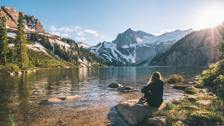
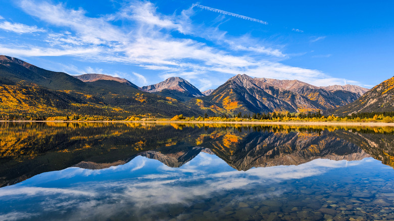
What makes it worth the effort is its scenery. Despite the cold, rain, and far-too-close-for-comfort moose encounters, the Colorado Trail offers an immersive experience of the state's most scenic locations. Large portions of the trail lead you above the tree line, allowing for stunning panoramic views. In the San Juan Mountains, you'll relax among chattering marmots and pika in flower-filled meadows and witness distant mountains peeking through the clouds from your own elevated perch. You'll pass picturesque bodies of water like Twin Lakes in Pike/San Isabel National Forest (pictured) where you can take a swim or even camp. At night, dense forests provide much-needed cover from unforgiving, yet awe-inspiring alpine hailstorms.
Thru-hiking is not for the faint of heart, and this four to six-week-long journey can test even the most experienced thru-hikers. You'll need to use every available method to purify the water you find, as water sources can dry up in some segments. Even though the trail is long, the Colorado Trail Foundation has a useful list of resupply towns where you can spend the night and restock. Backpacker Magazine suggests using mail-drop services to mail yourself food and supplies before you reach your next lodge, especially in the southern leg, where supplies are sparse.
Methodology
With thousands of miles of trails, many of which overlap and intersect with each other, it's difficult to rank trails based on length with 100% accuracy. Different measurement tools and real-time challenges (like connectivity issues, storms, and changing landscapes) can affect the recorded length of the trail. For example, some websites list the Colorado Trail as a 486-mile trail, but the official website claims it's actually 567 miles long, which is the number we've used in this article. We stuck to well-established trails that many hikers have already used and reported on. Newer trails, like the nearly 300-mile Northern Colorado Trail, didn't make the list despite qualifying based on length because it isn't officially recognized by a government or private body yet. We also eliminated trails that overlapped a lot with others on the list, like the Maroon Bells 4 Pass Loop, which shares most of its scenic locations with the Capitol Creek Circuit.
We used AllTrails (a user-supported resource) and COTREX (the official Colorado government trails app) to find official figures for the other trails. If the numbers on both sites differed, we went with the number that was most corroborated by other visitors. We then looked through first-hand accounts from hikers for accurate descriptions of the route and scenery.
Even if you aren't an experienced thru-hiker, you can still tackle some of these trails (or segments of them) with the proper preparation and endurance fitness. Plan your trip for the right time of the year, as some trails may not be open year-round. Also, keep an eye out for weather conditions that could hinder your journey, like snow, storms, or wildfires, and make sure you have all the hiking equipment you need for a successful trip.