A Crystal-Colored Mountain In California Has A 4x4 Trail Right To The Top For Surreal Views Of Nevada
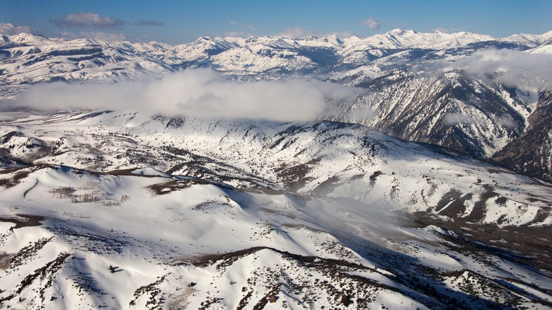
California is known for its diverse and varied landscapes. The Golden State has everything from desert to mountains to beaches to forests. It's one of the American states with the most mountain ranges as well as the state with the most national forests, and there's one stunning area that combines both of them. The Sweetwater Range and Mount Patterson, on the California-Nevada border in Toiyabe National Forest, is the perfect spot for thrill-seekers and outdoor enthusiasts — especially those with a 4x4 vehicle who love summit views.
Mount Patterson is a particularly striking outdoor destination since the mountain itself is covered in crystals. Summit Post describes the Sweetwater Range as having brightly hued volcanic rocks in a variety of colors — from yellow and red to purple and white — which form sparkling crystals in the mountains, including Mount Patterson. The Huntin Daddy lists "lots of colors" as a pro to this spot. On a sunny day, the mountains may sparkle a bit in the light from the crystals.
How to reach Mount Patterson
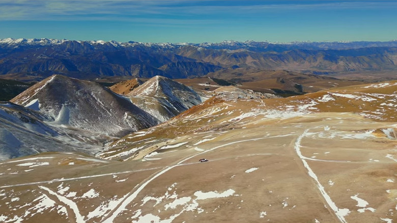
The summit of Mount Patterson can be reached on foot or via a 4x4 trail. The 4x4 trail is only suitable for high-clearance 4WD vehicles, particularly those that can let air out of the tires and have a compressor to pump them up afterwards. Note that this is a summer and fall track — it's not passable in winter due to snow drifts. But with the right vehicle at the right time of year, you can drive all the way to the summit. For 2WD vehicles, Summit Post recommends parking at Lobdell Lake and walking the rest of the way to the summit — after this point, the track gets rough and 4WD is necessary. The website 4 Wheel Parts advises that the area is a fragile ecosystem, so be sure to keep to designated trails.
At 11,673 feet, Mount Patterson offers sweeping views — The scenic panorama is well worth the effort to reach the top. The Huntin Daddy describes the summit scenery as "crazy good," while ONX Maps notes the 360-degree view as one of the major highlights. Besides the White Mountains and the Sawtooth Range, you can also see some of the rugged scenery of the Great Basin Desert which stretches across the state border into Nevada and beyond.
Mount Patterson is about a 45-minute drive from the underrated mountain town of Bridgeport. There are no signs, though, so research the route beforehand. Take Highway 395 north from Bridgeport for 15 miles before turning off on Road 31 and traveling a few miles to Road 67, which brings you to Lobdell Lake. Those with 4WD vehicles can drive along the eastern shore of Lobdell Lake on Road 115, which will eventually lead to the summit.