New England's 5 Highest Hiking Trails With Breathtaking Vistas
Rocky, rolling, and ancient, the mountains of New England are famous throughout the world. They aren't jagged, like the Rockies. They aren't iced in glaciers, like the Cascades. Their modest elevations won't give you nosebleeds, like sky-scraping Mount Denali. But hikers love these mountains for their time-honored trails and scenic summits. The Appalachians stretch all across the region, splitting off into multiple sub-ranges including the White Mountains, the Green Mountains, and the Taconics. With 67 peaks rising more than 4,000 feet above sea level, New England gives visiting alpinists plenty of options.
Northeastern hikes can be tricky, though: In general, these mountains are thickly forested, and you can hike for hours without a decent view. More than 700 miles of the Appalachian Trail cut through New England, and many sections are nicknamed the "Green Tunnel," owing to their claustrophobic walls of trees. So, if you're picking out a high mountain hike, you'll likely want a spectacular view at the top — and some are better than others.
Here are five of the highest trails in the region with breathtaking vistas. Note that these are not just the highest peaks in New England; rather, these are tall, hikeable mountains in four different states, and each is renowned for its lookout points, mostly at their tops. Put those boots to good use, or, in the case of two trails, you can just drive.
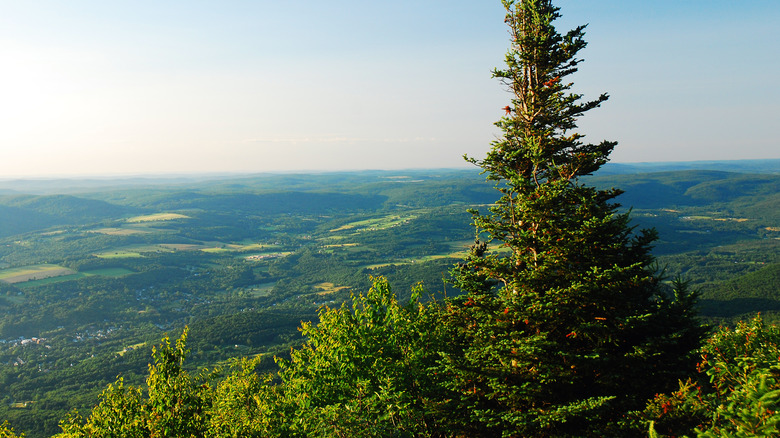
Mount Washington
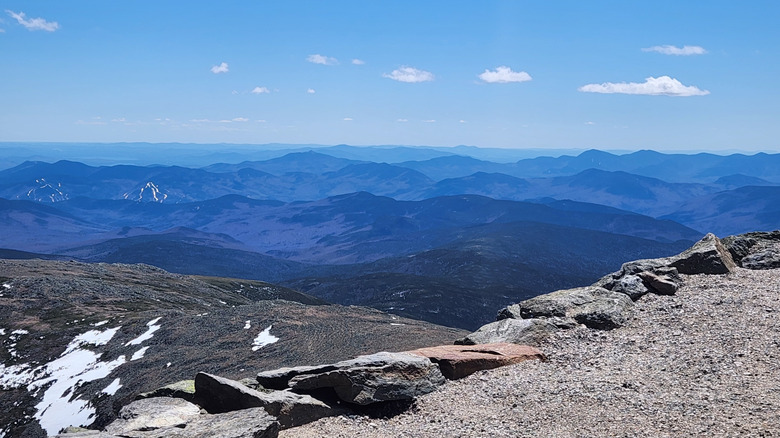
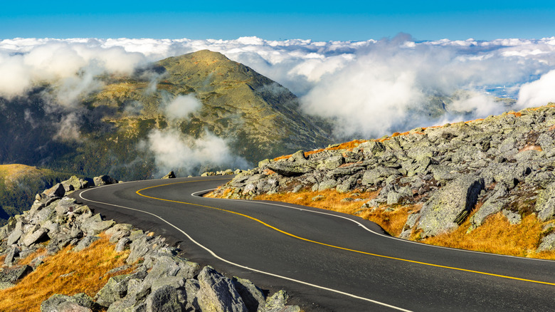
Mount Washington is the tallest mountain in New England, and many people visit New Hampshire just to hang out on its summit. The auto road to the top is well known among motorists, and a popular bumper sticker reads: "This Car Climbed Mount Washington." If you don't feel like sweating but the idea of driving that curved road makes you dizzy, you can also hop the Mount Washington Cog Railway, which slowly chugs you to the summit. Once you reach the top, the views of the Presidential Range are spectacular, and you can walk the rocky Summit Loop Trail to your heart's content.
This is also a beloved place to hike, although the 6,000-plus-foot ascent shouldn't be taken lightly. This mountain has several trails of varying lengths, and they're all subject to temperamental weather patterns; hidden in Mount Washington is one of America's most dangerous hiking trails with record-breaking winds. Even on pleasant days, hikers above tree line find themselves exposed to sun and gusts, so check the forecast and carry in all necessary gear. Successful hikers will find the Mount Washington Observatory, with its own museum, observation deck, and snack bar. "When you say paradise on earth, this mountain could justify the statement," wrote visitor Shubhi A. on Yelp. "So beautiful! So scenic!"
Note that camping on Mount Washington itself is not permitted, so hikers will have to set up their tents on one of the established campgrounds nearby. Hiking Mount Washington in winter is strongly discouraged, as the conditions can be deadly, and all open shelters are closed to the public. The best times to visit are mid-May through mid-October, although snow can fall as early as September.
Mount Katahdin
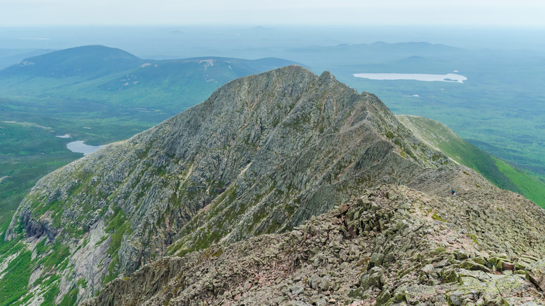
Mount Katahdin is the tallest mountain in Maine, and it's also the northern terminus of the Appalachian Trail, making it the Holy Grail of thru-hikers, who usually hike south to north. At 5,269 feet, Katahdin is one of the 10 highest peaks in all of New England; the sharp-looking summit resembles the Rockies more than the Appalachians, and its most famous section is fittingly called Knife's Edge. Katahdin also feels remote; it stands in the north-central part of the state, more than eight hours by car from Boston. "Mount Katahdin offers a plethora of opportunities for self-fulfillment," hiker KC-213 commented on Tripadvisor. "Just climbing the beast is a great accomplishment. The views are really incredible."
A full hike to the top of Mount Katahdin and back takes a grueling eight to 12 hours, so this is no place for newbies. The surrounding preserve, Baxter State Park, has hundreds of miles of trails, but Katahdin is the main draw, thanks to its sprawling views of the surrounding forests. For this reason, visitors require a trailhead pass, and the number of hikers is capped each day. Campers have to set up their tents in established backcountry sites, which are also limited and have no facilities or potable water. If you do stay the night in Baxter State Park, the views get even better: Maine's Dark Sky Sanctuary is a flourishing woodland with stargazing spots.
Camel's Hump
The most distinctive mountain in Vermont is Camel's Hump, a 4,083-foot ridge that looks from a distance like the pronounced back of a dromedary. The Green Mountains are beautiful from one end of the state to the other, but Camel's Hump (literally) stands apart, and its profile is a popular subject for photographers and landscape painters. Not surprisingly, Camel's Hump makes for a terrific day hike. The summit is a checkerboard of boulders and moss, and you can take in 360-degree views of undulating highlands all around. "[New Hampshire] hiker here," wrote u/JBorrelli12 on Reddit, alongside a heart-melting photograph of daybreak at the summit. "Made my way to your beautiful state and hiked Camels Hump for sunrise. Amazing!"
That said, Camel's Hump isn't the tallest mountain in Vermont; it's actually tied for third with Mount Ellen. Yet this particular peak is easy to spot and beautiful to behold, drawing about 20,000 hikers every year. The 4.8-mile Burrows Trail is designed for intermediate hikers and goes up over 2,200 feet in total; visitors should budget about four hours, especially in wet or wintry conditions. Not nearly as isolated as Katahdin or Mount Washington, Camel's Hump is a reasonable 45-minute drive from Burlington. The surrounding wilds are also worth exploring; Camel's Hump sits in the Camel's Hump State Park where you'll find plenty of trails and scenic waterways.
Mount Greylock
Compared with New England's mightier mountains, Mount Greylock is a bit squat, at 3,491 feet above sea level. What it lacks in height Greylock makes up for in reputation: This is the tallest point in Massachusetts, and its name sounds like a "Lord of the Rings" character. Indeed, the mountain has fascinated generations of writers, including Herman Melville, Henry David Thoreau, and even J.K. Rowling. This is the gem of the Berkshires, rising paternally over the small town of Adams (population 8,000). Mount Greylock is so far west that it's almost in upstate New York — closer to Albany than to Boston.
Dozens of miles of hiking trails crisscross the Mount Greylock State Reservation. One of the best routes is the Cheshire Harbor Trail, which goes to the top of Mount Greylock and back, for a total distance of 6.4 miles. Don't underestimate the climb; you'll ascend nearly 2,000 feet, and most hikers require about four hours to complete the circuit. The views of surroundings fields and forests are wondrous, even by Berkshire standards. As Joe M. put it in their Yelp review, "The summit was definitely worth the effort ... but the view was incredible. Seeing all the different mountains across the horizon was great (they had a very helpful guide to what you were seeing)."
If all you're not feeling the climb, you can also drive. The Mount Greylock Scenic Byway is a 16-mile motorway that takes you right to the top, with magnificent landscapes along the way. On a clear day, you can see as far as 70 miles — and while you won't notice any borders, the vista encompasses five different states.
Mount Monadnock
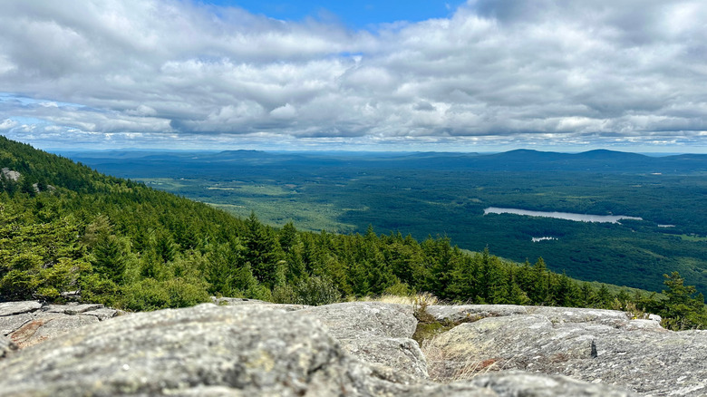
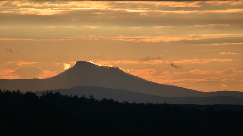
Mount Monadnock is actually shorter than Greylock, at 3,165 feet above sea level. This might seem unimpressive, considering any pothole in Denver is about 2,000 feet higher. Yet Monadnock stands out from the crowd because of its prominence: Instead of blending into other mountains, Monadnock rises 2,186 feet from top to bottom, higher than any other peak in southern New Hampshire. The 4-mile loop trail up is steep and rocky; some sections are better described as "scrambling" than hiking. The views at the stone-capped top reveal vast stretches of woods and scattered lakes.
More astonishing still, Monadnock is one of the most-climbed mountains in the world, drawing over 125,000 visitors to its summit each year. There are many possible reasons for this: The trailhead is just short of a two-hour drive from Boston, which is much closer than most of the Green or White mountains. The trail is a workout but well trafficked and easy to follow with blazes and cairns (or human-laid rock piles). Most hikers can complete the circuit in a single morning, leaving the afternoon for other activities. "It is beautiful and 100% worth the climb," wrote Cindy T on Tripadvisor in 2023. "The views are amazing. This is easily doable in 4-5 hours. Just be prepared for a strenuous hike."
Methodology
It's fairly easy to find and confirm the highest peaks in New England with a little online research, and many of them are located right next to each other in the Presidential Range of New Hampshire. They all have hiking trails to their summits as well, with magnificent clear-day views. Yet all of these mountains offer variations on the same view; to mix things up, we wanted to show off high mountains in different states across New England. Since we limited ourselves to five trails, we filtered out Connecticut and Rhode Island, states better known for rolling hills than high massifs.
Katahdin, Greylock, and Washington were all shoo-ins, since they're the tallest in their states and yield breathtaking vistas. Vermont has hordes of scenic summits, two of them taller than Camel's Hump, yet this mountain holds a special place in the local imagination. Many would disagree, pointing to Mount Mansfield — which really is the tallest — and if you can't pick between the two, you should really just climb both. Meanwhile, Monadnock is in a class of its own — prominent and popular, this mountain is a regional champion. Even the author of this story has climbed it twice.