Oregon's 5 Best Hiking Trails In Portland For A Scenic Outdoor Escape, According To Reviews
A trip to Portland, Oregon, is a time to eat, drink, and explore. The city is full of delicious restaurants, coffee shops, breweries, and cocktail bars. Unfortunately, you can't work up an appetite just by thrift shopping between meals. So if you're planning a trip to Stumptown, pack your hiking boots and tackle one of the many trails within the city limits. If you're visiting outside the summer season, pack a raincoat, too. Portlanders hike year-round — if they let a little rain stop them, they'd never do anything.
I grew up here and return often. I always make a point of hiking a portion of my usual trail, Wildwood. If I have time, I'll add another route to work off my totchos (tater tot nachos, a Portland specialty). One of my favorite things about Portland is its nature right inside the city's borders. The area sits on land traditionally inhabited by the Kalapuya and Chinookan peoples. Forest Park alone has 80 miles of trails, including 30 miles of Wildwood. There's a trailhead downtown that quickly takes you into moss-covered woods where the sudden quiet makes you feel like you are in the middle of nowhere. The local transit agency, TriMet, serves many trailheads.
Narrowing to just five in a nature-forward city like Portland is no easy task. I chose these trails based on my own experience and cross-referenced them with ratings on AllTrails and discussions on Reddit.
Zoo to 23rd via Wildwood and MAC Trails
My favorite hike in Portland won't show up on AllTrails, but a version of it is often mentioned on Reddit. The beauty of this one is that, with public transportation, it's a one-way hike that ends on a street lined with cafes.
To start, take the MAX Red or Blue line to Washington Park station. It's the only underground station in Portland's MAX system and, at about 260 feet below ground, is the deepest transit station in North America. Don't worry, there's an elevator to the surface. From there, walk away from the Oregon Zoo toward Southwest Knights Boulevard. Turn right and follow the road until you reach the Connector Trail, which becomes the Overlook Trail. Follow signs to Wildwood; you'll turn onto Walnut, which becomes Maple before merging into the main trail.
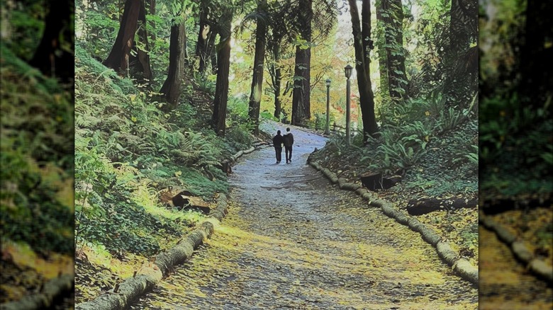
Open meadows give way to dense forest. Ferns and moss thrive under the canopy. The trail descends past an archery range in an open field before dipping back into the woods. When you reach the MAC Trail, you can detour toward the best Japanese garden outside of Japan, aka the Portland Japanese Garden or the International Rose Test Garden. Continue toward the Tudor-style restroom on Sacajawea Boulevard; behind it, a shaded paved path lined with old lanterns leads downhill. The path ends at Burnside — cross to 23rd for a well-earned dinner. Want to make the hike more of a workout? Do it in reverse!
Tryon Creek Triple Bridge Loop
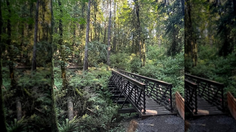
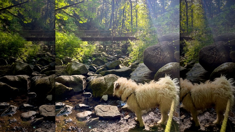
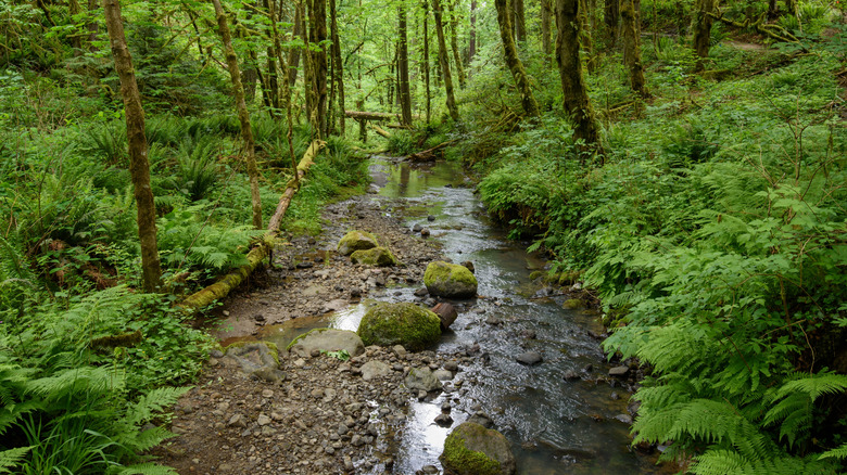
On the southern edge of the city sits Tryon Creek State Natural Area, a roughly 660-acre park with 8 miles of trails. Most of the park is within Portland city limits, with portions extending into Lake Oswego. The trails follow Tryon Creek and its tributaries before the water flows into the Willamette River. Keep an eye out for beavers and their dams, and listen for woodpeckers hammering away at the trees.
The Triple Bridge Loop is a 3.4-mile route that typically takes less than 2 hours. It's the highest-rated hike in the park on AllTrails. Reviewers praise its accessibility and scenery, though many note that it can be muddy year-round, so wear appropriate footwear. "Beautiful trail with few trail runners. Dog friendly with great views. Little muddy on some spots and well maintained," one user wrote.
The park is an intensely green escape into dense woods. Start at the Nature Center, where you can pick up a map or download one to your phone. The loop combines several trails to hit more of the bridges crossing the creek and see the terrain even further. The forest is second growth — the area was logged in the late 1800s – but decades of stewardship by the Friends of Tryon Creek have gotten it close to its old glory.
Mt. Tabor Loop
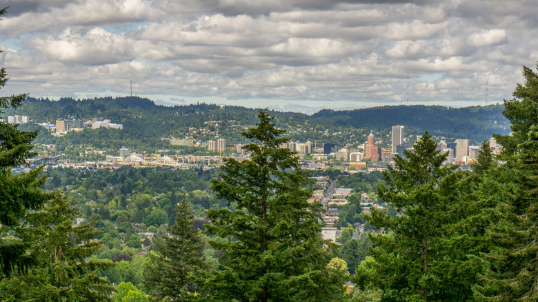
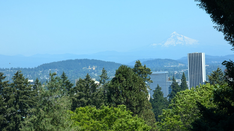
Portland is the only major U.S. city with an extinct volcanic cinder cone within its city limits. Mount Tabor is one of several in the area. All are green, forested bumps on the flat landscape stretching east of the Willamette River, but Tabor is the closest to the center of town.
On your way, consider stopping at Tabor Bread, about a mile from the park, for pastries or sourdough to pack for the summit. After your hike, head about three-quarters of a mile down Hawthorne Boulevard to the Bourdain-approved Apizza Scholls for a post-hike slice. Be sure to get in line before it opens at 5 p.m. Then, explore one of Portland's top neighborhoods.
Several trails crisscross the park. Entering from the west side takes you past reservoirs. Leave the paved roads for dirt paths to find quieter forested stretches. Take an uphill route, and you'll pass a basketball court built in the crater of a cinder cone — a striking place for a pickup game. At the summit, trails and roads converge. Each side offers sweeping views. Look west to see downtown and the West Hills; look east for Mount Hood rising above the trees. "Highly recommended. Natural beauty at its peak," one AllTrails user said of the Main Loop trail. Make a loop around the top, then head down for pizza and a beer.
Balch Creek
Another hike in the Tualatin Mountains on Portland's western edge, the Balch Creek trail follows a canyon alongside free-flowing water. Keep your eyes open for cutthroat trout. The trail begins in Lower Macleay Park, a peninsula of green that juts out from Forest Park into Northwest Portland.
Head up the Lower Macleay Trail under the Balch Gulch Bridge. You'll meet up with the creek just past the bridge. (The creek flows in tunnels from the bridge to the Willamette River.) About 20 minutes into the hike, you'll reach the Witch's Castle. The old stone building isn't a castle, and witches were never involved. Now covered in moss and graffiti, it was built in the 1930s as a public restroom. It was abandoned in the early 1960s and is now a daytime landmark and even an alleged party spot for high schoolers at night (alleged because growing up, I heard about it but was never invited). "Great trail run! Really feels like genuine Pacific Northwest. Lots of big trees, evergreens, ferns and running water. The witches castle is a pretty cool waypoint as well," an AllTrails user noted.
The Lower Macleay Trail merges with the Wildwood Trail at the castle. Continue along the creek until you reach the bridge crossing over it. You can turn back here, or start the steep hike up to Pittock Mansion, where you'll find an old house with lush gardens and stunning views. Whenever you get back to the trailhead, Great Notion Brewery is only a 10-minute walk away, where you can toast to a hike well done with some of the best hazy and sour beers in the U.S.
The 4T Trail
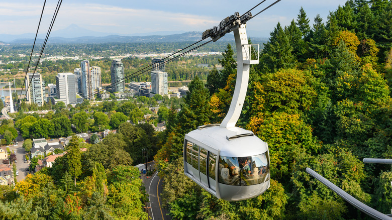
The 4T Trail is just under 10 miles long, but don't worry, not all of it is on foot. The name stands for Trail, Tram, Trolley, Train — the four modes of transportation you'll use. You can hop on at any point; look for the green, blue, red, and yellow circles with "4T" in the middle. It's a fun way to see the city and is often recommended on Reddit. "The 4T trail is a fun challenge," a user wrote. "It's more of fun way to see the city."
The train portion is the Red or Blue MAX that goes from the Washington Park Station to the Downtown Library (10th and Yamhill). The trolley portion is the Portland Streetcar NS Line between Southwest 10th Avenue and the South Waterfront. The tram lifts you above the city between the South Waterfront and Oregon Health & Science University. The trail portion hikes from the OHSU campus up to Council Crest Park – one of the highest points in Portland — and over to the Portland Zoo to meet back up with the MAX. You'll take a mix of the Marquam and Council Crest Trails, along with a few others. The way is well labeled; just follow the "4T' signs.
Bathrooms, water refill stations, and food stops are plentiful along the route. If you need a caffeine boost, fortunately, Portland is one of the best cities in the U.S. for coffee, and downtown, where you transfer between the train and trolley, has many amazing options within a few blocks.
Methodology
With 80 miles of trails in the West Hills alone, there are many options for the best hiking trails in Portland. To narrow the list, I chose routes with strong reviews, distinctive features, or memorable views.
I used a combination of AllTrails ratings, comments on Reddit, and my own personal experience growing up in Portland and returning often. I aimed for a mix of experiences – from getting lost in nature to fun urban adventures that start or end with a beer and pizza.