Paddle, Hike, Or Bike Along North Carolina's Unique Multisport Scenic River Trail
One day, you'll be able to hike the full length of the Deep River State Trail on foot. You could ride a bicycle down its gravelly surface, or, if you're more of a water person, you'll be able to put your kayak in the adjacent river and paddle your way down the Deep River, which runs alongside the terrestrial trail for its full 125 miles. This is what will set this trail apart from other linear parks across the country: When they say "multi-use," they really mean it.
Authorized in 2007, the Deep River State Trail is very much a work in progress. So far, outdoor enthusiasts can already walk, pedal, or float parts of this route through the woodlands and small towns of North Carolina. Small sections of the completed rail-trail are scattered along the route, and many additional sections should be developed soon. You probably shouldn't plan a thru-hike anytime soon, as an exact timetable for the completed trail isn't forthcoming, but sometime in the future, this trail should rival the peaceful vibes of North Carolina's wildlife wonderland at Alligator River.
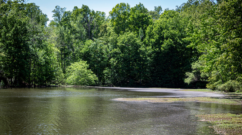
This isn't the first time humans have turned to this waterway to improve their lives: The Deep River has a long history of mills and manufacturing, and traces of that past are still evident in its dams and old structures. Part of the river is the Randleman Reservoir, which has provided drinking water to local households since its completion in 2004. This river is a tributary of the Cape Fear River, which flows into the Atlantic Ocean.
Deep River is a dynamic trail in the making
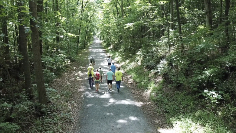
The most complete section of the Deep River State Trail is located in Franklinville. At the moment, it's an out-and-back journey along a gravel rail-trail that spans about 3 miles and includes a scenic walking bridge and rocky overlook. Franklinville itself is a quiet little town of about 1,100 residents; the earliest settlers came here in the late 1700s, and a grist mill harnessed the river to power its waterwheel around 1801. More mills would spring up along this corridor in the coming decades, many of which still stand along the Deep River's banks.
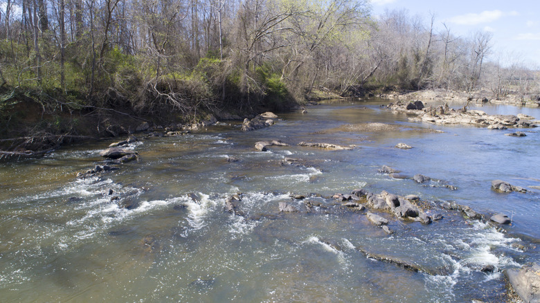
Kayakers can paddle large sections of this river, though a succession of dams tends to hinder their progress, as well as the waterway's ecological health. Contrary to its name, the water level of the Deep River can be fairly shallow; the Indigenous name "sapponah" means "deep" but refers to the steep slopes on either side. A restoration project is gradually removing redundant dams so the river can flow more fully. The region is extremely rocky, including large boulders scattered throughout.
One of the most unique aspects of the Deep River is the Cape Fear Shiner, a 2-inch-long freshwater fish in the minnow family. The species' numbers are humble, and it would have gone extinct if not for aggressive conservation efforts. Spotting one is exceedingly unlikely, and while the Deep River doesn't quite compare to the best national parks for spotting rare and endangered wildlife, paddlers can keep an eye out for this endangered, yellow-hued creature and know that it exists nowhere else in the world.
How to get to Deep River and where to stay
The Deep River runs through a very rural swathe of North Carolina, which is part of its appeal, but that does make it a little challenging to get to. Greensboro is the closest city, about 35 minutes away by car, and it's generally assumed that you'll drive (or get driven) to the trailhead. When the full 125-mile system is complete, it will reportedly start near Jamestown, less than 20 minutes from Greensboro by car — and just as importantly, only one hour by bicycle. Most thru-travelers will probably have to get picked up when reaching the end, on the sleepy edge of Lee County.
Another snag at the moment is where to stay the night: There aren't many established campgrounds between the town of Ramseur (near the trail's western end) and Jordan Lake (near the eastern end), and most hotels cluster around major towns, which are a fair distance from the river. Cyclists will have the easiest time finding accommodations, since they can hop onto roads and bike the "bonus miles" to inns and motels along the way, but long-distance hikers and paddlers may struggle to find a place to bed down when the 125-mile route is first completed. With time, more options will likely spring up. While you're in the region and looking for outdoor experiences, North Carolina's Blue Ridge mountain gateway of Clyde is a cozy crossroads with scenic trails and architectural gems.