This Is Canada's Most Scenic Mountain Hike On The Sunshine Coast, According To Reviews
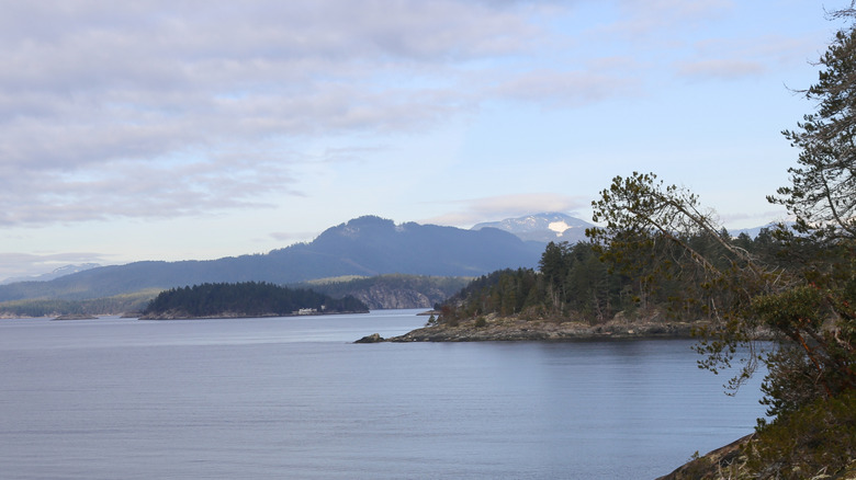
The Sunshine Coast district of British Columbia's west coast is a majestic region that has a reputation for long hikes with impressive vistas that mix mountains, forest, and sea. Stretching along the coast, you'll find the aptly named Sunshine Coast Trail, which reviewers point to as the most scenic hike in the region.
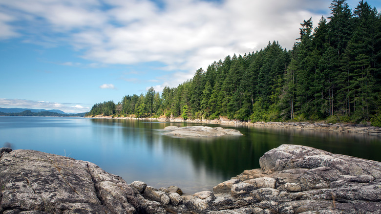
According to reviews on AllTrails, Google, and Tripadvisor, the trail isn't just beautiful — it's an exciting adventure. The entire length of the Sunshine Coast Trail is almost 112 miles, and it's divided into 11 sections that cover a huge chunk of the Sunshine Coast region. Along the way, hikers will find free, cozy hiker huts where they can stay overnight. In addition to a place to rest, these huts provide opportunities for swimming, canoeing, picnicking, and more.
Powell River and Lund are the most prominent cities near the trail, but it covers several points along this section of the Sunshine Coast. The trail also leads through many parks, recreation areas, and natural preserves on the coast — including Inland Lake and Malaspina Park.
Choose a scenic trail for your own time and experience level
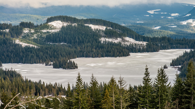
Since the Sunshine Coast Trail is long and covers a variety of landscapes, its difficulty varies from section to section. Section 1, which starts in Land's End and leads through Gwendoline Hills, is where hikers can find the Sarah Point Hut. The hut has a 4.8-star rating on Google, where reviewers praise the scenic views and urge caution if driving there. One reviewer bluntly states, "Do NOT attempt this without proper clearance, and legit 4x4 capabilities." A Tripadvisor review of a 3-day hike in this section mentions the route between Sarah Point and Shingle Mill, describing the view of Scout Mountain over Powell Lake as "especially breathtaking."
Section 2 continues from Gwendoline Hills and ends in Thunder Ridge. This part of the trail is rated as Moderate and includes the Manzanita Hut. The trail climbs high into Gwendoline Hills and gives you a view of the Okeover Inlet and the distant peaks of Vancouver Island. One AllTrails reviewer mentions that the view from Manzanita Hut is "beautiful up there" and worth the extra effort. Another reviewer states, "The scenery is absolutely stunning and the views from the top are worth every step."
Section 8 leads from Tin Hat Mountain to Lewis Lake, and it gets a lot of attention for its mountain views. Hikers should stop and rest in the Tin Hat Hut, which is located on a high mountain summit and offers views in every direction. Reviewers on AllTrails give the hut and nearby trails a 4.4-star rating.
A travel adventure on the Sunshine Coast
Section 11 includes Rainy Day Lake, Saltery Bay, Fairview Bay, and Troubridge. The part of the trail that includes Mount Troubridge has a higher difficulty level but is even more rewarding in terms of views. A review on Tripadvisor describes the area as having a "variety of trails" and "a lot of scenery." Hikers in Saltery Bay can also take a shortcut by driving their high clearance 4x4 vehicle along Rainy Day Lake Road to reach Mount Troubridge.
The Sunshine Coast isn't accessible via car alone, though, so unless you have access to a private boat or small plane, you'll have to take BC Ferries to the Sunshine Coast Trail. You can also use the ferry network as a way to travel to different sections of the trail or if you'd like to see more of the Georgia Strait. Powell River is a four-hour trip (by car and ferry) from Vancouver, while getting to Lund will take about 30 minutes longer (also with a ferry ride).
For those that are flying, Powell River Airport hosts one commercial carrier: Pacific Coastal Airlines. They can take you to various points along the coast, as well as to Vancouver International Airport. From Vancouver, you can head to some of the best West Coast beach camping destinations.