'The Amazon Of North Carolina' Starts On A Remote River Trail Adventure Perfect For Camping And Paddling
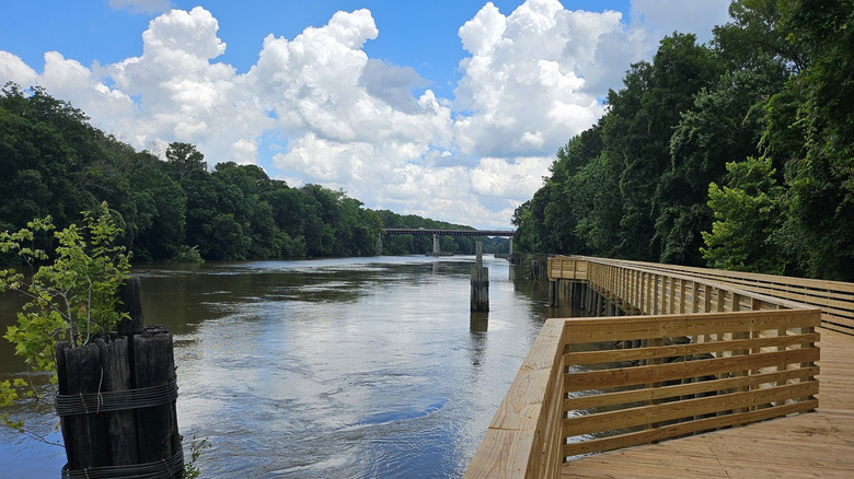
There's no shortage of scenic waterways in North Carolina, but few of the state's waterways feel as untouched as the Roanoke River State Trail. At its start, the river is fast-moving, before transitioning into a broad channel of calmer water framed by tree-lined banks. The landscape starts to narrow the further you go, with bald cypress and tupelo trees standing tall, their roots emerging from the dark waters. In some areas, the canopy is so thick that it filters the sunlight, creating an atmosphere that shows why the river has earned the nickname "The Amazon of North Carolina."
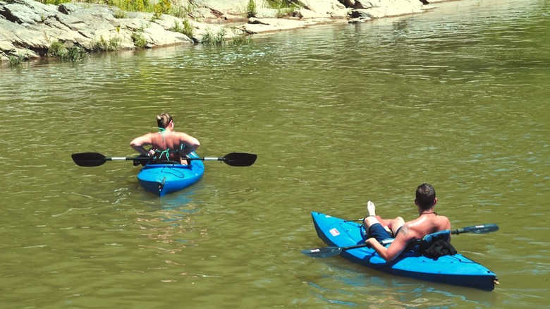
The Roanoke River actually begins in the Blue Ridge Mountains and winds through Virginia, where a portion of it makes up the Roanoke River Blueway, a top urban kayaking spot. When you get into North Carolina, you'll find the Roanoke River State Trail, a more remote stretch across eastern North Carolina running from Roanoke Rapids to Albemarle Sound, meant to be explored by canoe or kayak. Given its length and extensive network of side channels — some of which were once used in North Carolina's Underground Railroad — it's impossible to experience all the trail has to offer in a single day. Instead, many paddlers choose to take a multi-day trip, stopping overnight at the collection of riverside camping platforms along the way.
Enjoy paddling and camping around the Roanoke River State Trail
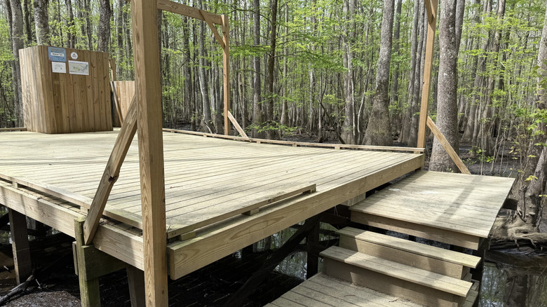
Starting in Roanoke Rapids, a stunning city with a historic downtown and charming shops, the Roanoke River State Trail stretches over 100 miles and offers a unique network of more than a dozen riverside campsites designed for paddlers traveling down the river. Raised above the water, these wooden platforms are connected by narrow boardwalks that wind through the vegetation. Some are enclosed, while others are open-air decks where campers can set up tents.
Spending the night along the Roanoke River offers a true off-the-grid experience. Dense forest stretches in every direction, with the sounds of wildlife echoing through the trees even after sunset. Along the way, paddlers may spot a wide range of animals that call the river home, including beavers, bobcats, and over 200 species of birds. One of these is the great blue heron, a wading bird that is often compared to a pterodactyl because of its towering size and deep, guttural squawk.
Many paddlers plan their routes ahead of time. One route recommended by Roanoke River Partners is the Lower Roanoke stretch between Williamston and the Hwy 45 Bridge near Plymouth. The journey can be completed over four days, beginning at the Roanoke River Boardwalk & Boat Ramp and ending at the Plymouth Boating Access Area, with stops at Conine, Cypress Cathedral, and Bear Run campsites. Additionally, those looking to get some fishing in can center their trip around a visit to Weldon, North Carolina's "Rockfish Capital of the World." Trips along the trail are usually one-way, so paddlers will also need to plan their transportation. Boat ramps along the river offer places to launch and park. However, because the put-in and take-out locations are different, visitors should arrange shuttle transportation to avoid having to paddle back to their point of origin.
Planning your visit to the Roanoke River State Trail
When planning a paddling trip along the Roanoke River State Trail, there are a few things to know. For example, camping platforms must be booked in advance. Paddlers can reserve them online, and prices start at $25 per day (at the time of writing). Many of them also don't have any built-in amenities, meaning paddlers need to bring everything they'll need, including drinking water and a portable toilet setup. River Landing, however, is a covered building with access to restrooms and showers via the River Landing Boardwalk.
It's also important to check the river conditions before setting out. Because the river's flow is controlled by hydroelectric dams, water levels can shift depending on flow release schedules and weather conditions — even though the most popular sections are usually only of moderate difficulty. In some cases, these changes can happen quickly, affecting both depth and current. When water levels are too low, the river becomes difficult to navigate in a boat. On the other hand, higher levels can mean that the water moves faster than expected.
Water levels aside, the best time to paddle the Roanoke River often depends on personal preference, as each season offers something different. Spring is especially scenic, with plants and trees coming back to life after a long winter slumber. Fall is another popular time to visit, thanks to cooler temperatures, fewer bugs, and colorful foliage. The summer offers warmer weather and longer daylight hours, but one of the tradeoffs is the mosquitoes. One paddler described them as being "so thick it looks like smog." Lastly, winter paddling can be cold, but for those willing to brave the temperatures, paddling down the river with freshly dusted snow all around can be well worth it.