The 7 Most Beautiful Mountain Trails Around Lake Tahoe Most Tourists Miss
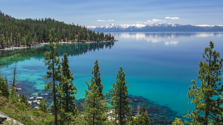
If Lake Tahoe is the Jewel of the Sierra, then the trails support the crown of mountains surrounding it. The beauty of this landscape was penned by famed adventurer John Muir in 1873, "I sauntered through the piney woods, pausing countless times to absorb the blue glimpses of the lake, all so heavenly clean, so terrestrial yet so openly spiritual." More than 150 years later, Lake Tahoe's trails still become part of every hiker's soul, from first steps to summit stances.
While the mountain trails surround one turquoise-tinged alpine lake, hiking here offers four shores across two states, each with a distinct personality from the water's edge to peak-bagging bliss. The North Shore brings a quieter escape with convenience, less than an hour's drive from Reno. Along the THe East Shore trails run steep, hugging the Carson Range. South Shore is known for its energetic atmosphere, but trails lead to waterfalls and other wonders while never leaving Tahoe too far out of sight. West Shore, one of the least visited areas, means less-crowded trails that surround hidden glacial lakes.
With millions of people visiting the Lake Tahoe Basin each year, finding a trail far from the maddening crowds means plotting your path like a local would. Every trail in this list was chosen for alpine scenery with lake views, smaller crowds, and unique aspects like waterfalls or rock formations along the way — and all have stellar reviews by hikers. Plus, the list covers viewpoints from all four shores, giving flexibility when visiting North America's oldest lake that's a crystal-clear vacation haven straddling two states.
A short hike to a secret beach at Skunk Harbor
The only thing that stinks about Skunk Harbor Trail on Lake Tahoe's east shore is parking along Highway 28, but early risers report the small lot has spaces. This three-mile out-and-back trail has 4.8 stars on AllTrails and Google, and meanders downhill through pine forest to a secluded beach tucked into a quiet cove — passing an abandoned stone cottage along the way. Boulders line the sandy shore leading into crystal clear waters. Wear your swimsuit, and bring a picnic, towel, and water for the hike back uphill. Reviews report few crowds, even on weekends, with some noting numbers rise in summer.
Seek solitude in the serenity of Glen Alpine Creek
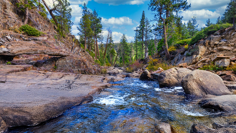
About 15 miles from the South Shore is Lily Lake and the Glen Alpine Creek Trail. Glen Alpine Falls sits right off the roadside, but about half a mile beyond that, a parking area opens the path to a breathtaking wilderness of granite peaks and glistening lakes high above Tahoe. With 4.7 stars on Google, this four mile out-and-back trail takes you through wilderness to the Upper Glen Alpine Falls which roar during spring run-off. Following a rocky ravine landscape along the way, hikers enjoy the serene sound of the babbling creek. AllTrails reviews note that even in May the hike can be peacefully uncrowded.
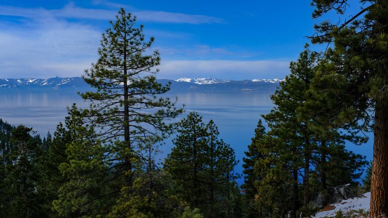
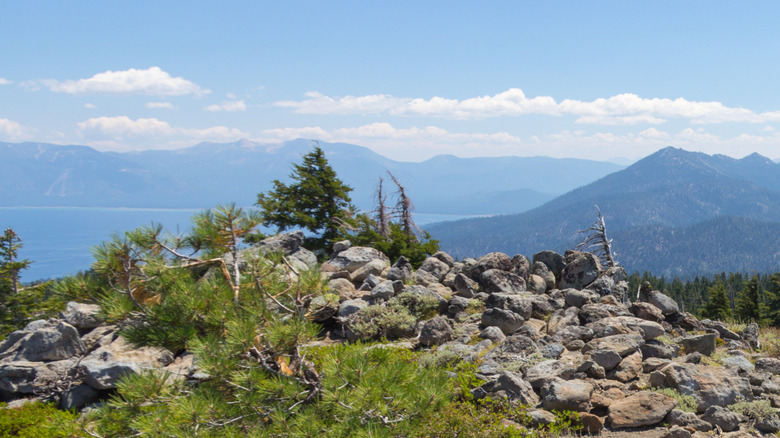
The 10,000 foot view of Lake Tahoe from Freel Peak
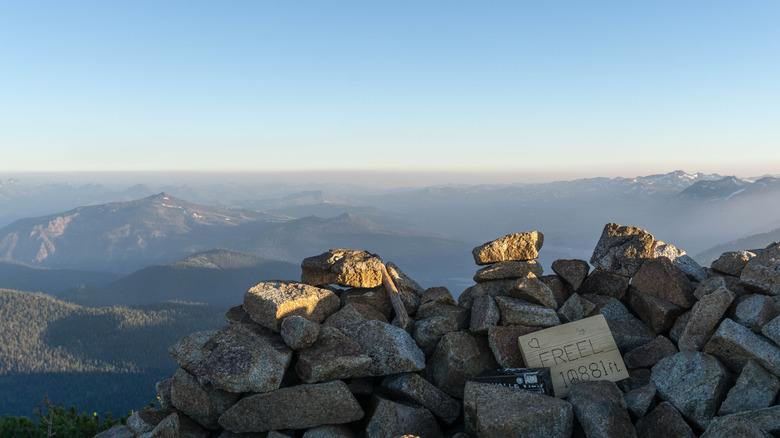
Go peak bagging by hiking the trail to the top of Freel Peak. As the highest peak around Tahoe, the panoramic vistas of mountains stretching off into the distance are worth the challenging 10-mile out-and-back hike. AllTrails reviews give the trail 4.5 stars, noting the expansive 360 degree views across the Tahoe Basin and into Carson Valley. With rough terrain and higher altitude, you likely won't pass many other hikers. As noted by Lake Tahoe Locals Facebook group, more people flock to Mount Tallac's stunning but more crowded trail.
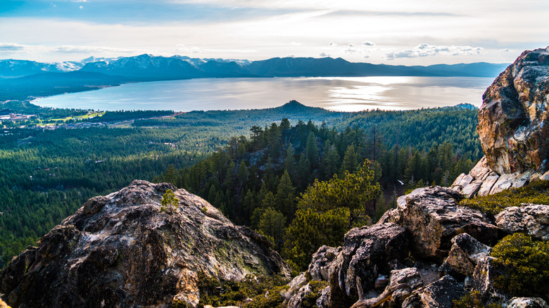
This view is bananas at Monkey Rock, especially at sunset.

There's more to see at the top of Monkey Rock Trail than the blue water of Lake Tahoe at this East Shore destination with 4.8 stars on AllTrails. As the name suggests, a rock that (uncannily) looks like a monkey sits at the top. Covering 2.6 miles out and back, the trail starts on the eastern edge of Incline Village, near America's Most Beautiful Bikeway. The trail takes you from near the water's edge through a forested path of towering tress, and weaves around to Monkey Rock. Go at sunset to see Lake Tahoe and Incline Village painted in golden hour glory. As AllTrails reviews point out, it's less crowded at sunset, too!
Hike, climb, or scramble to Castle Rock's royal views
Start the drive up Kingsbury Grade in Stateline, and after a short side trip, the path to Lake Tahoe royalty starts. The 2.9-mile lollipop Castle Rock Loop Trail begins on the famed Tahoe Rim Trail before forking off to Castle Rock's viewpoint. Thick forest with peek-a-boo views of Lake Tahoe lines meandering switchbacks. AllTrails reviews note a lack of crowds, even on weekends, and give the trail 4.8 stars. Scramble to the top of Castle Rock, about 7,900 feet high — but watch for signs noting if peregrine falcons are nesting, and that's the only time to skip the scramble.
Soak in the sunrise at Ellis Peak
Get a pre-sunrise start 11 miles from Tahoe City on the West Shore to see the rising sun paint the landscape over Lake Tahoe from Ellis Peak Trail. Park along Barker Pass Road and start the 3-mile journey with about 1,000 feet of elevation change along the way. The trade-off for smaller hiking crowds is that mountain bikers and OHVs can ride portions of this trail. With 4.8 stars on Google, this trail rewards hikers with views of Lake Tahoe shimmering on one side, and the glacial peak landscape across Desolation Wilderness unfolding on the other side.
Explore North Shore's famed lookout
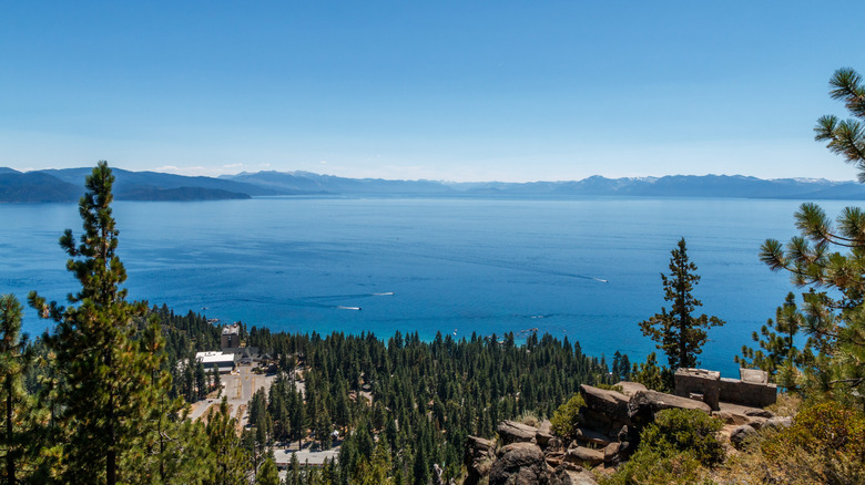
The Stateline Lookout Trail on the North Shore starts 2.5 miles from Kings Beach, barely on the Nevada side. The trail gets 4.8 stars on AllTrails and begins in a residential neighborhood half a mile from Highway 28, so the average tourist wouldn't happen upon it. It crosses into California along the wide 1.7-mile path to the foundation of an old fire tower, providing a stage that makes Lake Tahoe look like an infinity pool in the distance. Get a bird's eye view of Lake Tahoe's Crystal Bay retreat on the Nevada-California border, right below the vantage point.