Forget The Grand Canyon's Crowded South Rim, This Wildly Underrated North Rim Trail Has Perfect Mountain Views
For many people, a trip to the Grand Canyon isn't so much a question of if they should go, but when. Between 4 and 5 million people visit the Grand Canyon every year (via the National Park Service Statistics). Most of these visitors make their way to the South Rim, which is the easiest to access. A mere 10% of Grand Canyon visitors head to the North Rim for isolated trails, higher elevations, and equally spectacular views. For avid hikers and mountain bikers looking for a long trail with epic Grand Canyon views, there isn't much better than the North Rim's Rainbow Rim Trail.
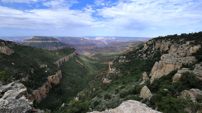
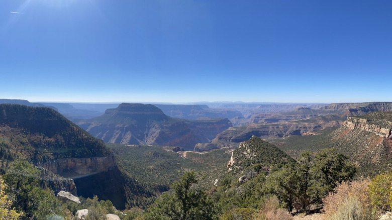
The 19th-century geologist John Wesley Powell once said, "The wonders of the Grand Canyon cannot be adequately represented in symbols of speech, nor by speech itself." This certainly seems true of those who travel along the Rainbow Rim Trail, as words often fail to convey its sheer beauty. Not only are those on the trail treated to multiple enthralling Grand Canyon overlooks, but parts of the trail also veer away from the Canyon into dense forests and meadows full of wildflowers. There are five main Grand Canyon lookouts along this route, and all can be independently accessed via forest roads.
While the most famous sections of the Grand Canyon lie within Grand Canyon National Park, parts of it stretch beyond the park, including the Rainbow Rim Trail, which lies entirely within the Kaibab National Forest. Because of its location outside the National Park, it offers something that the more popular South Rim — and even some North Rim — trails don't: mountain biking through less-traveled parts of the canyon. Since cyclists and even horseback riders are allowed to explore the Rainbow Rim Trail, it's far more appealing to off-roading enthusiasts than the busy South Rim.
Explore the Rainbow Rim Trail
The Rainbow Rim Trail follows the Grand Canyon's North Rim in an undulating route that repeatedly veers in and out from the edge of the canyon. Most of the trail is on a single track stretching from Timp Point at the eastern end to Parissawampitts Point at the western end. Other trailheads on the way include North Timp Point, Locust Point, and Fence Point, in that order, so you can customize your route between them for a shorter ride.
According to Alltrails, the entire route spans just over 35 miles out-and-back and takes approximately 14 hours to cover. Since you'll be riding at an average height of 8000 feet above sea level, it's best to split the trip over two days. For most of it, you'll be riding through forests and meadows in complete solitude, with nary another soul in sight, although one Tripadvisor review points out the higher probability of wildlife sightings.
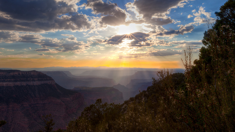
While the forests themselves are scenic, the appeal of this trail is in its sharp twists and turns that abruptly exit the forest and take you right to the edge of the canyon, where the land simply drops away, and you're treated to panoramic views of the sweeping valleys. Some of the landmarks seen on this trail include Powell Plateau, Steamboat Mountain, Tapeats Amphitheater, and Great Thumb Mesas. There's a lot to consider when choosing between the South Rim and North Rim, but there's no denying that the North Rim's remote location and higher elevation allow for a more peaceful experience at the Canyon's overlooks. "So much of the route is all about those brief vignettes out across the endless expanse as you trace the rim of the canyon on a wonderful dirt ribbon," says The Radavist.
Things to know before hiking or biking the Rainbow Rim Trail
Flagstaff is the closest city with an airport to the Grand Canyon, but the trip to the North Rim takes a much longer route through Jacob Lake. From Flagstaff to the South Rim is just under 80 miles (approximately a 1.5-hour drive), while the route to the North Rim is at least a 3.5-hour drive over 207 miles. So, when you plan your Rainbow Rim Trail hike, take the drive time to the North Rim into account. If you're driving in from other cities like Las Vegas or Phoenix, consider spending a night in Flagstaff first, where you can stargaze at the world's first International Dark Sky City.
The Rainbow Rim Trail is also not for beginner bikers or anyone who isn't at least somewhat familiar with high-altitude mountain biking. You'll need to be fairly confident with your bike, as horses on the route may kick up loose rocks and sand, making the ride more shaky. While the trail itself is on the moderate side, the steady climb and rocky paths might increase its overall difficulty. Note that e-bikes aren't allowed on the Rainbow Rim Trail. The best time to attempt this hike/biking trip is between May and October, when the weather is pleasant.
All five trailheads along the Rainbow Rim Trail are accessible via forest roads off US Highway 67, also known as the "Most Pleasant 44 Miles in America." You can find the exact directions to each trailhead on the Kaibab National Forest's Rainbow Rim Trail page. Be sure to carry enough water for two days (there's no water available along the trail) and download your maps offline before you reach the area, as cell service can be spotty in these parts.