
Between Indianapolis And Chicago Is A Trail In A Vibrant College City Blending History With Tranquil Nature
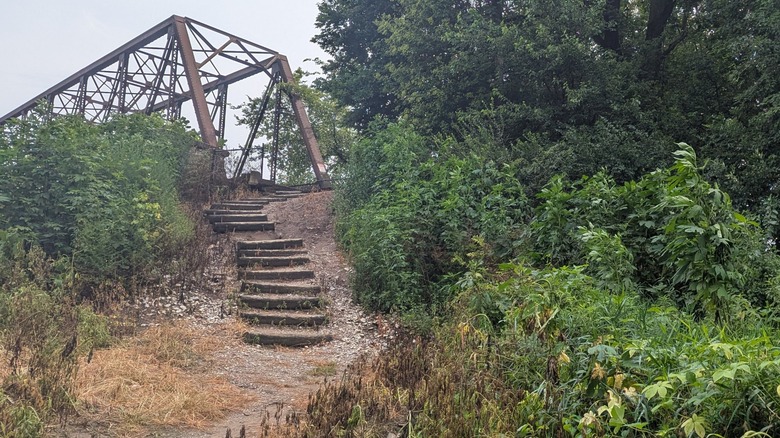
Indiana may evoke cornfields and sports, but there's so much more to the Hoosier State than that. Take a stroll through the forested woodlands along the Wabash River in the state's north-central region on any given afternoon. Depending on the season, you might smell the sun baking the tall grass or turning the leaves golden; listen to a soundtrack of red-winged blackbirds and the gentle splash of a fishing lure dropping into the river; and watch colorful butterflies or soft snowflakes drift through your peripheral vision. Away from urban noise, rimmed by marshland, and shaded by buckeye, sycamore, and cottonwood trees, this nature oasis is part of the 13.4-mile Wabash Heritage Trail. This scenic, multi-use path runs along Burnett Creek and the Wabash River, traversing historic landmarks, residential parks, and farmland. The easy-to-moderate trail is open to the public and popular for jogging, strolling, and experiencing a slice of nature.
The Wabash Heritage Trail is steeped in American history. Its northern end at the Tippecanoe Battlefield in Battle Ground, Indiana, is a National Historic Landmark. The 96-acre site now includes a park, a nature center, and a museum. In 1811, it was where the Battle of Tippecanoe took place, fought between the U.S. Army under William Henry Harrison and a Native American confederation associated with Shawnee leader Tecumseh. "Go there for a great history lesson," writes one Google reviewer. "The museum itself is small but packed with information, and the battlefield itself is easy to stroll," adds another.
At the trail's southern terminus, Fort Ouiatenon is believed to have been the site of one of the earliest French trading posts. Today, the approximately 90-acre park is home to a wooden blockhouse built in 1930 in the style of 18th-century traders. The park also features picnic areas and a concrete boat ramp with river access.
Navigating the Wabash Heritage Trail
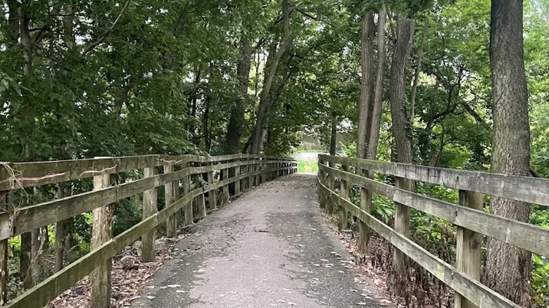
The core of the trail is the Wabash River, the longest free-flowing river east of the Mississippi. It begins near Fort Recovery, Ohio, and flows southwest across northwestern Indiana, then veers south to form part of the Indiana-Illinois border before washing into the Ohio River. "Wabash" is believed to be a French translation of a Miami word generally meaning "clear water over white stones," though centuries of agriculture and development have turned it noticeably murkier. Along the trail, anglers can cast lines for some of the river's 150 fish species, including catfish, carp, and smallmouth bass. Just note that those over 18 do need a fishing license in Indiana.
Lafayette is one of America's fastest-growing metro areas, so some of the trails are within earshot of highways and in sight of residential areas. Even so, much of the route is surprisingly tranquil before reaching the bustling Purdue University, a Big Ten conference school and home to the Boilermakers and more than 50,000 students.
Primarily located in Indiana's Tippecanoe County, the linear trail starts north of the river's western bank in Battle Ground, next to Prophetstown, Indiana's newest state park with historic grasslands and woodlands. From there, it follows Burnett Creek to Davis Ferry Park on the Wabash River, which also features a boat launch. A footbridge crosses the river at Davis Ferry, continuing the trail southeast along the river's eastern bank. A few miles farther down, the trail crosses the John T. Myers Pedestrian Bridge into West Lafayette and Tapawingo Park, where it continues along the river's northern bank. Some parts can be muddy depending on the season, but reviewers say it's typically passable. Note that bicycles are permitted only on the trail's paved urban sections.
The trail offers a nature oasis close to the city
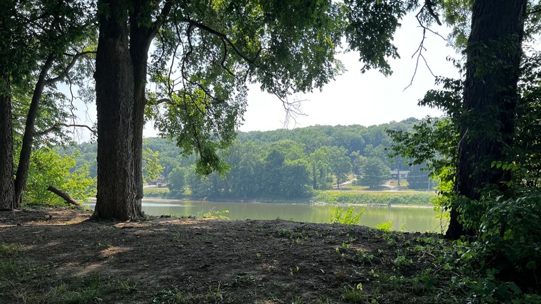
Along the way, additional access points include McAllister Park, formerly the Lafayette Municipal Golf Course, which features a disc golf course and a model plane airstrip; Riehle Plaza, an outdoor events area near downtown Lafayette; and Lyboult Sports Park. The trail's primary bicycle-friendly section is a 3-mile paved stretch from South River Road to Sagamore Parkway, with an extension path through West Lafayette's Happy Hollow Park. The stretch of river between Davis Ferry Park and Tapawingo Park is also considered an easy paddle. Put in at the Davis Ferry boat launch and beach on the sand at Tapawingo Park.
Though the Wabash Heritage Trail passes through urban and residential areas, it still offers ample opportunities to spot wildlife. More than 300 bird species have been recorded throughout the county, and hikers frequently report seeing squirrels, deer, and other animals. "Great views of Indiana farmland and the Wabash river," wrote one Google reviewer. "So many local species of animals that are ready to greet you." Offshore, Heron Island Nature Preserve is an undeveloped 11-acre river islet accessible only by boat and, though overrun with poison ivy, supports a heron rookery. The trail is also close to the Celery Bog Nature Area, a once-thriving farm now a wetland and wildlife mecca with trails, located along the Indiana Birding Trail. It's worth the slight detour for outdoor enthusiasts and nature photographers, as more than 260 species of birds have been documented there.
Lafayette, Indiana, is the travel hub for the Wabash Heritage Trail. Close by, Purdue University Airport (LAF) is a regional link to Chicago O'Hare International Airport (ORD) 140 miles northwest, and Indianapolis International Airport (IND), less than 70 miles southeast. Lafayette is also home to an Amtrak station, providing rail access to the rest of the U.S.