
Between Hartford And Albany Is New England's Underrated State Park With A Scenic Waterfall And Fishing Spots
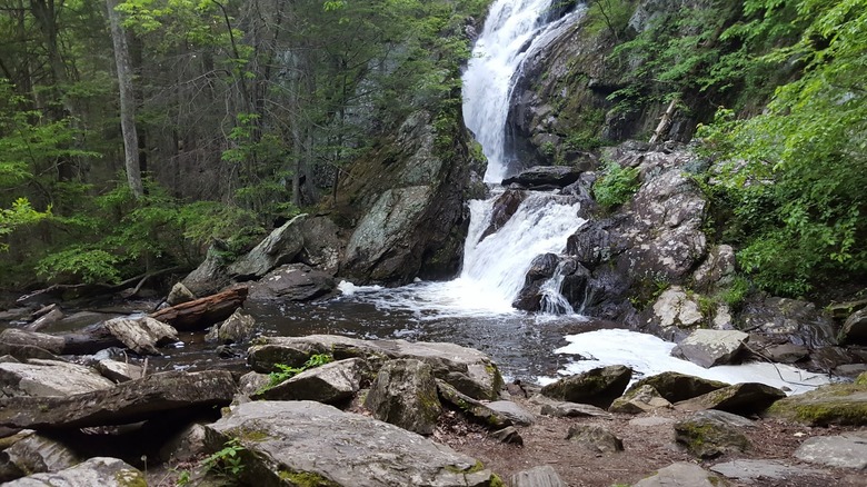
There are few things more majestic in nature than a waterfall. There is just something about the roar of the rushing water that can make you forget about your stress and just appreciate the lovely world we live in. If you're visiting New England, there are lots to choose from. However, there is one scenic waterfall in the underrated Campbell Falls State Park, which, though largely in the state of Connecticut, crosses the border into Massachusetts at its northernmost point. In fact, if you hike to the falls from the Connecticut side, you can see a marker at the state line. (Both states take care of the park.) There is a hike in from each state, and neither one is very long. You can enjoy some stream fishing, or splash in the pool at the base of the 50-foot falls. This is a quiet park with no development, so bring water and maybe a picnic lunch.
While researching this underrated state park of just over 100 acres, we looked at its high ratings on review sites and low numbers of actual reviews. It's rated 4.7/5 on Tripadvisor with only 36 reviews, 4.8/5 on Google Maps with under 300, and 4.5/5 on Yelp with a mere 16. One reviewer on Google Maps refers to the park as "incredibly peaceful," while another says, "very serene mid-week with minimal crowds." On AllTrails, a reviewer calls it "absolutely beautiful, peaceful and quiet." The park is around 40 miles northwest of Hartford, Connecticut, and about 62 miles southeast of Albany, New York. It's a good idea to rent a car for this trip. The closest airport is Bradley International Airport, around 38 miles away in Windsor Locks, Connecticut.
All about Campbell Falls State Park in both Connecticut and Massachusetts
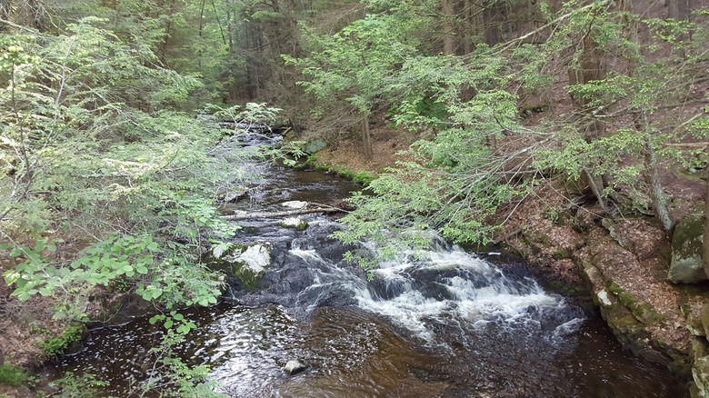
Campbell Falls State Park is set between the peaceful, artsy town of New Marlborough, Massachusetts, which is just over 6 miles north, and the cozy town of Norfolk, Connecticut, in the Litchfield Hills, just under 5 miles south. If you're staying in either place, it's a quick trip for a few hours of peace in nature, and there are no parking fees. The Whiting River, which feeds the falls, runs southeast, but bends back up north close to the state line. However, its Ginger Creek tributary continues down through the whole park, as you can see on the park map. It's perfect if you want to do a little fishing. You can try for brook or brown trout while enjoying the tranquil surroundings.
You can hike to Campbell Falls from both the Massachusetts side and the Connecticut side; however, note that the falls are on the Massachusetts side. If you're starting in that state, the hike from the parking lot on Campbell Falls Road is very short — less than a quarter mile — but it's steep. Wear the right shoes because there can be mud, especially if you go right after a rainfall.
If you come in from the Connecticut side, you'll start the hike at the parking lot at the official entrance on Tobey Hill Road in the middle of the park. This hike through the pretty forest is considered easy by AllTrails, and is a mile roundtrip, with a 131-foot elevation gain. This route has yellow markers to follow. Finally, if you're looking to visit another waterfall after the relatively short hike to Campbell Falls, the popular Bash Bish Falls, the highest waterfall in Massachusetts, is only 24 miles away.