
Colorado's Scenic Byway Loops Through Quaint Mountain Towns, Rugged Canyons, And Wild Alpine Vistas
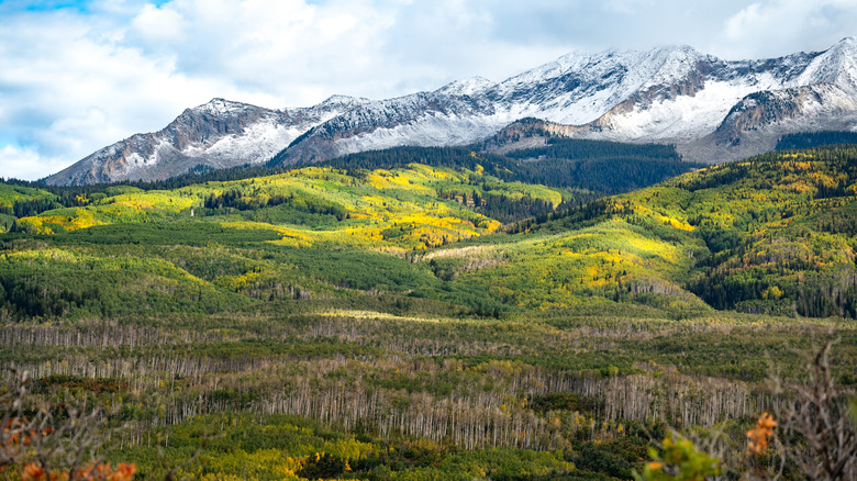
In a state that counts a whopping 26 designated scenic byways, it can be tricky to know exactly where to begin with jaw-dropping Colorado drives. But if you come on the hunt for charming mountain towns, vast wildernesses draped across the high Rockies, and visions of colossal canyons carved out of the ground, then you could do a whole lot worse than the West Elk Loop. It's 205 miles of west-central Colorado backcountry, knitting together national forests and old mining settlements.
The route, which typically takes up to eight hours to complete from end to end, forms a big circle amid the Centennial State's onetime prospecting and ranching country. That means there are plenty of alluring pitstops to make along the way, from the Victorian facades of Crested Butte, a ski town steeped in history, to the former farming and cowboy hub of Carbondale, which dates all the way back to the 1880s. Of course, the great outdoors beckons at virtually every turn, too — the Black Canyon of the Gunnison National Park, the Gunnison National Forest, and trail-rich areas like the Kebler Pass all sit neatly along the way.
If you're already packing the hiking poles and camera, then look to get to Carbondale, the traditional starting point of the West Elk Loop. That's just a short 30-minute detour off of Interstate 70, which, in turn, can link you to the Denver International Airport (DEN) — a major arrival point for both international and domestic flights — in around three hours. I-70 also goes westwards to the Grand Junction Regional Airport (GJT). It's about a 90-minute drive to the start of the byway from there, but only domestic flight arrivals are available.
Mountain town after mountain town on the West Elk Loop
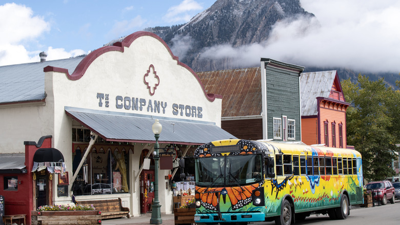
Unlike Colorado's Mount Blue Sky Scenic Byway, the highest paved road in North America, the West Elk Loop is as much defined by the towns it passes through as the vast wildernesses it traverses. First up is likely to be Carbondale. Flanked by mountains and winding rivers, it's got a long agricultural history, and — perhaps more to the point — a downtown that offers all sorts of eats, from edgy Japanese sushi kitchens to homegrown Colorado brewpubs.
Colorado's "wildflower capital" of Crested Butte pops up in a flurry of lupines and fireweed later on in the drive. Part ski town, part outdoor recreation center, it also lays claim to being one of the largest National Historic Districts in all of Colorado. Be sure to cruise down Elk Avenue past timber-fronted buildings with their roots in the gold mining heyday of the 1800s. Or, take a detour to a local trailhead to hike one of the umpteen wildflower trails in the area. There's everything from mellow meadow walks to more hardcore day hikes that will take you all the way across to the celeb-ridden alpine playground of Aspen.
Those heading clockwise around the West Elk Loop will eventually pass by Hotchkiss, which is wedged between state and national preserves some 5,300-plus feet up, with mountains looming right on the doorstep. The town is known for its orchards, making this a prime place to sample fresh homegrown fruit. It's served in juice — and cider — form down at highly rated Big B's Delicious Orchards, where you can pitch a tent for the evening, glug all-natural juices, and even settle in for summertime live music shows.
Western Colorado's great outdoors along the West Elk Loop
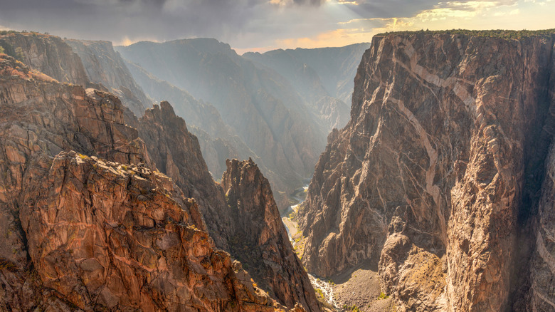
There's quite the array of natural wonders situated along the 205 miles of the West Elk Loop. There's even a national park: the Black Canyon of the Gunnison, which flanks the south side of the byway's westernmost edge in a symphony of 2-billion-year-old rocks and nigh-on 3,000-foot-high canyon walls. The less-visited North Rim is closest to the West Elk Loop itself, though you will need to navigate unpaved gravel roads to access the web of hikes there, some of which even offer views of the famed Painted Wall, the highest cliff face in the state!
You don't even have to venture deep into the parks to get stunning views, though. They abound on the side of the byway itself. The scenic high-mountain Kebler Pass goes through surreal landscapes on the northeast portion of the loop, for example. It passes through what some say is the single largest living organism on the globe — a sprawling grove of quaking aspens. Plus, the route ascends over 10,000 feet up into the West Elk Mountains to offer pullouts where you can gaze at the Ragged Mountains and the alpine forests below them. After the pass, you'll eventually crisscross the reservoirs of the Curecanti National Recreation Area, where the vistas are dominated by the shimmering, stretched-out waters of the Blue Mesa Reservoir, Colorado's largest lake.
One thing to note: Timing is key on the West Elk Loop. For one, there are seasonal closures (between November and May) on the 30-mile stretch of high-altitude road over the Kebler Pass. On top of that, many past visitors highly recommend coming in fall to really squeeze the most out of the views, with Uncover Colorado picking out the middle of September to the beginning of October as the absolute pinnacle for leaf peeping in these parts.