
One Of Ozark National Forest's Best Scenic Drives Spotlights Vibrant Foliage And Breathtaking Mountain Views
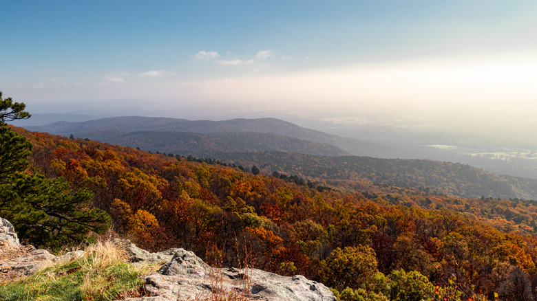
Ozark-St.Franics National Forest spreads across 1.2 million acres of northeastern Arkansas and comprises creeks, lakes, caves, narrow river valleys, and forests of oak, hickory, and short-leaf pine, offering a scenic playground for outdoor adventuring. Such a landscape might encourage you to lace up your hiking boots or dust off your kayak, but it also accommodates exploring from behind the wheel. The Pig Trail Scenic Byway, often shortened to the "Pig Trail," is a paved road weaving through the forests between Fayetteville, Arkansas' second largest city, and the city of Ozark, around 70 miles to the south. The actual stretch of road defined as the Pig Trail, however, is 24.4 miles long, starting around Saint Paul.
Pigs, for all their virtues, aren't often associated with beauty, which begs the question: How does a scenic byway acquire such a name? Naturally, theories abound. Perhaps the most sensible is that pigs once roamed the area around the Mulberry River, which the byway still crosses. Some say the road is shaped like a pig's tail, though it's more of a crooked hook shape, while others reckon the name is connected to the University of Arkansas. UA, in nearby Fayetteville, a creative city known as the "Athens of the Ozarks," is famous for its Razorbacks football team, named after a type of feral hog common in the state. The likelihood is that it's an amalgamation of the above, perhaps with a sprinkling of something else.
Whatever the byway's nominal origins, it's pretty to look at. Slicing through corridors of trees and cresting mountains, it offers great views across the national forest, especially as the leaves begin to turn in fall. There are places to stop, too, whether that's to take in the landscape from the Ozark Scenic Overlook or to paddle in the Mulberry River.
Mountain Views and Foliage on the Pig Trail Scenic Byway
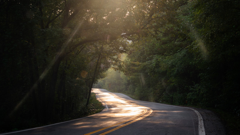
Because the Pig Trail traverses the Boston Mountains, it provides drivers with top-drawer scenery: sun splitting the tunnels of trees, throwing long shadows across the asphalt, and, in the northern section of the trail, at the Ozark Scenic Overlook, views of the mountains sloping towards the river system. Lots of bikers come to this corner of Arkansas, enticed by the byway's rollercoaster-like layout, with twists and turns and sharp switchbacks and steep inclines. Motorcycle magazines have showered the Pig Trail with praise; RoadRUNNER even described it as the finest biking route in Arkansas.
Autumn is perhaps peak season for driving the Pig Trail, when shades of amber, crimson, gold, and ochre jostle in the forest canopy. It might not be quite as magnificent as New England, but there's a reason Midwesterners crave a fall vacation in the Ozarks. The best window for fall foliage in Ozark National Forest is usually mid-October to early November. This coincides with floating season on the Mulberry River, which tends to begin around late October (any earlier than that, the water level likely won't be high enough). If you want to kayak under the tumbling fall leaves, head to Turner Bend for maps, information, and boat and cabin rentals. There are also camping and RV sites here.
The Pig Trail is short, so you could start at either end and drive it in both directions in one day. If you don't want to camp at Turner Bend, Fayetteville, Ozark, and Saint Paul offer a variety of accommodations. You could also consider overnighting in Eureka Springs or Bentonville, which are considered among the prettiest small towns in the Ozarks. Both are just over an hour's drive from the Pig Trail.