
One Of The UK's Most Dangerous Hikes Highlights Idyllic Nature Views Of The Scottish Highlands
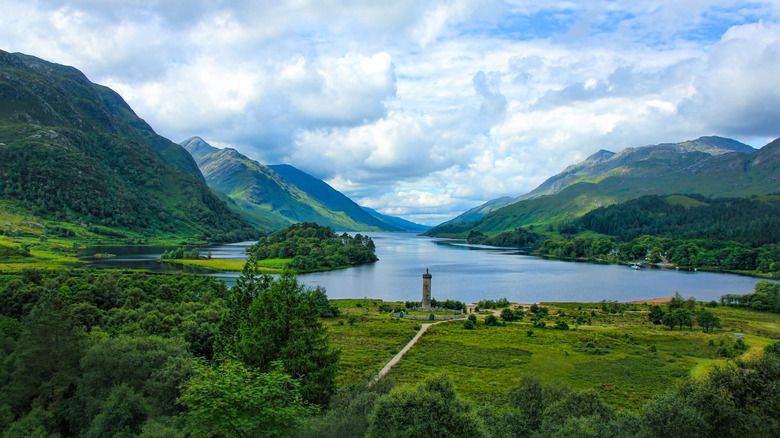
Few would immediately consider Scotland to be the stage for a dangerous, long-distance hike. It doesn't have mountain peaks higher than the clouds like the Himalayas, or icy, treacherous glaciers like the Alps. There are no dark forests filled with formidable predators or seething, lava-spewing volcanoes. Yet, the land that routinely inspires fantasy worlds is home to one of the UK's most treacherous trails — the 236-mile-long Cape Wrath Trail.
Unlike other long-distance trails, the Cape Wrath Trail doesn't immediately seem dangerous. It isn't as long as the Appalachian Trail, nor does it require crossing narrow wooden planks at a height like China's Mount Huashan. But its seemingly innocent vistas sport traps that could catch the most experienced hikers unaware. The route stretches from Fort Williams in the south to the Cape Wrath Lighthouse — the most north-westerly corner of mainland Britain. On the way, you'll pass through Scotland's western highlands, peat bogs, moors, coastal cliffs, and wilderness areas so remote and isolated that you're unlikely to come across a single person for days. Therein lies the problem. The Cape Wrath Trail isn't officially recognized as a National Trail, which means there's no "official" route nor any signage. If you're not a skilled hiker and familiar with wilderness navigation, it's easy to get lost or venture off the path into more dangerous territory.
So...why do it then? Aside from the adrenaline-pumping feeling of conquering a new challenge, the main draw of the Cape Wrath Trail is its gorgeous views. You'll trek through otherworldly areas that made their way into fiction as the hills around Hogwarts School or the wild, treacherous highlands of Robert Louis Stevenson's "Kidnapped." You'll also cross stunning coastal cliffs, tranquil beaches, and verdant valleys on the Cape Wrath Trail.
What makes the Cape Wrath Trail dangerous?
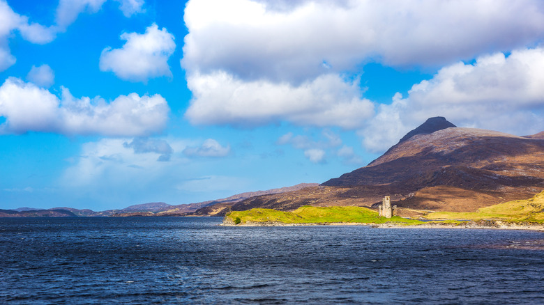
The Cape Wrath Trail is a true backpacker's challenge. Since it isn't officially recognized, there are no signs confirming you're on the right path, and little to no facilities on the way. While some hikers use the few small towns and villages along the way as temporary settlements, it's far more likely that you'll have to pitch your tent in the middle of nowhere or rely on isolated "bothies" — small, free shelters with a fireplace or a stove if you're lucky — for shelter. If night falls and you're nowhere near a bothy or a village, tough luck. You just have to set up camp wherever you are and hope the weather doesn't hate you.
Speaking of weather — that's another hurdle Cape Wrath hikers have to deal with. The trail moves through the western Scottish Highlands, where warm, moisture-rich winds from the Atlantic Ocean hit the mountains, cool down, and form rain. The UK's characteristic muggy, rainy weather is a constant on the Cape Wrath Trail, so hikers often have to pitch their tents in wet, windy weather and trudge through muddy paths, peat bogs that turn into a quicksand-like texture when wet, and gushing rivers with no bridges. As a group of German hikers on this trail said (via Adventure.com), "We had nothing but wet for two weeks."
With facilities on the route practically non-existent, hikers also have to carry everything they might need for the few weeks they'll spend on this trail. Resupply points are limited to a few small-town stores along the way, and you might go days without coming across one. You'll also have to carry your own tent and other hiking essentials.
On the other hand, the Cape Wrath Trail's views are stunning
The journey begins at Fort William, where you're immediately met with the epic Scottish massif Ben Nevis, the UK's tallest mountain. While this trail doesn't go up the mountain, its looming backdrop is a sign of the stunning sights to come. From Fort William, there are two options to reach the village of Morvich in Kintail. The first, tougher route involves a ferry across Loch Linnhe, then a southward walk along a sea loch (a narrow sea inlet), before heading north through a glen up to the historic hamlet of Glenfinnan. From there, you'll cross the rough wilderness of Knoydart to Morvich. The second route is somewhat easier, following the Great Glen Way and then continuing along a series of glens (narrow valleys between mountain slopes) until Morvich.
From Morvich, the route continues through what is known as Scotland's Great Wilderness, for there is truly nothing but vast tracts of wild land as far as you can see. You'll scale colossal mountains, navigate steep valleys, and sleep surrounded by nothing but the rushing wind and nonchalant animals. The trek's halfway point is near Ullapool, famously known as the UK's "Most Beautiful" Village. This is one of the larger settlements on this route, so it's a good place to resupply for the final northward push.
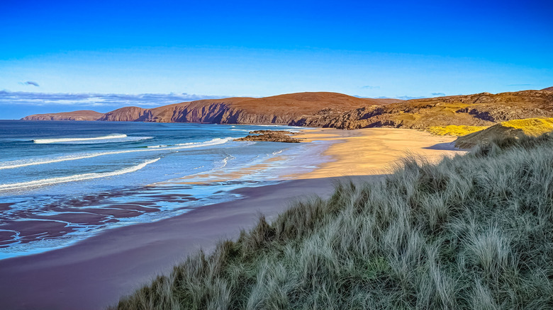
From Ullapool, you'll continue past flowing rivers and vast moors and valleys before reaching the rocky, waterfall-rich lands of Assynt. Here, one of the trail's biggest attractions appears — the thundering roar of Eas a' Chual Aluinn, the UK's largest waterfall, more than three times the height of Niagara Falls. Past Assynt, you'll walk beside the gorgeous waters of Sandwood Bay Beach before arriving at the remote cliffs where the Cape Wrath Lighthouse stands.