
Between Lake Tahoe And Reno Is A Hidden Gem Mountain Trail With Breathtaking Panoramic Views
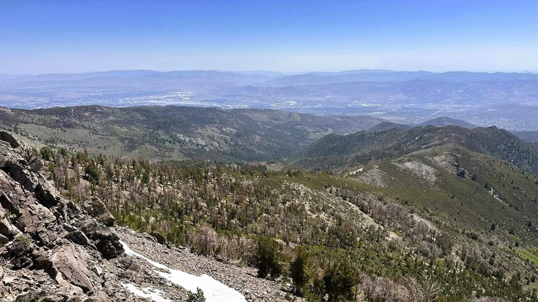
When hiking in the Reno-Tahoe area, much of the attention is given to Mount Rose, one of the tallest peaks in the Carson Range of the Sierra Nevada. But for anyone seeking a quieter alternative, there's the Thomas Creek Trail, a route that gradually climbs up the side of Snowflower Mountain, offering stunning views along the way. This scenic trail sits roughly between the neon lights of Reno and the busy beaches of Lake Tahoe. Underrated and often overlooked, this hike offers solitude, rugged wilderness, and sweeping mountain views.
Hiking the Thomas Creek Trail is an excellent way to get into the Mount Rose Wilderness without tackling one of the area's better-known summits, but it takes some work, with one AllTrails recording describing it as a "Beautiful but challenging hike. Stream crossings are easy. Great views, wildflowers are blooming." The trail system includes the Upper Thomas Creek Trail farther into the mountains and the Lower Thomas Creek Trail. The upper trail is the more challenging trek, approaching the summit of Snowflower Mountain before an off-trail ridge section leads to a scramble to the top, while the lower trail is a moderately challenging hike that winds along the creek, with views of the mountains in the distance.
Before you leave for the hike, here are some logistics. The main trailhead is accessible all year long, although winter conditions can make it difficult to navigate, and it is located roughly 20 miles from both Reno and the northern part of Lake Tahoe. There's no entry fee or permits required for a standard day hike, but you should come prepared with a map and more water than you think you might need. Even though the forest has shady spots, remember to protect your face and neck with sunscreen, especially if hiking in the summer.
What to expect on the Thomas Creek Trail
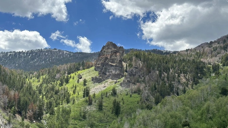
Casual hikers should start with the Lower Thomas Creek Trail from Arrowcreek Park. It's a moderate hike that begins on a gentle path alongside the eponymous creek, although you should expect a well-traveled dirt path shared with mountain bikers. As you move deeper into the canyon, the trail becomes rocky with steeper sections. You'll hike through desert terrain with rolling sagebrush hills before the trail opens to views of Reno and the peaks of the Carson Range. Near the end of the route, you'll approach forested terrain, where you can connect to the upper section of the trail.
At 15 miles round trip, the Upper Thomas Creek Trail is better for avid hikers. Though challenging, hikers rave about this trek, with one AllTrails user saying, "Don't let the distance and elevation gain scare you off this trail. The incline is gradual with switchbacks at the steepest part ... Well worth the time and effort." Expect a dramatic landscape, not too dissimilar to the incredible views from nearby Mount Houghton. Vistas extend across Reno (known as the "World's Biggest Little City") to the northeast, with sweeping views of the Washoe Valley and rolling hills dotted with evergreens. You'll also pass a rock outcropping known locally as Rainbow Rock.
The farther you hike into the forest, the more you'll hear the flowing creek, the rustling of chipmunks, and bird songs, while multiple creek crossings will keep you alert as you make your way through the rugged terrain. Roughly 6 miles in, you'll reach the point where the trail connects with the Rim to Reno Trail in the. Mount Rose Wilderness. At this point, you can turn around and head back to the trailhead or continue along the Rim to Reno Trail before leaving the established trail to follow the ridge toward Snowflower Mountain's summit.