
England's Own 'Atlantis' Is A Ghost Town That Slowly Fell Into The Sea With Few Crowds And Wild Views
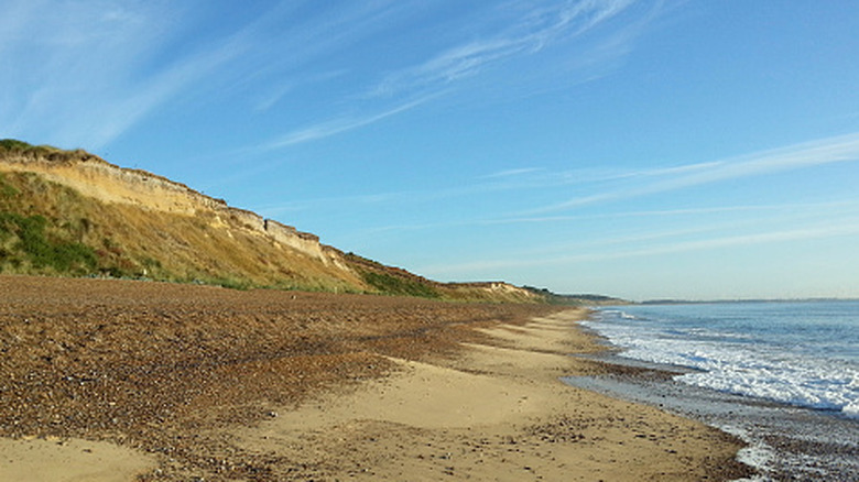
Dunwich today looks like a quiet Suffolk village, but just offshore lie the remains of a much larger medieval settlement that was gradually claimed by the North Sea. Once a major port for fishing, trade, and shipbuilding, Dunwich was also a center of religious and political life. By the early 13th century, the town stretched for a mile along the coast and covered an area comparable to the City of London at the time. Now, most of this settlement is gone or hidden underwater, with only a small village of about 120 people remaining.
Located about 115 miles northeast of London, Dunwich rests just above a stretch of beach that bears its same name. Called "Britain's very own 'Atlantis'" by BBC Travel, the medieval town that remains beneath the waves inspires its own local legends. Stormy weather is said to stir the church bells from the lost city, bringing the sound ashore. Modern surveys show substantial archaeological remains, including churches, windmills, and port buildings, are found hidden beneath the waves.
The town did not disappear in a single event, but after repeated storms, surges, and coastal erosion. These natural forces destroyed port buildings and altered the harbor, reducing Dunwich's effectiveness as a trading port. Residents and commerce gradually moved elsewhere. This is a ghost town unlike most others in England, because the missing town now lies beneath the sea. Instead of abandoned buildings and empty streets, Dunwich offers a mix of surviving ruins, a small village and museum, and a scenic shoreline hiding archaeological evidence. Plan a stop here as part of a wider Suffolk Coast itinerary to explore other quirky towns along this coastline.
From a thriving port to an underwater ghost town: What happened to England's lost city?
Dunwich grew from an earlier Saxon trading center into an important medieval community centered on North Sea fishing and commerce. By the early 1200s, the town had expanded considerably and included churches, chapels, hospitals, and other civic buildings. Parts of the town were built on low-lying ground near the river, vulnerable to flooding. Other areas stood on higher ground of erodible sands that gave way to coastal erosion. The prosperity of the settlement depended heavily on the harbor, which was damaged by a series of storms in the 13th and 14th centuries. As the coastline continued to retreat, the sea eventually consumed the town, with about half the town gone by the late 16th century. The last of the medieval churches was lost to the sea in the early 20th century.
Now the lost city sits within a mile of shore, where archaeological remains lie only 10 to 30 feet underwater. Hidden in the North Sea's low visibility and silty water, researchers working on a mapping project have combined historic maps with geophysical surveys, magnetometer, and sonar imaging to identify structures located beneath the water. Earlier work by the University of Southampton helped locate churches, friaries, and other medieval-era buildings.
While Dunwich may be England's Atlantis, about 50 miles south, another English coastal town, Walton-on-the-Naze, has also experienced long-term erosion that has changed the landscape and erased historic structures. In the northwest, Mardale Green is a ghost town that has been long-sunk beneath the Haweswater reservoir, though in recent dry summers part of the ruins can be seen again.
Explore Dunwich's medieval ruins and coastal landscape
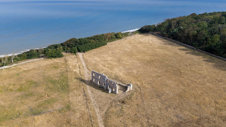
Adjacent to the present-day village are the ruins of a 13th-century Greyfriars friary, which was rebuilt after the original building was swept away. The ruins still standing today were half a mile from the sea when built, but are now close to the cliff's edge. A Google Maps reviewer noted, "Only part of the refectory and the perimeter walls survive. Even so, the ruin looks particularly dramatic in the warm glow of the evening light." Another surviving medieval site is the chapel of St. James' Hospital, a leper hospital dating back to the 12th century.
Dunwich Heath and Beach is a National Trust site known for its relatively quiet atmosphere, offering wide North Sea views and an uncrowded, undeveloped shoreline. Visitor reviews note wide stretches of pebbly and sand-mixed beach, a large free parking area, a small cafe, and restrooms. One Google Maps user summed it up as having an "open, spacious feel, with uninterrupted views along the coast in both directions." The beach is also dog-friendly. Unfortunately, at the time of writing, Dunwich Heath and Beach remain closed following a wildfire in July 2026.
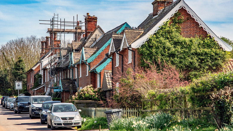
In the village, the Dunwich Museum adds context to the remains visitors are seeing in the area. Open seasonally from April to October, the museum showcases the town's history from Roman times to the present day and offers Dunwich Historic Trail maps for self-guided tours of the village and surrounding area. The village is also home to a pub, several tearooms, a cafe, the 19th-century St. James Church, and a campground. Nearby Dunwich Forest adds an option for hikers on a trail through mixed woodland, marshland, and wetland. Dunwich village and the surrounding area give visitors a way to explore the area's history on land while most of the lost city remains beneath the North Sea.