
Goodbye Big Bear Lake: This Refreshing, High-Elevation Escape Offers Less-Crowded Fishing And Hiking
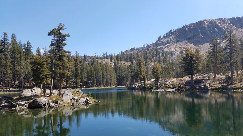
Big Bear Lake is a popular mountain lake town in California, with about 5 million visitors each year. In the summer, the 7-mile lake draws large crowds for swimming, fishing, paddleboarding, jet skiing, and boating. There are also over 100 miles of hiking and biking trails nearby. While the town, the lake, and surrounding forests are eye-catching, the crowds that flood the town can sometimes spoil the trip, especially if you're seeking a quiet weekend getaway or vacation. Luckily, California has thousands of lakes to choose from where people can hike, swim, and fish without crowds. One such lake is Iron Lakes, located in Madera County in the Sierra National Forest.
With just 13 Google Maps reviews and 79 AllTrails reviews for its primary hiking trail, the Iron Lakes Trail, you won't find many similar places with fewer crowds. Part of what makes Iron Lakes such a hidden gem is that it takes some effort to reach it.
Iron Lakes sits at over 8,000 feet, so while the hike to the lake is relatively short, it's intense if you've just driven to the trailhead from a significantly lower elevation. Furthermore, driving to the lake's trailhead — or directly to the lake via the Iron Mountain OHV Route, which shares the Iron Lakes Trail — calls for particular vehicle specifications, which we'll explore below. Still, avid hiker and AllTrails reviewer N W. assures that the location is worth your energy, stating, "[Iron Lakes is a] great lake to swim, fish, and get away from it all."
How to reach the secluded paradise of Iron Lakes
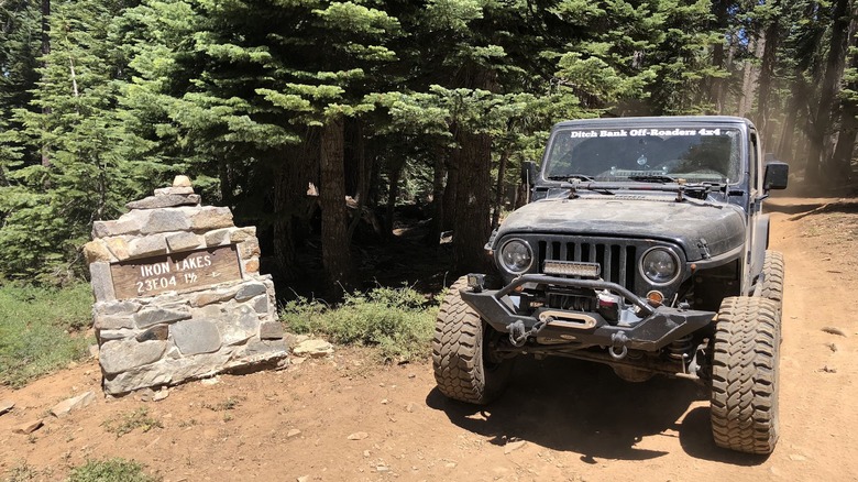
The trailhead to Iron Lakes is just off Sky Ranch Road (Forest Road 6S10). Unlike the secluded, crystal-clear Charlotte Lake, you'll need a vehicle with high ground clearance and four-wheel drive (or all-wheel drive) to traverse the road's upper portion, which leads you to the lake's trailhead.
There are multiple forks along Sky Ranch Road, so it's essential to download your directions prior to your trip so you can follow the route in case of signal loss. Most of upper Sky Ranch Road will be dirt roads where you may encounter washboard conditions and clumps of sizable rocks, making for a bumpy ride. As you drive, you'll pass by sky-scraping pine trees, and the path will occasionally open up to provide views of the surrounding forests and terrain. Driving North to Iron Lakes from Fresno, California, the closest major city, takes roughly two hours.
Once you reach the lake's trailhead, park near its stone "Iron Lakes 1 1/2 Miles" sign if you'd prefer to hike the 1.7-mile out-and-back Iron Lakes Trail rather than drive the remaining portion. You'll immediately begin the hike with a steep climb. As you walk, you'll find the path is well-defined, but quite rocky, requiring cautious navigation and good hiking boots. Along the trail, you'll pass groups of tall pines and cedars typical of the Sierra National Forest, which has some unspoken rules you should know before visiting. In the summer, especially after higher amounts of rain, you may find grass and wildflowers peeking out of the rocky soil.
The real views come as you crest the hill to a scree field, which descends to Iron Lakes. Here, the vibrant lake is shaded with hues of sapphire-blue and emerald green, beckoning you to take a swim in its cool and refreshing alpine water.
Enjoy the quiet nature of Iron Lakes
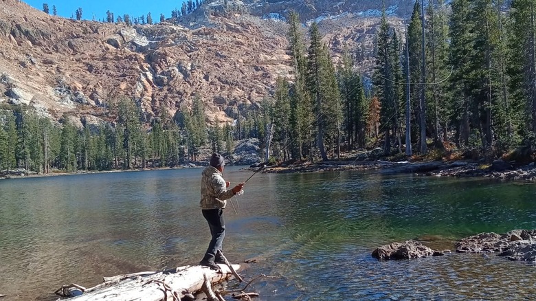
If you plan to stay overnight, other visitors say there are areas for dispersed camping with bear boxes nearby to safely store your food. Just be sure to get your wilderness permit. With Iron Lakes located at over 8,000 feet, it's a high-elevation destination, but also a good spot to acclimatize if you're planning to hike even higher elevations, such as the trails at Ediza Lake.
While you should plan to bring your own food, you could also try fishing in the lake. Other anglers have caught brook trout, which have acclaimed flavor. What could be better than catching your own fish and cooking it up for a camp meal! As you eat, enjoy views of the rugged landscape, with the quiet interrupted only by the wind in the trees, the rustling of small animals, and the songs of local birds, such as tweeting Mountain Chickadees.
Since you can drive directly to the lakeshore via the OHV route, you should absolutely pack your inflatable paddle board or raft for Iron Lakes. However, since the trail from the parking area and campsite is a short distance, it wouldn't be too difficult to carry these items, either. Paddle around the calm lake surface, take the occasional dip, and enjoy the California sun. You also have other hiking trails and lakes nearby that you can explore, such as the 1.9-mile Bare Island Lake Trail that begins at the Iron Creek Trail and passes by Junction Lake and Bare Island Lake. These locations are even less popular than Iron Lakes and thus might not be well-marked, so explore with caution.