
The Most Breathtaking Scenic Drives Through The American Southwest
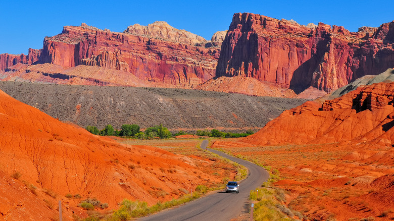
The American Southwest is a region of dramatic contrasts, where snow-capped mountains rise above sunbaked desert floors. Spanning parts of Arizona, New Mexico, Utah, Colorado, and Nevada, the region includes some of the country's most breathtaking landscapes. National parks, remote wilderness areas, and small towns dot this landscape, which I was fortunate enough to drive across on a lengthy cross-country journey. I wound through everything from ponderosa pine forests to dusty valleys surrounded by towering rock formations.
Driving through the region is as much about the journey as the destination. Highways cut through seemingly endless stretches of desert, passing abandoned mining towns, otherworldly parks, historic Route 66 landmarks, and roadside diners. Timing matters when venturing into the Southwest. In parts of Arizona, Nevada, and southern Utah, summer temperatures can climb well above 100 degrees Fahrenheit, making long desert drives brutal, especially when shade and services are scarce. Spring and fall generally offer more comfortable conditions, though a change in elevation can bring a surprisingly sharp shift in weather.
Our selection of the 10 most scenic drives in the Southwest considers the variety of landscapes along each route, access to national parks and monuments, distinctive geological formations, state parks, and other natural attractions. We also considered the roadside experiences, from historic landmarks and quirky pitstops to classic diners and towns. Beyond reviews, I'm sharing my firsthand accounts of driving these great American roads on a trip that took me from the beaches of Los Angeles County to Big Bend National Park in Texas.
Trail of the Ancients Scenic Byway, Colorado
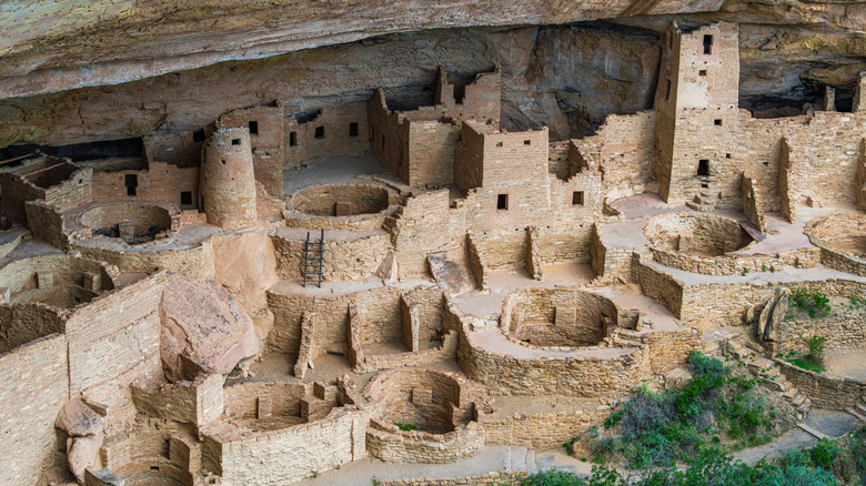
The 480-mile Trail of the Ancients Scenic Byway is an unbelievable storied, scenic road that crosses Colorado, Utah, and New Mexico through the Four Corners region. In my opinion, the 116-mile Colorado portion is the most picturesque. From Cortez, the first stop is Mesa Verde National Park, which preserves Ancestral Puebloan cliff dwellings, while Hovenweep National Monument features ancient stone towers. At the trail's northern end, Canyons of the Ancients National Monument protects thousands of archaeological sites. Follow the byway northwest to Hovenweep, then continue to Canyons of the Ancients — US-491 and US-160 connect travelers to the Four Corners Monument farther south.
Top of the Rockies Scenic Byway, Colorado
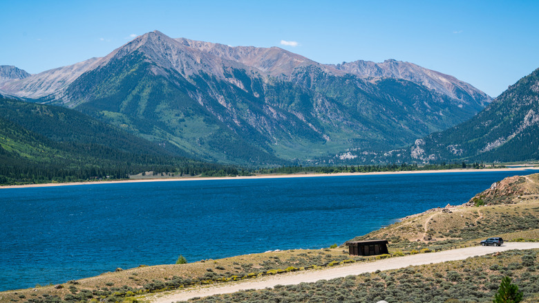
Towering above Colorado's central Rockies, the Top of the Rockies Scenic Byway passes beneath some of the state's highest peaks — including Mount Elbert and Mount Massive — with alpine valleys, evergreen forests, and glacial lakes breaking up the breathtaking panoramas. The 83-mile route connects Aspen, Twin Lakes, Leadville, and Minturn, crosses the Continental Divide, and winds through three high mountain passes — Independence, Tennessee, and Fremont — beside the Arkansas River. One Google reviewer called this drive "once in a lifetime." From Aspen, follow CO-82 east over Independence Pass toward Twin Lakes, then continue north toward Leadville and US-24.
Red Rock All American Road, Arizona
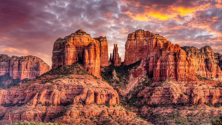
Arizona's 8-mile Red Rock All-American Road, also known as State Route 179, showcases the towering sandstone formations that define this part of the high desert. I started the drive in the Village of Oak Creek, following Highway 179 north through Sedona and Coconino National Forest. The first two must-see stops on the route are Bell Rock and Courthouse Butte. Continue north from the formations to reach Cathedral Rock and the Chapel of the Holy Cross — a striking church built into a rocky hillside. The nearby Dry Creek Scenic Road is an excellent extension with panoramic views of rugged, unspoiled desert beauty.
Dead Horse Mesa Scenic Byway, Utah
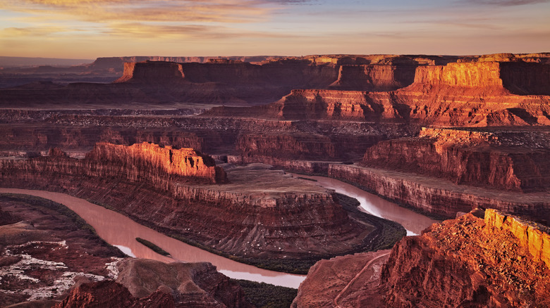
Utah's 22.5-mile Dead Horse Mesa Scenic Byway leads from Moab toward Dead Horse Point State Park and Canyonlands National Park on UT-313, with expansive views across the Colorado Plateau. The route crosses rugged desert terrain, where layered canyons and sandstone cliffs frame the La Sal Mountains and Abajo Mountains. Stop at Dead Horse Point for sweeping views of the Colorado River. Moab Giants – a roadside dinosaur-themed park — and Sevenmile Canyon are other notable stops, while Anticline Overlook is worth a longer detour. Next door, Arches National Park was another favorite destination of mine near this stretch of highway.
Kaibab Plateau North Rim Parkway, Arizona
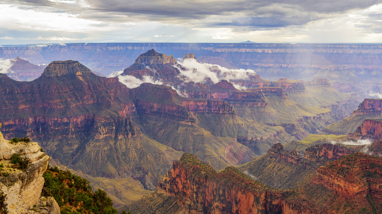
Forests and open alpine meadows line State Route 67 between Jacob Lake and the Grand Canyon's North Rim as it winds through Kaibab National Forest on Arizona's 42-mile Kaibab Plateau-North Rim Parkway. The elevation rises toward the canyon, and the trees give way to dramatic overlooks of Grand Canyon National Park, whose North Rim sits 1,000 feet higher than the South Rim. On my drive, I stopped at the Meadow at Crane Lake pullout to enjoy the forest scenery before continuing south on Route 67 to the North Rim entrance.
Historic Route 66, Arizona
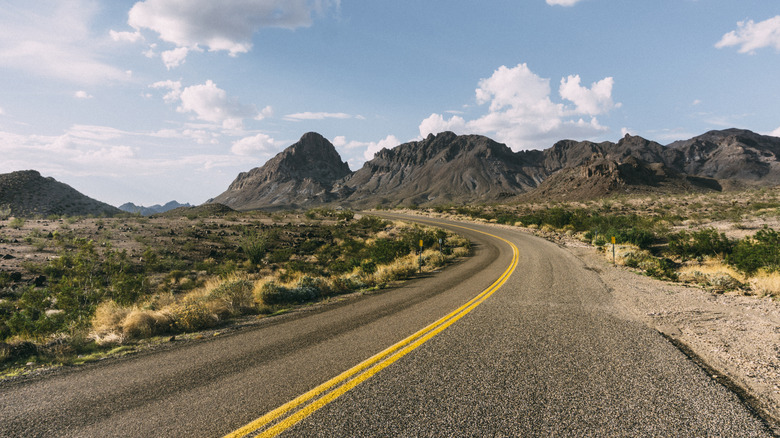
Route 66 is nicknamed the Main Street of America and stretches for 2,448 miles from the Santa Monica Pier in California to Navy Pier in Chicago. I drove 152 miles of this route through Arizona and fell in love with the quirky roadside stops between Lupton and Topock. Arizona's Historic Route 66 passes through desert valleys, pine forests, rugged mountains, and grasslands, with vintage motels, neon signs, and mom-and-pop diners breaking up the journey. Some key stops I recommend include Seligman (the "birthplace" of the historic road), Kingman's Arizona Route 66 Museum, and Petrified Forest National Park.
Zion Scenic Byway, Utah
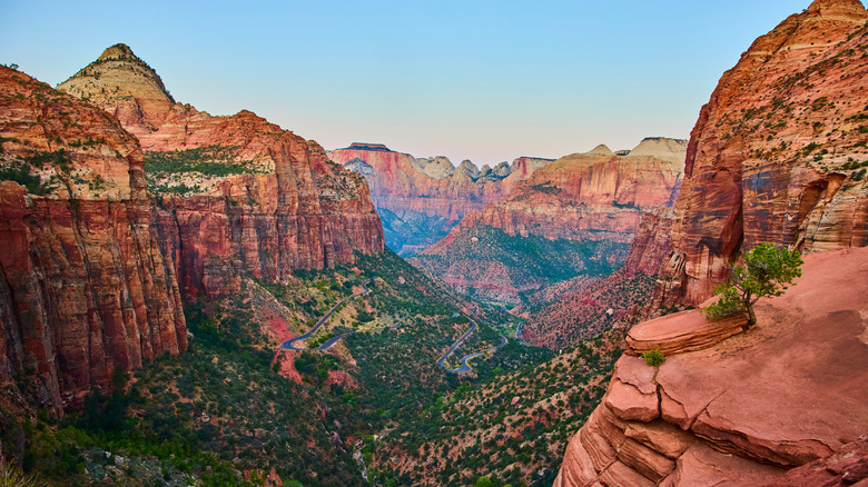
Utah's 54-mile Zion Scenic Byway follows State Route 9 from La Verkin to the eastern entrance of Zion National Park, passing through Hurricane, Virgin, Rockville, and Springdale. Don't stop the journey at the park entrance. Instead, spend some time in the park and check out these 11 tips from park rangers for enjoying Zion. The road enters a mile-long tunnel carved through the mountains with an impressive viewpoint before reaching Checkerboard Mesa. Reviewers rave about how beautiful this park is, with one stating, "Zion National Park completely lived up to the hype and ended up being one of the most unforgettable places I've ever visited."
Turquoise Trail National Scenic Byway, New Mexico
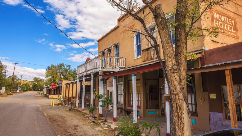
Once a center for turquoise mining, the hills between Albuquerque and Santa Fe now draw travelers to New Mexico's 52-mile Turquoise Trail National Scenic Byway. One Google reviewer noted, "You can see so much of the beauty of Northern New Mexico from this route." Following NM-14, the route winds through piñon-juniper woodland, rugged rock outcroppings, and the Sandia Mountains. Stop in the former mining town of Los Cerrillos, where adobe buildings and a local mining museum recall the area's mineral-rich past. Next door, Madrid's historic stores now house independent galleries, cafés, and shops.
Nebo Loop Scenic Byway, Utah
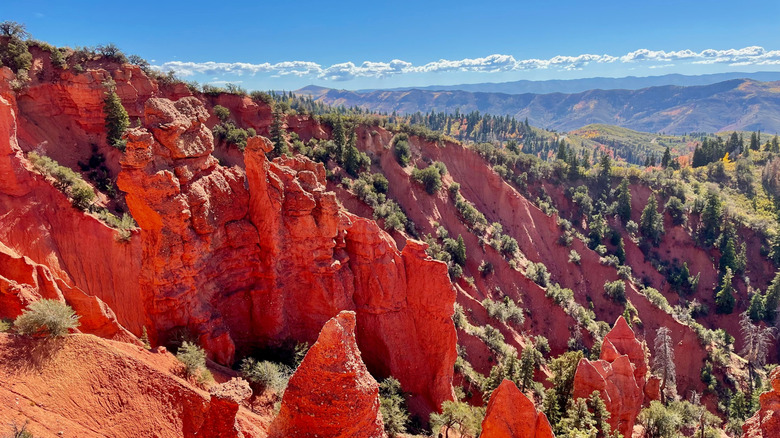
Utah's 37-mile Nebo Loop Scenic Byway winds through the Wasatch Range, passing beneath Mount Nebo, the range's 11,928-foot summit. From Payson, I drove east on 7th South into Payson Canyon and followed the byway south toward Nephi. The most dramatic aspect of this drive is the landscape shift — it quickly changes from open valley floors to dense forest as the car climbs up, with red-rock formations and gray sandstone cliffs appearing along the route. Stop at Devils Kitchen Geologic Site and take in the mountain views from ample roadside overlooks.
Jemez Mountain Trail National Scenic Byway, New Mexico
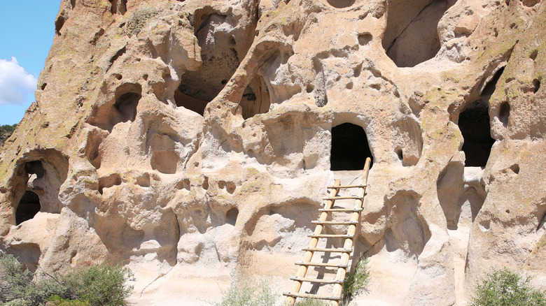
The 163-mile Jemez Mountain Trail National Scenic Byway winds through northern New Mexico. It begins near San Ysidro and connects high-desert valleys and the historic town of Los Alamos to the vast volcanic basin of Valles Caldera National Preserve. Along the way, travelers can explore ancestral Pueblo dwellings at Bandelier National Monument, see the towering Battleship Rock formation, and stop at Soda Dam. Other notable stops on the route include Jemez Springs, the Walatowa Visitor Center, Jemez Falls, and the Bradbury Science Museum in Los Alamos.