
Next To Mount Rainier National Park Is Washington's Giant Forest With Scenic Waterfalls And An Active Volcano
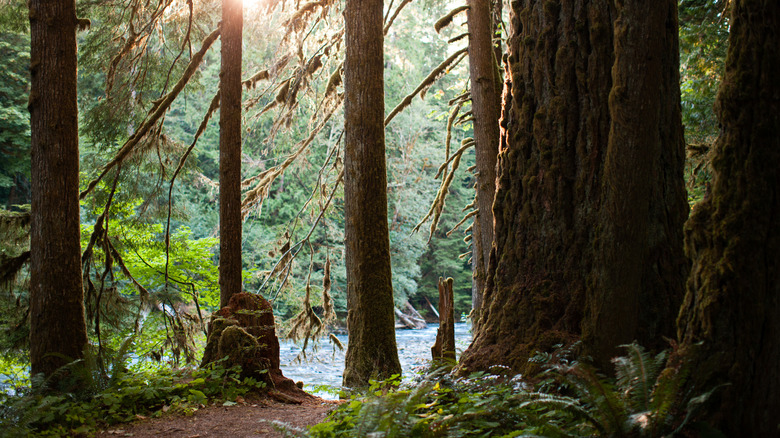
Washington state is nearly carpeted with lush, green forests, much of it old-growth, and some are more renowned than others. Situated alongside the famous Mount Rainier National Park is the unsung, yet equally beautiful Gifford Pinchot National Forest. Its vast expanse of 1.3 million acres contains multiple gorgeous waterfalls, as well as the towering active Mount St. Helens volcano. Those who remember its 1980 eruption saw it previously standing over 1,300 feet taller than it is now, and the massive eruption made nationwide news, with ash spreading halfway across the country. Today, the forest is once again a green paradise.
The northern part of this gigantic forest starts just southeast of the gorgeous Mount Rainier, stretching all the way down to the Columbia River at Washington's border with Oregon and encompassing Mount St. Helens and Mount Adams. It opened as a separate national park in 1949 and is packed with wooded campgrounds, scenic trails, and fishing spots, not to mention stunning waterfalls like Iron Creek, Lewis River, and Panther Creek falls. Day Use Passes can be obtained online as well as at Forest Service offices. Before setting out, be sure to check for alerts in case of wildfires or possible area closures.
Whether you're a Seattle local or flying into Sea-Tac International Airport (SEA), a drive to the northern part of the Gifford Pinchot National Forest takes about two hours and 20 minutes, depending on traffic. If coming up from Portland International Airport (PDX), the drive to the same area is a little over three hours, though one can reach one of its southernmost trailheads in an hour. There are no direct buses or trains to the forest itself. As this region of the Pacific Northwest is heavily forested, the views while driving from either of the above cities are sure to be magnificent.
Winsome waterfalls found throughout Gifford Pinchot National Forest
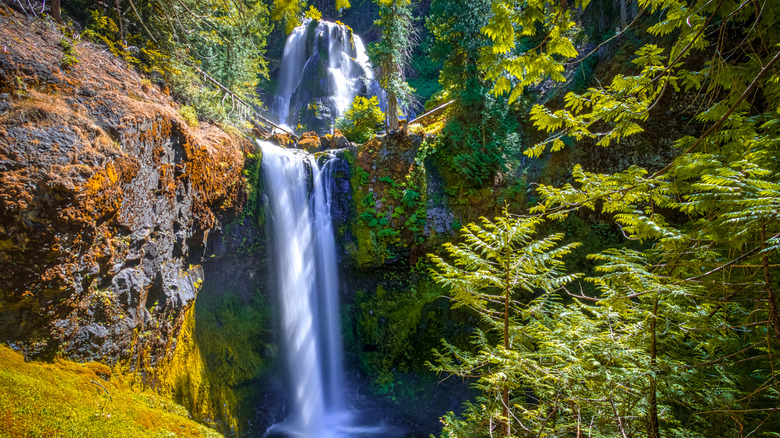
Lush waterfalls like one would expect in the Pacific Northwest can be found throughout the Gifford Pinchot National Forest. While they aren't as vast as Niagara Falls' dramatic, great gorge, they more than make up for it with their sheer beauty. Most are reachable by hiking, like the 3.4-mile Lower Falls Creek Trail. Starting at the end of Forest Road 3062, the route follows along Falls Creek until reaching the cascades, which flow over mossy rocks into a small pool surrounded by tall, sturdy trees.
The easiest waterfall to visit is Panther Creek Falls, which lies just off Forest Road 65. To see it, one must traverse the short dirt path, Trail 137, which has wooden railings for part of the way. However, the full path is not wheelchair-accessible. A gravel parking area sits on the other side of the road. Once you reach the falls, you'll see two main falls, with a ton of trickling streams around them, leading into a pool of deep aquamarine.
The secret and very unique waterfall known as Walupt Falls is a difficult route, but well worth the effort. The unofficial trail is only about 2 miles in length, yet it is doesn't have guidance and is difficult to see, per AllTrails. The beginning of the trail can be found at Walupt Horse Camp, along NF-2160, and having a GPS device on hand is strongly recommended, as well as a trail map on your phone that you can access offline. It would be wise to watch a trail guide video before heading out as well (like this one from Waterfall Whispering ☀️ on YouTube). The trek may sound like a lot, yet the contours of this waterfall and its surroundings are unlike the vast majority you may have seen — it's worth viewing in person.
The infamous active volcano in Gifford Pinchot National Forest
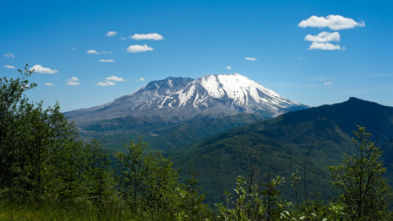
On May 18, 1980, Pacific Northwest residents were going about their morning when, at 8:32 a.m., an intense earthquake registering a magnitude of 5.1 caused Mount St. Helens to unleash fury, killing 57 people (per History). A massive part of the northern face and summit fell away, and a gigantic explosion shot debris 15 miles into the air, which could be heard over 200 miles away. The resulting ash cloud caused some surrounding areas to become as dark as night. Trees were flattened as far as 200 miles from the volcano.
Two years later, the Mount Saint Helens National Volcanic Monument was established within the wide expanse of Gifford Pinchot National Forest, offering three access points to Mount St. Helens. Plus, a webcam of the volcano allows anyone to receive a live view. Those with a hike to Mount St. Helens' summit on their bucket list have several options to get near, circumnavigate, or climb atop the active volcano. Bear in mind that climbing the mountain itself is considered quite difficult (even for experienced hikers and mountaineers), and a permit must be obtained prior to setting out. Always check the current conditions of the area before hiking.
Since the forest covers so much area, it is likely that one would like to stay for a few days. In addition to multiple campgrounds, there are plenty of cabin rentals on the usual vacation rental sites, like Vrbo and Airbnb. Hotels and restaurants can be found in small towns around the forest, like Packwood (at the north end of the forest), Cougar (near Mount St. Helens), and Carson at the southern end on the Columbia River. Per the U.S. Forest Service, dogs must be leashed at recreation sites and along most trails, but may roam free while in the wild forest.