
One Of Canada's Prettiest Lakes In The Rockies Is A High-Elevation National Park Gem Surrounded By Mountains
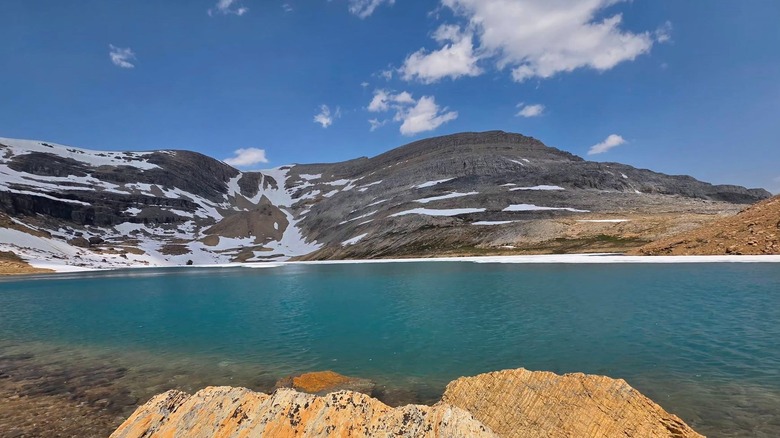
The Canadian Rockies are known for their craggy brown and grey mountains, dark green alpine forests, and startlingly bright alpine lakes. Places like Lake Louise and Maligne Lake are some of the country's most sought-after natural destinations for those very sights. However, there's a little-known gem in Yoho National Park that might have an even more otherworldly view, with a shimmering blue lake set against a stark background of dark mountain peaks and snow.
Kiwetinok Lake lies at the base of Kiwetinok Peak, a pretty technical backcountry mountain hiking destination. It might also be the country's highest named lake at an altitude of over 8,000 feet, although this isn't officially confirmed. While several nearby alpine lakes provide easier access, Kiwetinok Lake deserves its own trip just for the stunning spectacle it presents. Accessible only via a backcountry hike, Kiwetinok Lake rewards hikers with a calm, glittering blue surface framed against the peaks of Mount Pollinger, Mount Kerr, and Kiwetinok Peak. The lake's icy waters are too cold for most of the year for anything but admiring from outside, but some people are known to swim in it during summer.
A near-constant layer of snow adorns the dark brown folds and ridges of the mountains behind the lake, leaving the brilliant blue water as the only pop of color in the scene, and all the more eye-catching for it. The route to the lake is just as scenic, featuring sweeping valleys, distant peaks, and views of thin waterfall ribbons. Your journey will likely begin at Field, a charming Rocky Mountain town inside Yoho National Park, between Golden and Banff on the Trans Canada Highway. If you're flying in, Field is around 130 miles west of Calgary.
The scenic route to Kiwetinok Lake
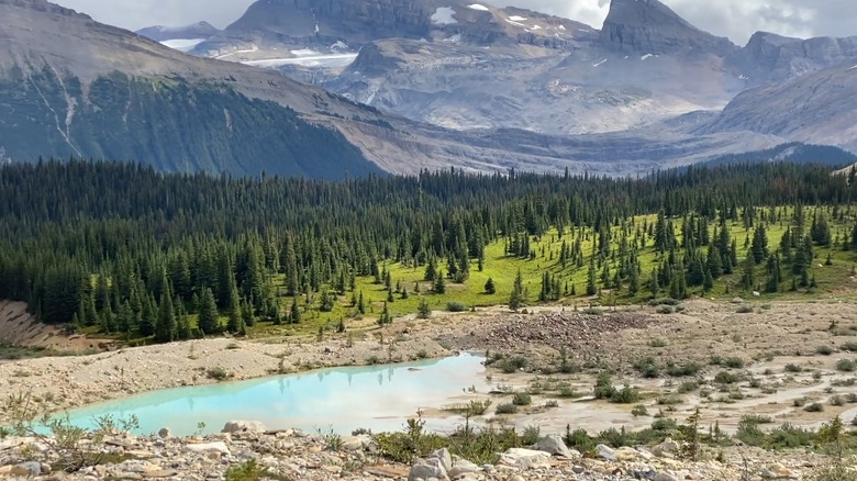
From Field, head east on the Trans Canada Highway for about 2.5 miles until the exit to Yoho Valley Road (aka Yoho River Road). This road is closed between October and June because of heavy snowfall. When it's open, Yoho River Road goes up to the Whiskey Jack Wilderness Hostel, which is also the trailhead for the Iceline Trail to Takkakaw Falls. Head along the western path — with mountain paths and peekaboo views of Takkakaw Falls — to go to the Stanley Mitchell Hut and Little Yoho Campground.
The trek to Kiwetinok Lake begins from there. Although the trek from the Iceline Trailhead to the lake and back can be done in a day, most people cover it in two sections and stay overnight at the Stanley Mitchell Hut or the Little Yoho Campground. You'll cross several creeks on your way, so wear your best waterproof boots. You'll also hike past multiple moraines — large debris piles left over from moving glaciers. Apart from the moraines, the trail mostly keeps to a fairly gentle incline, with some sections covered in gravel and others requiring a steeper climb over large rocks. While some reviews on AllTrails said the trail can be hard to find under the snow, hikers frequently leave cairns (small stacks of rocks) in harder-to-spot areas to mark the path.
Yoho National Park is often considered as scenic as neighboring Banff, but with fewer crowds, and nowhere is that more apparent than on the route to Kiwetinok Lake. The long backcountry hike and high altitude make it less accessible than Banff's famous lakes, or even Yoho National Park's own crystal-clear Emerald Lake. However, the calm blue lake, serene alpine forests, and isolated route make it worth the effort.