
The 5 Most Dangerous Hikes Near Lake Tahoe
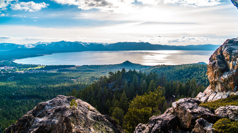
Lake Tahoe has long been a premier vacation destination, and hiking is one of the best ways to experience its stunning outdoor setting. Visitors can find plenty of short, easy trails to enjoy the lake's sublime scenery without too much exertion. However, these easier, family-friendly hikes sit amid the backdrop of a rugged — and dangerous — mountainous terrain. Lake Tahoe, after all, is located in the dramatic Sierra Nevada mountains on the border between Nevada and California. The vast parks and forests surrounding the lake have plenty of challenging, and potentially treacherous, trails that will push even experienced hikers to their limits, but reward them with jaw-dropping vistas.
The trail network includes several peaks that exceed 10,000 feet in elevation — with plenty of difficult, and outright strenuous, hiking that brings considerable risk and poses notable dangers that can potentially result in injury and even death. While different hikers may have varying standards for determining a trail's difficulty level, a few Tahoe area trails receive consistent ratings as "challenging," "strenuous," or "dangerous" from popular hiking outlets.
Based on difficulty ratings from AllTrails.com, reviews from experienced hikers, and reports on specific safety incidents, these five trails in particular represent the epitome of the area's hiking hazards. While a particular trail's risks can vary between the summer and the winter, these five trails warrant warnings that would-be mountaineers should heed before leaving the safety of their Tahoe vacation rental. In all cases, precautions apply. Never hike these trails alone or in less than good physical condition. Always come prepared with more water and energy snacks than you think you need and clothing layers for rapidly changing weather conditions. Satellite links on mobile devices, travel first-aid kits, and equipment specific to trail conditions are all advisable. Last but not least, always check current trail advisories as well as monitoring real-time weather forecasts.
The Shirley Canyon Trail
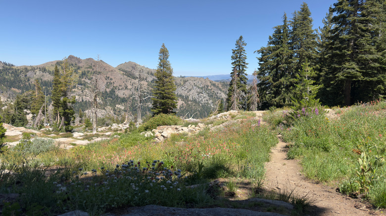
The Shirley Canyon Trail is a (relatively) short but intense canyon trek in the complex mountain topography of California's Tahoe National Forest. Shirley Canyon is filled with mountain vistas, beautiful waterfalls, deep natural pools, and wildflowers blossoming among giant boulders. About four miles in, hikers can take a scenic break at the serene Shirley Lake during the otherwise strenuous hike. The Shirley Canyon Trail, located just eight miles from Tahoe City, is in California's picturesque alpine ski resort haven of Olympic Valley, where Shirley Canyon hikers can unwind with less dangerous outdoor recreation and cozy, mountainside lodging.
Covering around six miles out and back, the Shirley Canyon Trail features 1,350 feet of elevation gain and treacherous terrain through mountain forests. Along the trail, high cliffs drops and steep slopes — combined with unstable, very rocky footing — pose the danger of losing your balance and falling down either a cliff or slope, as has happened in the past. Hikers report a lot of scrambling over boulders and scaling rocks. The trail can be poorly marked in places, making it much more likely that unprepared hikers could get lost in the Sierra Nevada mountains (where weather conditions can become life-threatening without warning). Wet conditions from mountain snowmelt, which can extend well into the summer, can also exacerbate the trail's unstable conditions. Compounding these issues is the fact that much of the trail passes through private property, meaning that the Forest Service does not manage or maintain the trail fully.
To reduce the risk of getting lost on the trail, hikers are advised to download an official trail map, and to look out for and follow the blue markings along the way. Sturdy hiking boots with good traction are a must, as they can help mitigate the trail's unsteady terrain. As well, hiking gloves and poles are highly recommended given Shirley Canyon's rockier segments and boulder scrambling.
Mount Tallac Trail
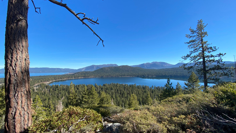
Hitting an elevation of 9,735 feet, Mount Tallac is the highest peak on Lake Tahoe's shoreline. The mountain's elevation and steep, granite face along the lake's southwestern corner often create a distinctive "cross" of snow visible to Lake Tahoe visitors throughout the year. The 10-mile Mount Tallac Trail is one of the most dangerous trails in the Lake Tahoe region, albeit one with heavenly views that more than match its challenges.
Mount Tallac is located within the foreboding Desolation Wilderness of Eldorado National Forest. Despite its off-putting name, the Desolation Wilderness is a breathtaking expanse of granite peaks and glistening lakes above Lake Tahoe, but it does pose risks of potentially aggressive black bears, mountain lions, and dangerous storms that can appear without warning. Mount Tallac's summit is about 1,700 feet above the point at which altitude sickness can set in. Falls are a major risk during the trail segments following steep ridgelines or precarious switchbacks across an unstable scree field (a collection of loose gravel and rocks at the base of a cliff). The Mount Tallac summit rises above the tree line, where hikers have little protection from lightning. Snow can linger into the spring and summer.
The Mount Tallac Trail is only recommended for experienced and physically fit hikers. Hikers can reduce the risk of altitude sickness by acclimating their bodies to the higher elevation beforehand and drinking plenty of fluids. Bring a cold-weather jacket and additional changes of clothing to prepare for Mount Tallac's constantly changing weather. Bear-proof food storage containers are mandatory to avoid attracting the Desolation Wilderness' hungry black bears.
Castle Peak via Warren Lake Trail
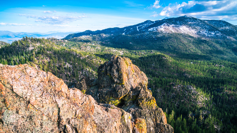
Located about 23 miles west of the Lake Tahoe town of Kings Beach, the 9,103-foot Castle Peak earns its name with a group of three prominent rocky towers at its summit that mimic the turrets on a medieval castle. Castle Peak's one-of-a-kind profile (resulting from its legacy as an ancient volcano) is a wonderful landmark to enjoy from a distance, but the Castle Peak summit also provides unsurpassed panoramas of the Sierra Nevada and the many small mountain lakes around Lake Tahoe — including the infamous Donner Lake and the more whimsically named Frog Lake.
Unfortunately, the main trail to the Castle Peak summit is a strenuous, 7.5-mile trek up steep and often unstable terrain, with at least a few areas that require dangerous scrambles across boulder fields. At one point, hikers will cover more than 1,000 feet of elevation gain in less than a mile and a half. Various sections of the trail involve steep climbs towards the summit, and sharp descents to glacial basins and mountain lakes. The mountain's snow accumulation and sheer slopes increase the risk of fatal avalanches, especially during winter storms when low visibility may obscure oncoming avalanches from view. In February of 2026, an avalanche on Castle Peak claimed the lives of nine skiers during a particularly severe winter storm.
The best time to try the Castle Peak Trail is June through October, when the trail is usually (but not always) free of snow. Always track real-time avalanche reports on a site like Sierra Avalanche Center before attempting Castle Peak. If you plan on going all the way to the summit, equipment like a helmet, climbing ropes, a harness, and slings is critical for the Class 3 scrambling you'll encounter on the way. Given the risk of avalanches, a personal locator beacon (PLB) is highly recommended.
Tinker Knob via Granite Chief Trail and the Pacific Crest Trail
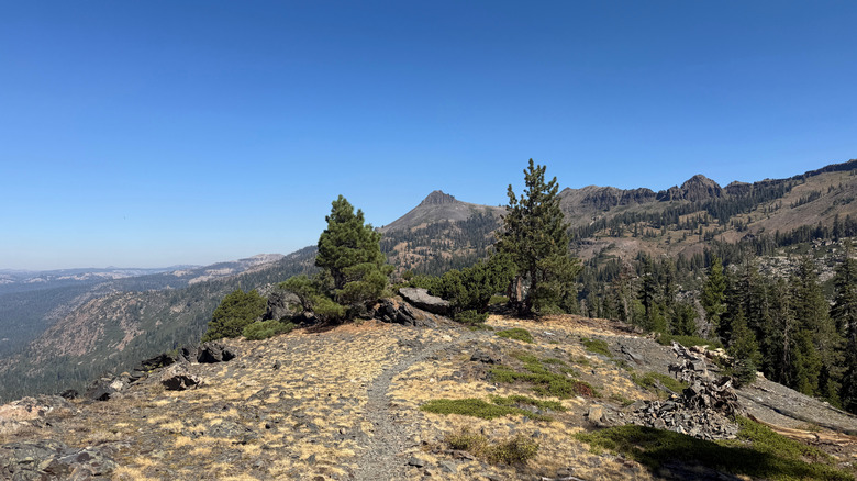
Similar to Shirley Canyon, the route to Tinker Knob begins in Olympic Valley, about eight miles from Tahoe City. The first few miles follow the Granite Chief Trail through Tahoe National Forest. While the shorter Granite Chief Trail alone is a fairly challenging mountain climb, the full hike to Tinker Knob covers a total of 15 miles across the northern Sierra Nevada mountains, with a whopping 4,000 feet of elevation gain. The hike also intersects with a (very) small segment of the epic Pacific Crest Trail, a 2,650-mile behemoth of a hike and one of the most ridiculously long-distance hiking trails in the United States.
Tinker Knob, the trail's centerpiece, is an 8,949-foot summit on a larger volcanic mountain ridge. The summit certainly provides magnificent views (including both the Nevada deserts and the California coastal ranges on clear days), but such a high-elevation ascent will always come with dangers. Hikers must prepare for steep climbs, unmarked sections, and dangerous rock field scrambling near the summit, all of which pose significant injury risk in a remote area that emergency services may have a hard time reaching. The trail's higher elevation areas have very little tree cover, leaving hikers dangerously exposed to the elements, specifically lightning strikes. Heat sickness from direct sunlight and heavy winds are additional environmental hazards.
The risk of heat-related illness means that an abundant water supply is essential, especially since the Granite Chief Trail's natural water systems may be contaminated with harmful pathogens. Always check the weather forecasts before you embark to track the risk of lightning storms. Avoid the trail's exposed areas if conditions look potentially stormy, and make sure that you're familiar with essential lightning safety protocols for hikers before setting out.
Rubicon Peak Trail
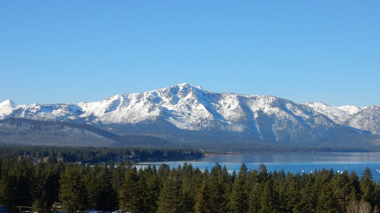
The 3.8-mile Rubicon Peak Trail (not to be confused with the popular Rubicon OHV Trail) is a short but dangerous ascent up one of Lake Tahoe's most challenging summits. Located in the Lake Tahoe Basin Management Unit just 2.3 miles from Emerald Bay, Rubicon Peak has arguably the best summit views of the celebrated lake and its surrounding mountains. Rubicon Peak's 9,183-foot altitude means more than 2,000 feet of vertical ascent crammed into less than four miles of hiking. While the first mile or so has a relatively modest gradient, the final few miles quickly become much, much steeper, to the point where the line between "hiking" and "climbing" starts to blur.
Such an unforgiving ascent is dangerous enough just for the strain it puts on one's cardiovascular system, but Rubicon Peak's higher-elevation sections also transition from relatively manageable dirt paths to dangerously loose fields of uneven scree and gravel. Hikers have to scramble over loose rocks and traverse large boulders en route to the summit, increasing the risk of accidental falls and serious injury. Melting snow can create slippery conditions even into the summer, and loose rocks make the descent nearly as dangerous as the ascent.
Rubicon Peak's summit area is generally unmaintained and hard to follow, so downloading trail maps (or bringing a physical copy) is essential for keeping your bearings in the trail's more dangerous sections. The safest time to attempt the Rubicon Peak Trail is usually June through October, when snow and ice pose less of a risk. Otherwise, crampons and ice axes are necessary equipment during colder months (and advisable even during the summer as a precaution).